Storms overnight could be strong to severe

-
1:23

City of South Bend presents an ’Age-Friendly Plan’ to better...
-
0:54

South Bend Venues Parks and Arts hosts ’Adult Recess’
-
2:27

Why Aneyas Williams turned down the transfer portal and stayed...
-
2:21

Bourbon community rallies around Triton boys’ basketball team...
-
5:02

Dave Matthews shares details about LLC bankruptcy filings
-
1:00

Warming up this weekend before more storms next week
-
1:46

A chilly and calm start to the weekend
-
1:00

NIPSCO workers rally in South Bend for new contract
-
1:53

Severe weather threat is over, MUCH colder Friday
-
3:43

South Bend Mayor James Mueller delivers 2026 State of the City...
-
0:52

Family and friends of Adrian Cruz voice frustration in sentencing...
-
2:13

Potawatomi Zoo prepares for opening day with new attractions

ABC57 First Warning Neighborhood Weather Forecast
Wednesday, July 28th, 2021
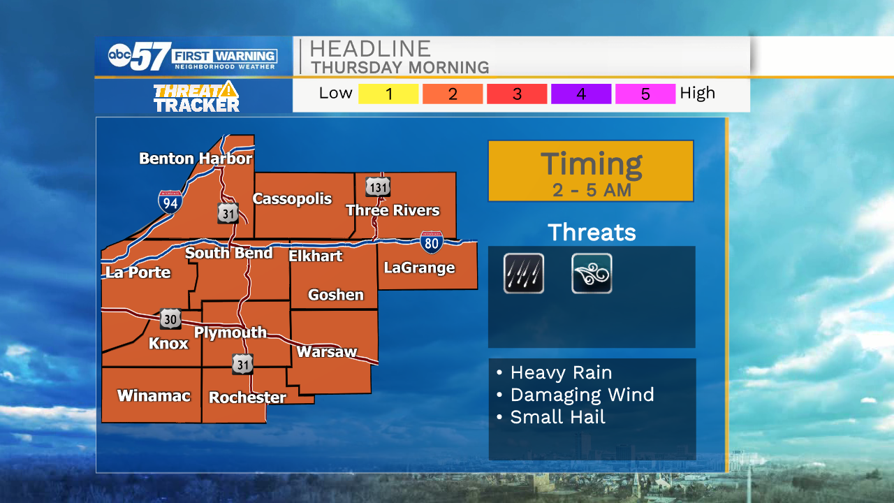
Today is our last hot and muggy day in this stretch. Tonight, storms move in between 2 to 4 AM. They could be strong or severe with greatest threats being straight-line wind and heavy rain. Non-severe scattered storms will continue into late Thursday morning as the cold front passes through. Clouds break up for Thursday evening.
Friday looks beautiful and comfortable as we only top out in the upper 70s. Despite a chance of rain Saturday night, the weekend looks nice too. A mix of sun and clouds with a high near 80.
Today: Mostly sunny. High 88.
Tonight: Scattered storms, possibly strong to severe. Low 72.
Thursday: AM showers/storms. High 82.
Friday: Partly cloudy. High 78.