


Warmer months mean more thunderstorm activity. You've probably heard our First Warning Neighborhood reference the "SPC outlook" or say that we have a "marginal risk" for a certain day. What do these things mean, exactly?
For starters, SPC is the Storm Prediction Center. Based in Norman, Oklahoma, the SPC puts together an outlook each day with the likelihood for strong to severe storms for a particular area.
When thunderstorms are expected, they are assigned a category by SPC.
Here is a breakdown of each of the five categories. Marginal poses the lowest threat level, while high is the highest risk for severe storms.
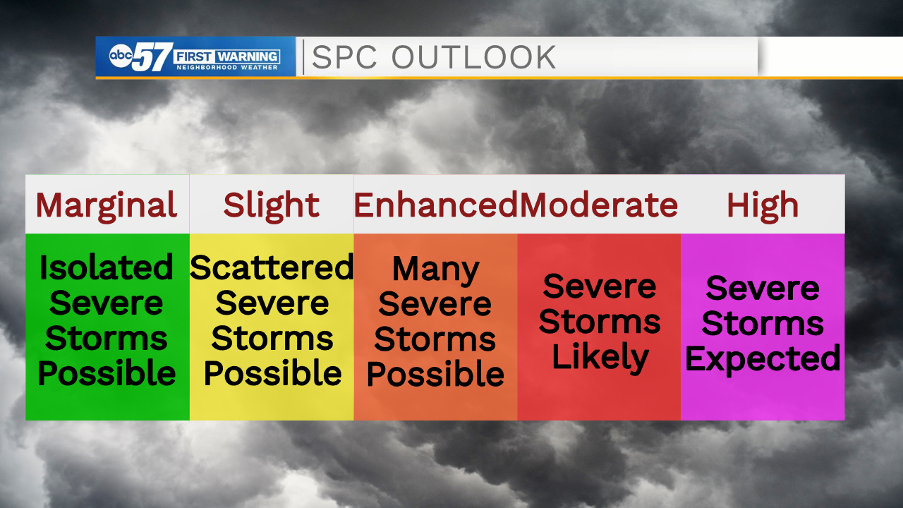
While marginal risks may mean an isolated severe storm, moderate and high categories mean severe storms are expected to be widespread.
To reach the severe threshold, storms have to meet one of three criteria: hail greater than an inch in diameter, damaging wind gusts over 58 m.p.h., or a tornado.
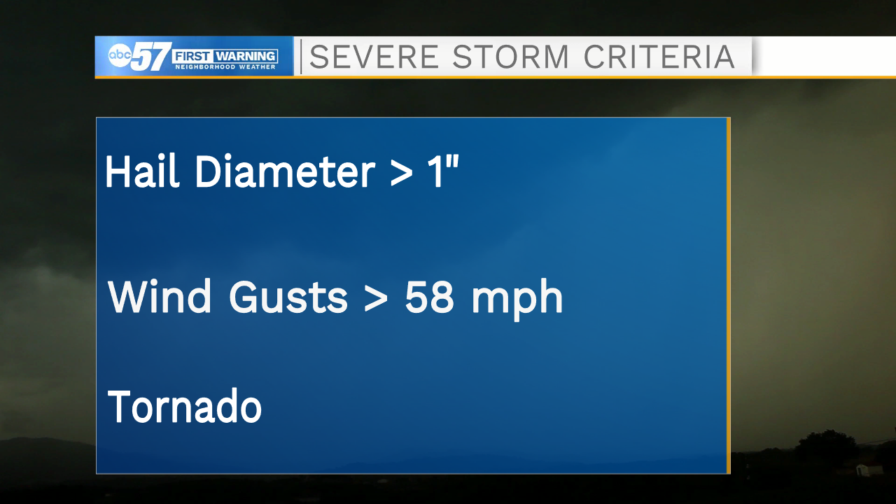 These are the generic criteria to be considered a severe storm. These are not necessarily threats for tonight's storms.
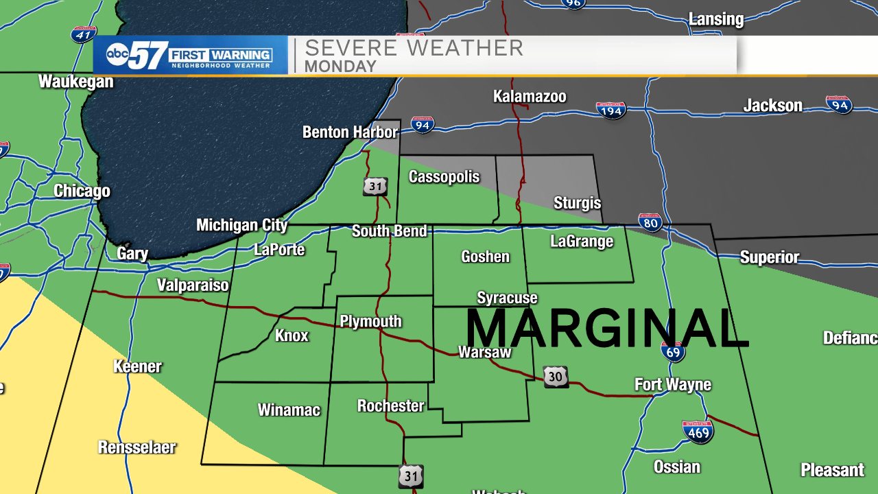
Tonight, there is a marginal risk for strong to severe storms in Michiana. This is depicted in the green color by SPC. You can see in yellow there is a slight risk just south of Michiana, so a few more severe storms could be possible there.
Our biggest threats tonight are gusty winds and periods of heavy rain. It is possible that winds could gust over 58 m.p.h. briefly in these storms, which would consider it a severe storm.
Luckily, the other two criteria (hail and tornado) do not look to be of any concern for tonight.
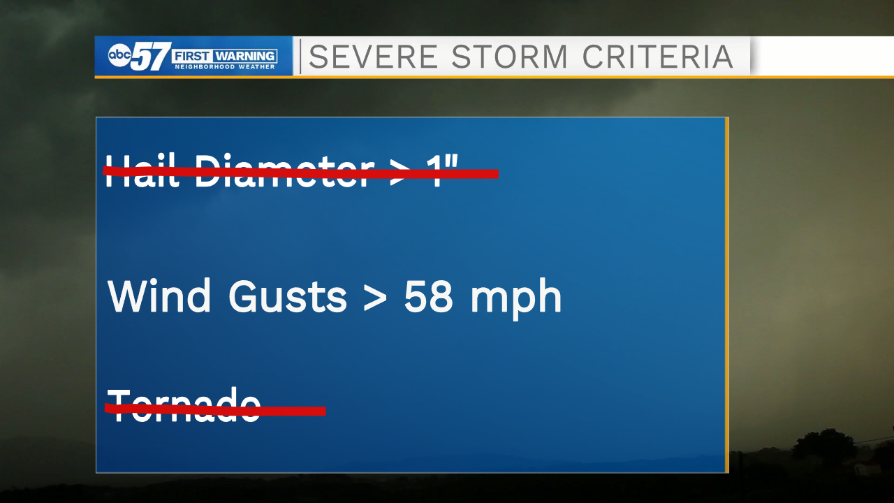 Tonight's threats won't include hail or a tornado, just gusty winds.
It's a good night to stay weather aware - stay tuned for more coverage on ABC57 this evening or download our Mobile Weather App for weather alerts, forecasts, and real-time RADAR.