Storm chances increase tomorrow afternoon and evening

-
1:24

Happy feet hit the floor at 24th Annual Daddy Daughter Dance
-
3:35

New house bills could reorganize local school corporations
-
1:58

New era underway at Knollwood Country Club
-
3:51

Local Police Departments concerned over House Bill 1186
-
2:55

’Save Lakeside Woods’ successfully buys land back from developer,...
-
3:26

SBCSC announces community partnership to improve school literacy
-
2:21

Freezing rain reaches Michiana Wednesday night
-
2:25

Potential ice jamming in New Buffalo
-
2:31

The History Museum’s ’Worker’s Home’ brings 1950s African...
-
1:39

Cloudy and cooling down today with a wintry mix tomorrow
-
0:52

Mishawaka High School holds signing day for student athletes
-
2:47

Local Latin markets concerned about possible tariffs

This evening a few isolated showers and thunderstorms are possible, primarily in northern Michiana. A storm or two could be on the stronger side producing some gustier winds. Those will clear later this evening and then partly cloudy skies remain through the overnight hours. Tomorrow afternoon will be another hot and humid one for Father’s Day. High temperatures will top out to around 90 degrees. The heat and humidity will provide fuel for strong to severe thunderstorm development tomorrow late afternoon and evening. Storms that develop tomorrow will be capable of producing all modes of severe weather; large hail, damaging winds, and isolated tornadoes. The storms of higher concern will arrive around 5 or 6pm. Those will clear out and then another line of heavy rain and thunderstorms will move in around midnight. Those will linger into Monday morning.
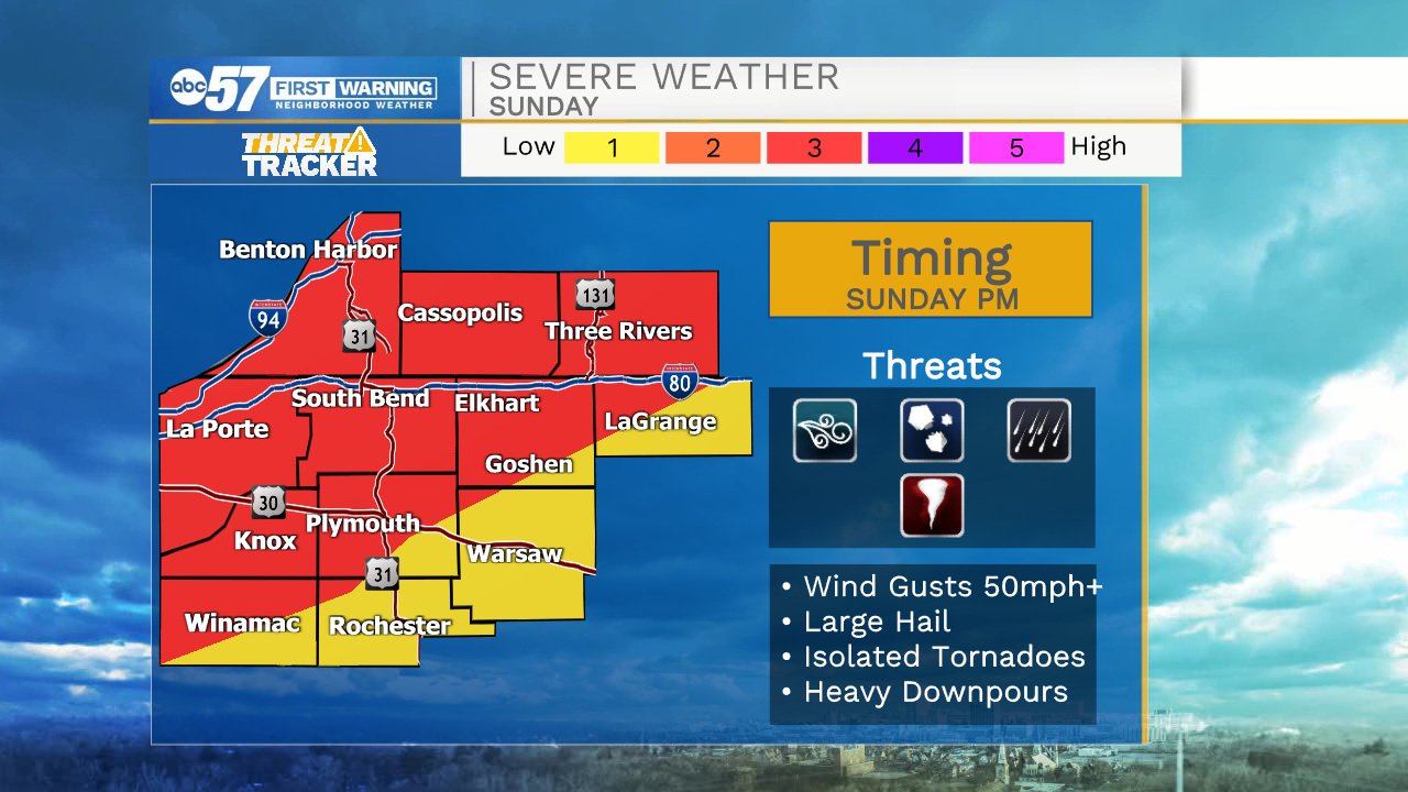
Tonight: isolated showers/storms. Low 63.
Tomorrow: Thunderstorms. High 90.
Monday: Mostly cloudy. High 76.
Tuesday: Mostly cloudy. High 70.