


It’s a soggy Sunday and the start to a soggy week.
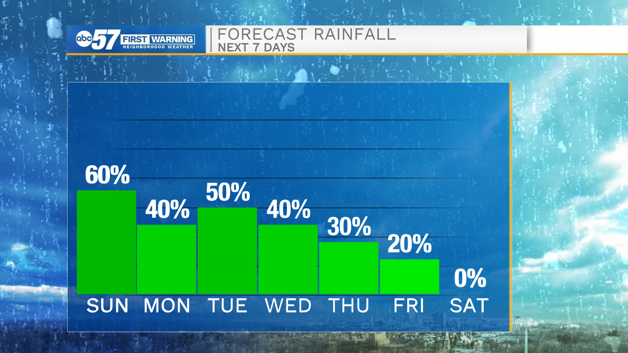
This forecast has lots of rain chances for Michiana. Today, we’ll see a round of showers and a few thunderstorms through 2 p.m.
Storms and showers over parts of Illinois and Wisconsin right now will be here in Michiana soon, starting around 8 AM.#INwx#MIwx@ABC57Newspic.twitter.com/gI4HFa9aHl
— Maci Tetrick (@mtetrick_wx) September 6, 2020
Outside of this time, isolated showers or thunderstorms aren’t out of the question, but a lot of the late afternoon/early evening hours will stay dry and mostly cloudy.
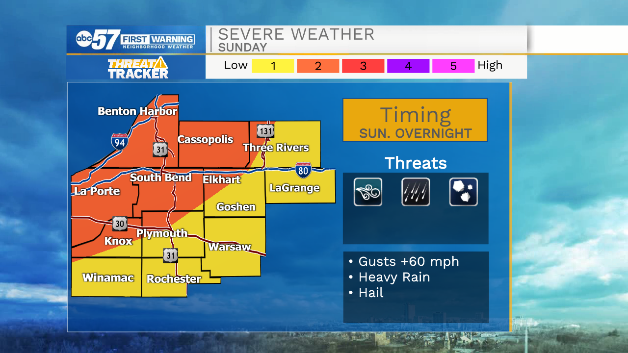
Overnight we’ll see a second round of rain and thunderstorms. Timing looks best between 10 p.m. through 4 a.m. Monday. A few of these overnight storms could be on the strong to low severe side, with gusty damaging winds the primary concern.
There are a few showers through noon Monday. It stays mostly cloudy in the afternoon. Monday overnight there are scattered thunderstorms again. Thunderstorms stay widespread Tuesday. By Wednesday, storm and rain chances become more isolated. There are a few more isolated showers and possibly a thunderstorm Thursday before finally drying out for Friday and next weekend.
This week, temperatures will feel normal for this time of year—starting to feel like fall with daytime highs in the mid 70s.
Today: Scattered thunderstorms and rain. High 78.
Tonight: Thunderstorms, some strong to low end severe possible. Low 66.
Labor Day Monday: AM showers. Afternoon and overnight thunderstorms. High 74.
Tuesday: Scattered storms. High 75.