
-
0:46

Paramount School of Excellence hosts teacher fair
-
2:30

Voting advocacy, peaceful demonstrations and donations: South...
-
2:04

Warming to start the week, Showers and storms by Tuesday
-
2:10

Cool, but calm, today
-
1:23

City of South Bend presents an ’Age-Friendly Plan’ to better...
-
0:54

South Bend Venues Parks and Arts hosts ’Adult Recess’
-
2:27

Why Aneyas Williams turned down the transfer portal and stayed...
-
2:21

Bourbon community rallies around Triton boys’ basketball team...
-
5:02

Dave Matthews shares details about LLC bankruptcy filings
-
1:00

Warming up this weekend before more storms next week
-
1:46

A chilly and calm start to the weekend
-
1:00

NIPSCO workers rally in South Bend for new contract

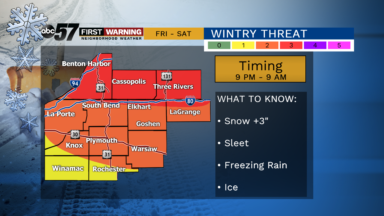
Friday, the day is snow-free. Friday evening the storm begins with a burst of wet heavy snow. The snow transitions to sleet and rain after midnight. There is the potential for more than three inches of snow by early Saturday. However sleet and rain will compress that snow to slush and the cold ground will freeze that slush into an icy mess. Temperatures warm above freezing Saturday but slick conditions remain concerning through mid-morning. Temperatures tank again in Sunday, with a chance of lake effect snow.
Tonight: Few clouds. Low of 16.
Friday: Mostly cloudy, snow late. High of 30.
Saturday: Wintry mix. High of 40.
Sunday: Lake effect snow showers. High of 16
TIMING IS KEY !!! This event is avoidable
Sign up for the ABC 57 Newsletter