Severe threat has ended, rain ending overnight
Posted: Jun 14, 2017 8:43 PM EDT

-
3:14

Plans for a functional ambulance in talks in Union Township
-
3:08

St. Joe County Council votes to amend council rules
-
3:32

Dog finds new life after being saved from troubled Kosciusko...
-
0:54

Elkhart Clinic main campus set to reopen after gasoline vapor...
-
3:56

Reflecting on the COVID-19 global pandemic, five years later
-
0:34

Tickets for WNBA pre-season matchup at Purcell Pavillion go on...
-
1:16

Warming up this week with a windy weekend ahead
-
0:38

South Bend Washington’s Coach Reynolds resigns, will explore...
-
3:38

Andrews University buries time capsule for 2075
-
0:25

Berrien County Sheriff’s Office K9s receive body armor donation
-
2:23

National Weather Service cutting back on weather balloon launches
-
2:47

Juday Creek Golf Course plans to rise from the ashes as they...

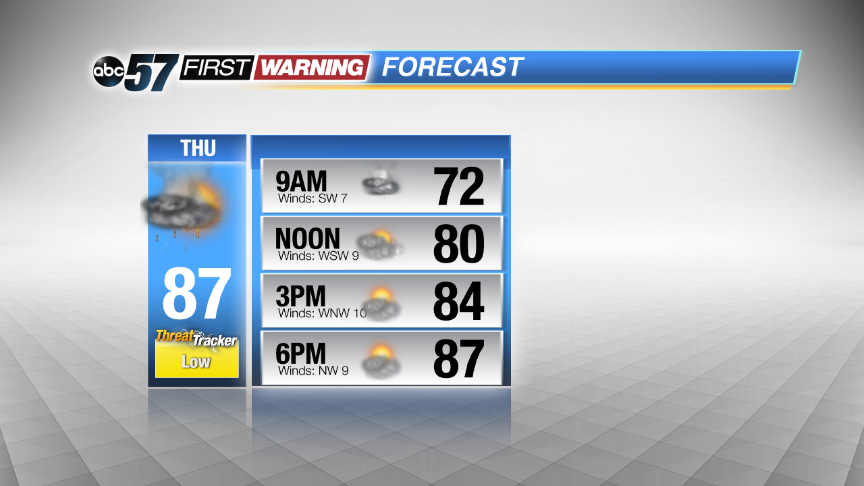
The severe threat is over, steady rain continues until after midnight then ends by Thursday morning. The forecast stays muggy, with a chance of showers and storms through the end of the week. This is a typical summertime weather pattern, storms develop in the late afternoon but may be highly scattered. The severe threat looks low Thursday, in what could be the driest of the next three days.
Tonight: Scattered showers and storms. Some could be strong to severe. Lows near 70.
Thursday: Morning showers and storms then partly sunny, high in the upper 80s.
Friday: PM scattered storms, highs in the upper 80s.
Saturday: More scattered showers and storms, highs in the upper 80s.
Sign up for the ABC 57Newsletter