
-
0:21

Colfax Avenue eastbound lane closed for water and sewer work
-
0:46

Madison Street closed for lifestyle district project
-
4:11

Non-profit organization provides deep dive into Blackstone, a...
-
1:52

Storms possible overnight, strong storms by Tuesday evening
-
3:48

New partnership aims to help fight food insecurity across Elkhart...
-
2:00

A sunny Monday ahead, rainy almost every other day this week
-
2:59

Dusty May leads Michigan back to Final Four with dominant win...
-
0:37

Vendors and cosplayers showcase art at South Bend Anime Fest
-
3:06

Palm Sunday procession in South Bend unites faiths in call to...
-
0:48

2026 Auto Show brings crowd to Century Center Sunday
-
2:34

Warm to start the week, Rainy week ahead
-
2:44

Warmer, breezier, and cloudier than yesterday

Showers work their way in late this morning into the afternoon. A couple rumbles of thunder are possible with breezy conditions. After the cold front passes through, temperatures fall into the 50s tomorrow with a chance of lake effect rain. The sunshine is back Wednesday but it’s short-lived as another cold front swings through Thursday, bringing another chance of rain after midday. As we wrap up the work week and head into the weekend, it looks to stay nice and dry. Temperatures overall remain cool. Most daytime highs remain in the 50s.
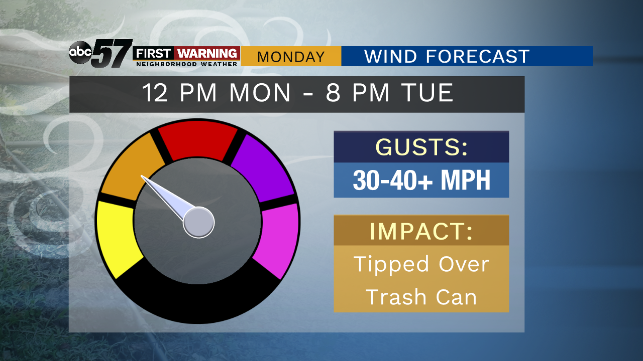
Today: Windy with rain and perhaps a few thunderstorms. High of 65.
Tonight: Few clouds, chance of rain. Low of 46.
Tuesday: Windy and mostly cloudy. Lake effect showers possible. High of 54.
Wednesday: Mix of sun and clouds. High of 58.