
-
3:41

Present Pillars to host “Dad Strong 5K“ to support fathers...
-
1:44

Warming up through Wednesday
-
2:34

From Niles to South Bend: Jays 2 Keeps the Spirit Alive for basketball...
-
0:46

44th annual Tri Kappa Antique Show boosts charities and scholarships
-
1:48

Scattered showers this evening, Much cooler overnight
-
1:50

Showers and storms this afternoon
-
0:20

One person injured in shooting
-
0:36

Eddies Circuit Robotics holds competition Saturday
-
0:32

21st annual Nappanee Model Train Show
-
0:38

Local boys basketball team headed to IHSAA state finals
-
3:49

Midwest Meowfest brings kitten advocacy to attendees, new homes...
-
1:52

Mild tonight, showers tomorrow

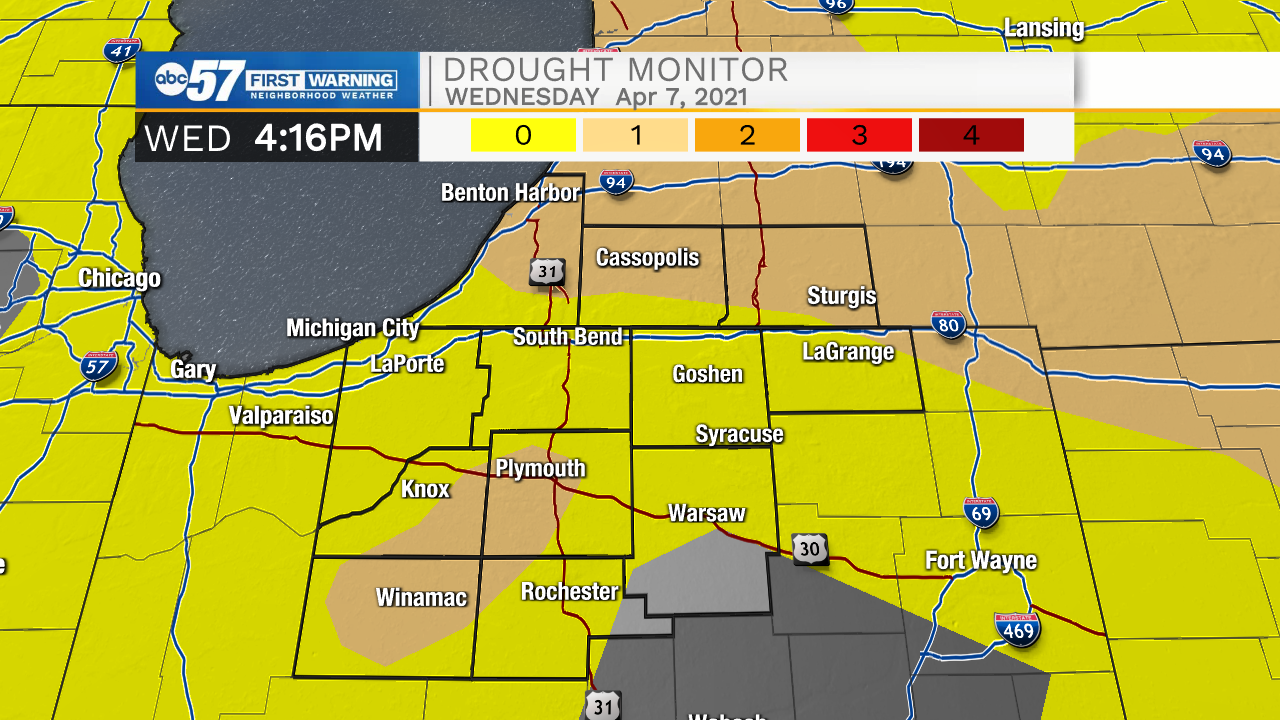
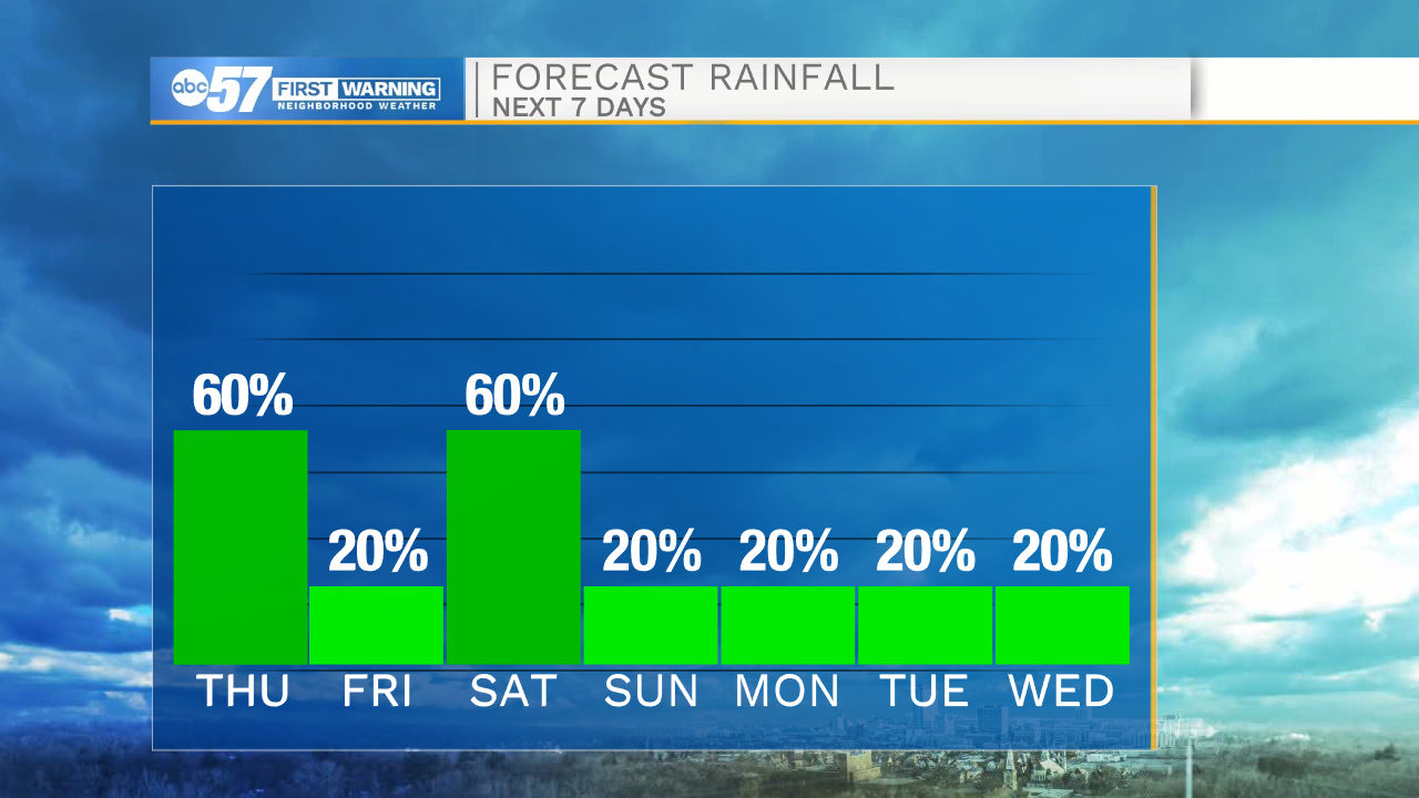
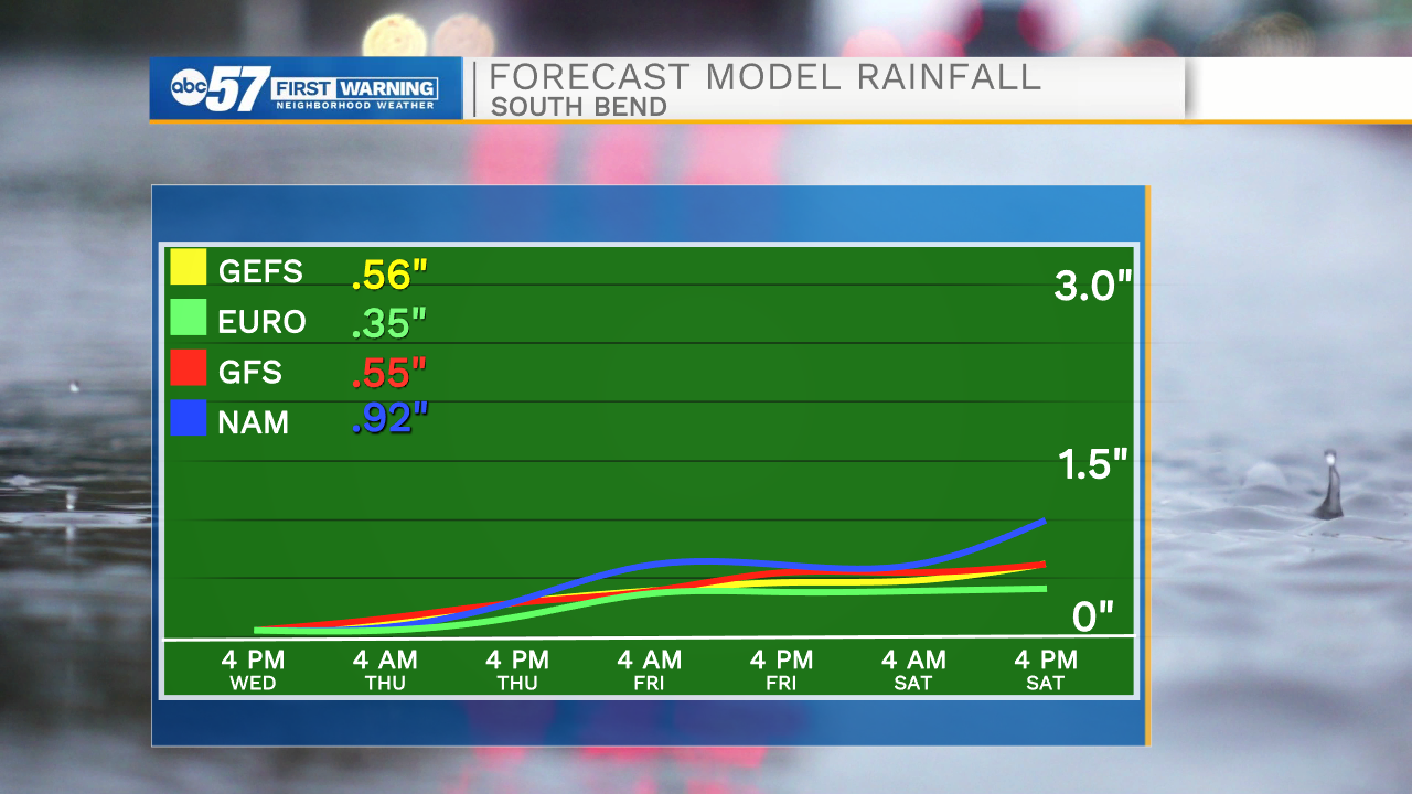
Feeling a little muggy for April, Thursday brings our best chance of rain, scattered showers and thunderstorms, upwards of a quarter inch of rain, higher totals under downpours. The pattern stays active, but showers wane into Friday, Saturday has a greater rain potential, more than a half inch, but there's still some doubt on the exact track of the system. Temperatures cool into the 60s, still seasonably mild, but we may see the return of frosty low temperatures by the end of next week.
Tonight: Mostly cloudy, chance of isolated shower/ storm. Low 62.
Thursday: T-Showers. High 70.
Friday: AM rain chance then mostly cloudy. High 66.
Saturday: Showers: High 68
Sign up for the ABC 57 Newsletter