Rain changes to snow tonight, accumulation still suspect

-
1:50

Showers and storms this afternoon
-
0:20

One person injured in shooting
-
0:36

Eddies Circuit Robotics holds competition Saturday
-
0:32

21st annual Nappanee Model Train Show
-
0:38

Local boys basketball team headed to IHSAA state finals
-
3:49

Midwest Meowfest brings kitten advocacy to attendees, new homes...
-
1:52

Mild tonight, showers tomorrow
-
1:43

Pleasant to start the weekend
-
3:06

Pulaski County weighs stricter solar rules amid resident concerns
-
0:40

Marian High School hosts World Down Syndrome Awareness Walk
-
2:33

South Bend leaders call for an end to gun violence
-
2:01

Tae Johnson, Notre Dame secondary stands out as Irish open spring...

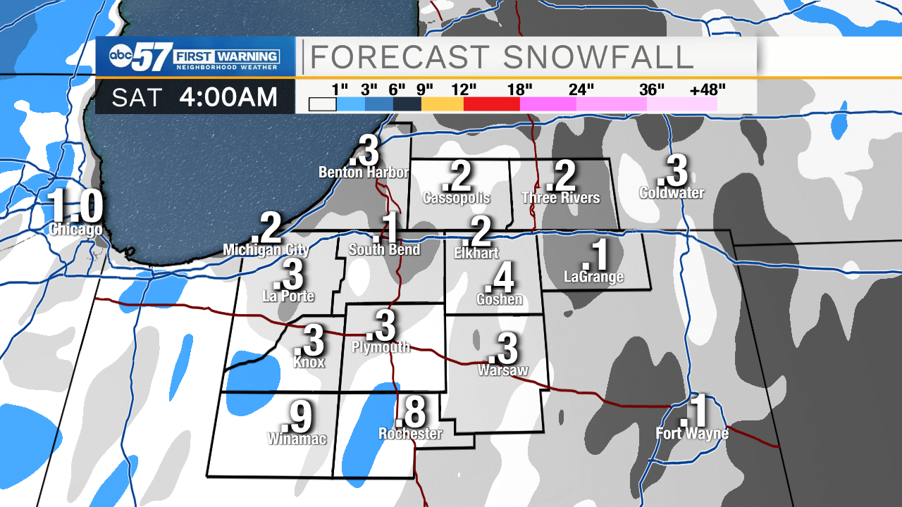
There snow in the forecast but little is expected to stick Friday. Scattered snow showers and flurries are unlikely to accumulate with temperatures warming into the mid to upper 30s. There will be more snow showers Saturday and Sunday as a broad area of low-pressure swirls through the great lakes. At this moment, it is unlikely for more than an inch per day. There may be some lake enhancement Saturday, that could bring some areas a little more, but that still seems a stretch given the lack of true cold air. The pattern stays active next week but real cold air remains missing.
Tonight: Rain showers, changing to scattered snow after midnight. Low 32.
Friday: Scattered snow showers. High 38.
Saturday: Scattered snow showers. High 36.
Sunday: Scattered snow showers. High 32.