Quiet Sunday; precipitation turning wintry this week

-
4:24

Michiana Crime Stoppers shredding event
-
1:16

’IvyCares’ program setting students up for success in and...
-
1:45

Windy and wet this weekend, but unseasonable warmth as well
-
3:13

Local players react to $3 million investment in Byer Softball...
-
0:32

Layoffs at Whirlpool could affect workers in Benton Harbor
-
1:03

Annual District Sisterhood Conference at Ivy Tech empowers students
-
1:49

Back home in downtown South Bend, YMCA to open new location
-
2:16

This week’s ABC57 Cub Reporter is Nicholas Zentz
-
3:05

Amazon Web Services invests $11 billion to build data center...
-
4:05

Riley High School student center stage at the NFL Draft
-
1:35

Rain, wind, and milder temperatures forecast this weekend
-
2:49

Joe Alt expected to be drafted in the first round of NFL Draft

Skies cleared overnight, so we’re waking up to another cool morning with temperatures in the 30s and patchy frost on windshields and grass.

Don't write the whole day off though. There is a nice warm up through the afternoon, hitting a high in the low 60s today with a few peeks of sunshine. This will be one of the warmer days this week so enjoy it!
Tonight is quiet, and luckily temperatures shouldn’t fall into the frost category, staying around 40. Monday is a pleasant day – mostly sunny with highs in the mid 60s. Monday afternoon and evening, we’ll see a few rain showers.
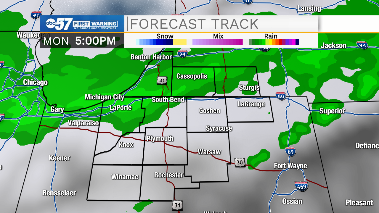
Tuesday temperatures tank; highs struggle to make it to 40 degrees. Precipitation likely turns wintry through the day.
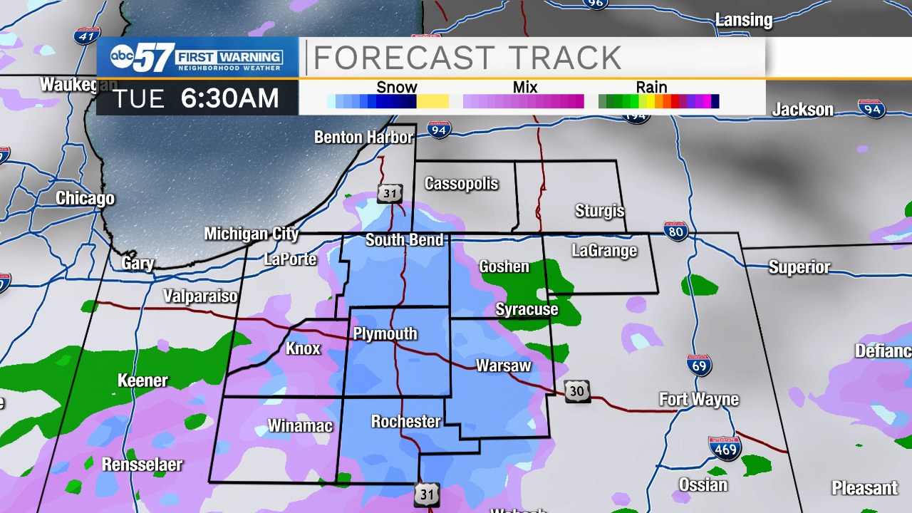
Late Tuesday evening and overnight is the highest concern for any accumulating snow.
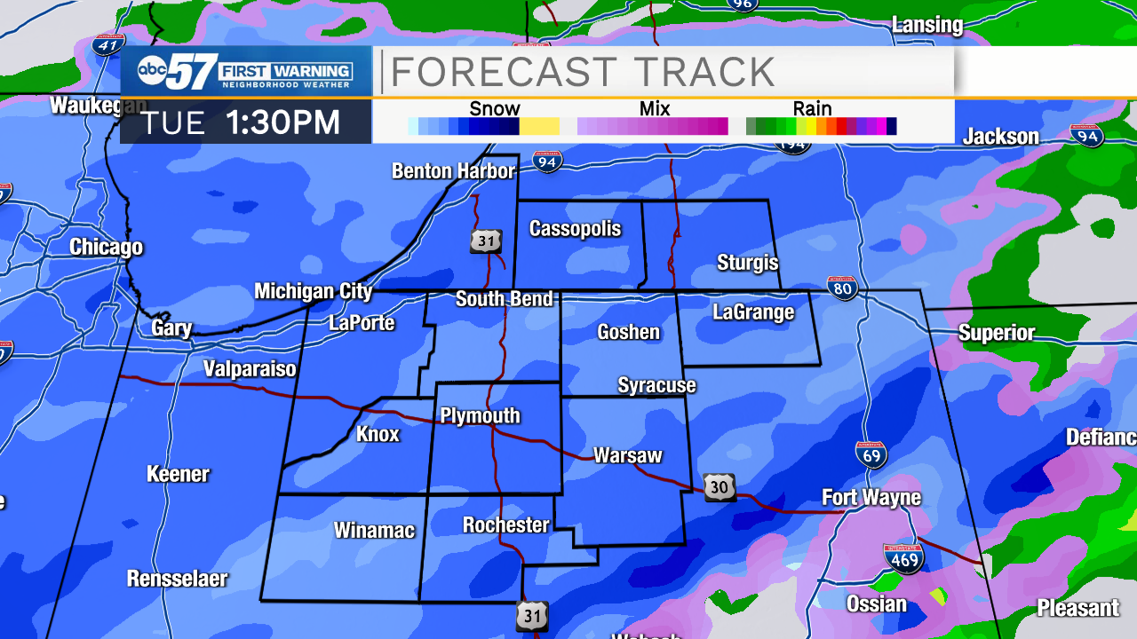
Tuesday night and Wednesday morning roads could be slick, but snow tapers off past Wednesday morning. The rest of the week looks dry and snow likely starts to melt quickly with our warm ground temperatures.
Today: Partly cloudy. High 62.
Tonight: Partly cloudy. Low 40.
Monday: Mostly sunny, breezy. PM rain. High 64.
Tuesday: Mixed precipitation with mostly snow by evening. High 39.