Possible record breaking high temperatures again Monday
By: John Hammersmith
Posted: Nov 8, 2020 4:30 PM EDT

-
4:33

Blustery and stormy today
-
0:39

Michiana Home Show continues to bring vendors to South Bend
-
0:58

Cookies and Canvas for the Heart raises awareness for children’s...
-
2:07

Most residents have power restored following high winds
-
0:44

26th annual St. Patrick’s Day Parade takes over Downtown South...
-
2:42

Active weather arrives Sunday
-
3:22

Calm today, storms return Sunday
-
2:58

Thousands of people across Michiana experienced power outages...
-
1:13

Earl Wigfall holds Detective Trivia Night for Sheriff campaign
-
1:50

Preparations underway for South Bend’s annual St. Patrick’s...
-
0:24

CAVA set to open in Mishawaka
-
1:16

Groundbreaking project underway for housing development

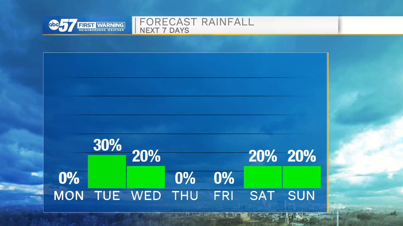
Clear skies will remain in the forecast through tomorrow evening, and then cloud cover will increase into Tuesday. A few stray showers are possible by early Tuesday afternoon with increasing rain chances into Tuesday evening. Rain showers will clear out by the early to mid-morning hours Wednesday. Wednesday afternoon temperatures will only top out in the lower 50s under sunny skies. Colder, more seasonable temperatures stick around through the ending part of the week and next weekend. More rain chances return to the forecast next Saturday and Sunday.
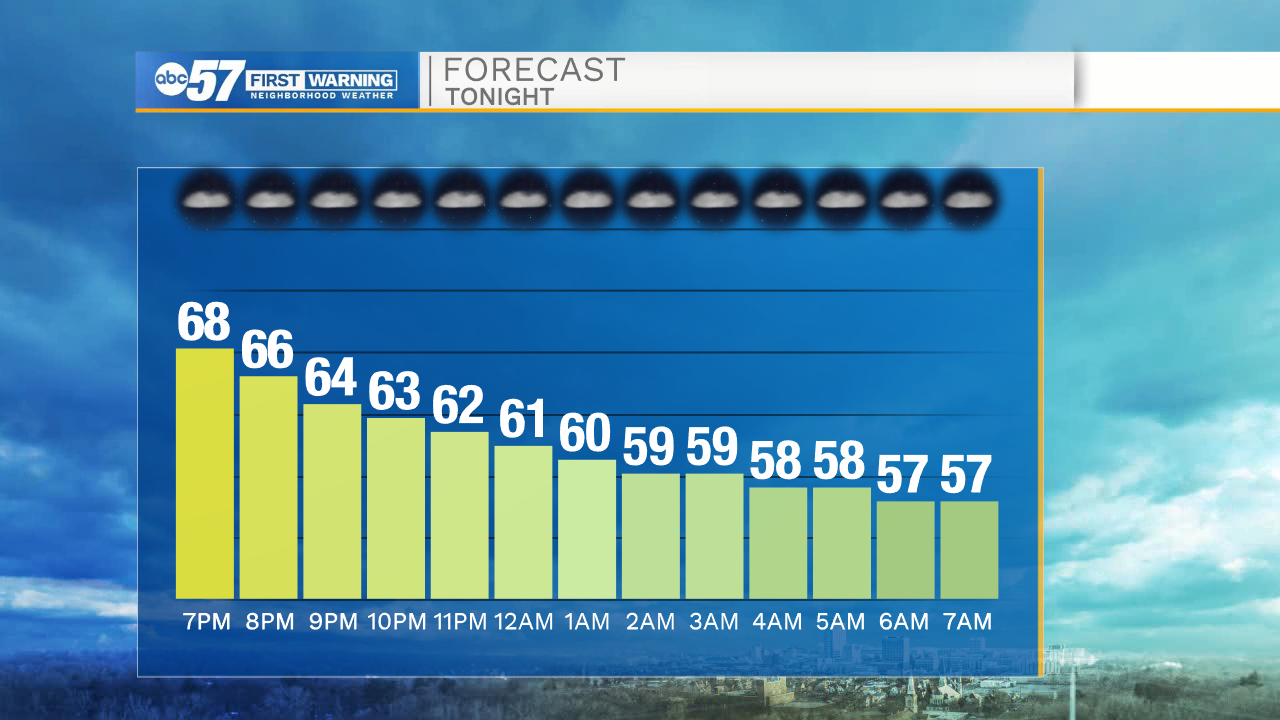
Tonight: Clear. Low 57.
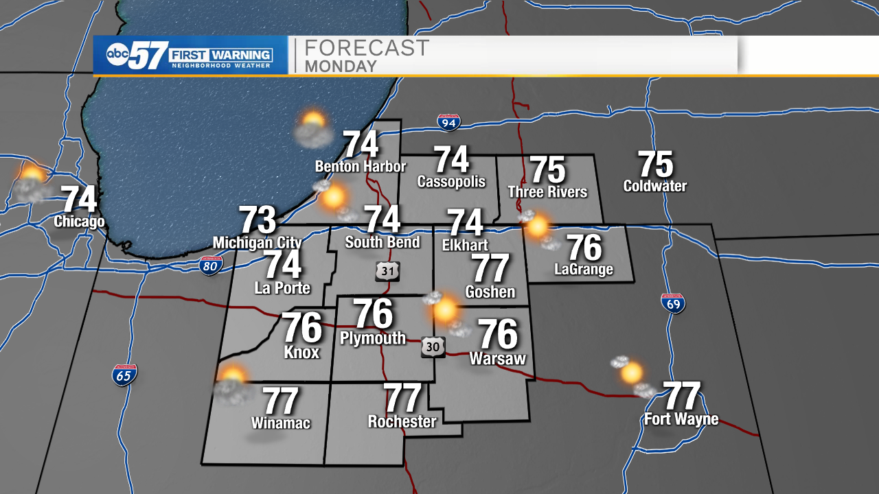
Tomorrow: Mostly sunny. High 74.
Tuesday: Rain showers. High 72.
Wednesday: Sunny. High 50.
Sign up for the ABC 57 Newsletter