You've probably seen some pretty high-definition satellite images of cloud cover when watching a weather forecast on TV.
Meteorologists can use weather satellite imagery to help forecast the weather, track severe thunderstorms, monitor winter storms, among many other things.
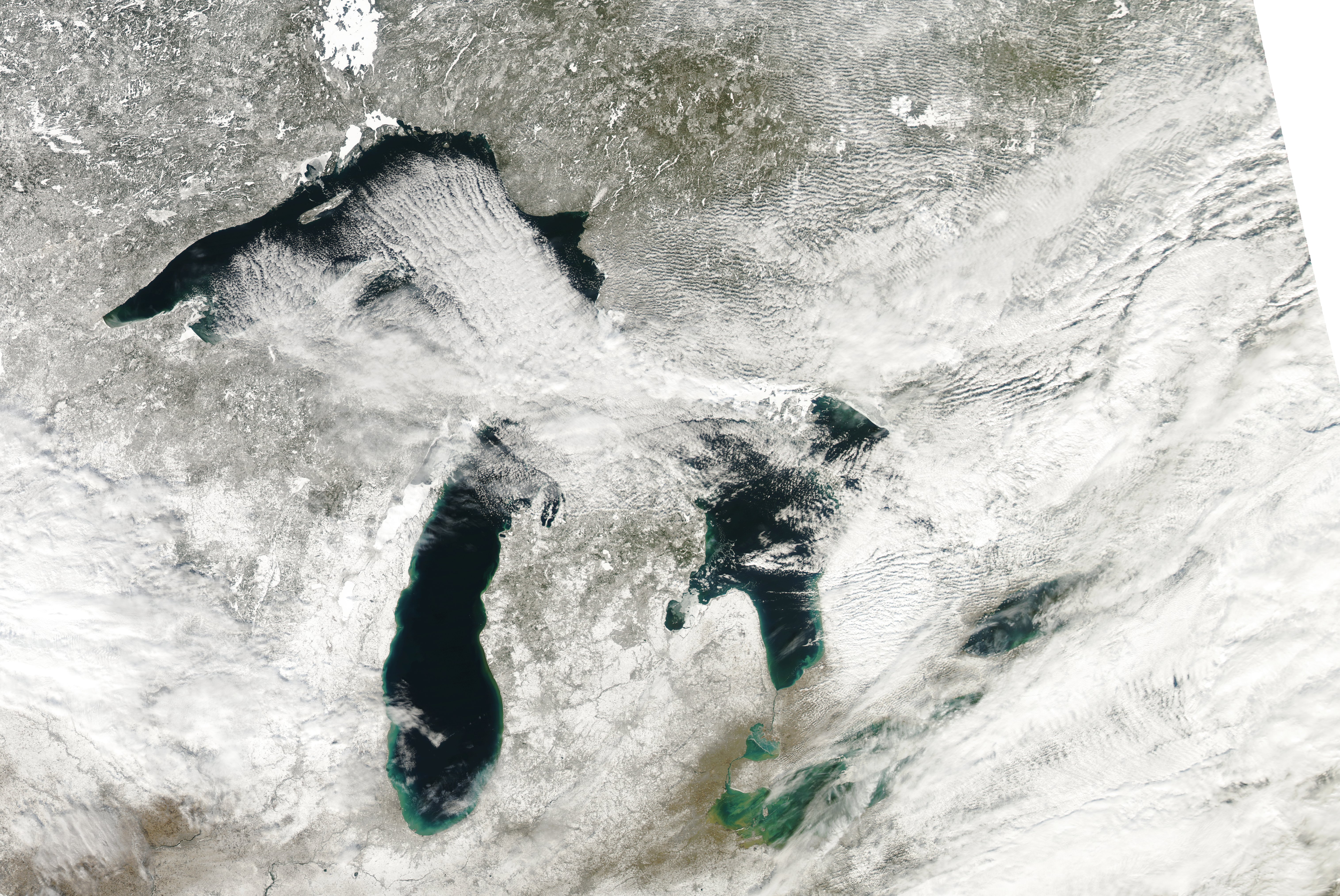 MODIS image of the Great Lakes on a rare clear winter day.
MODIS stands for "Moderate Resolution Imaging Spectroradiometer," and is a key scientific tool aboard both the Terra and Aqua satellites that revolve around Earth.
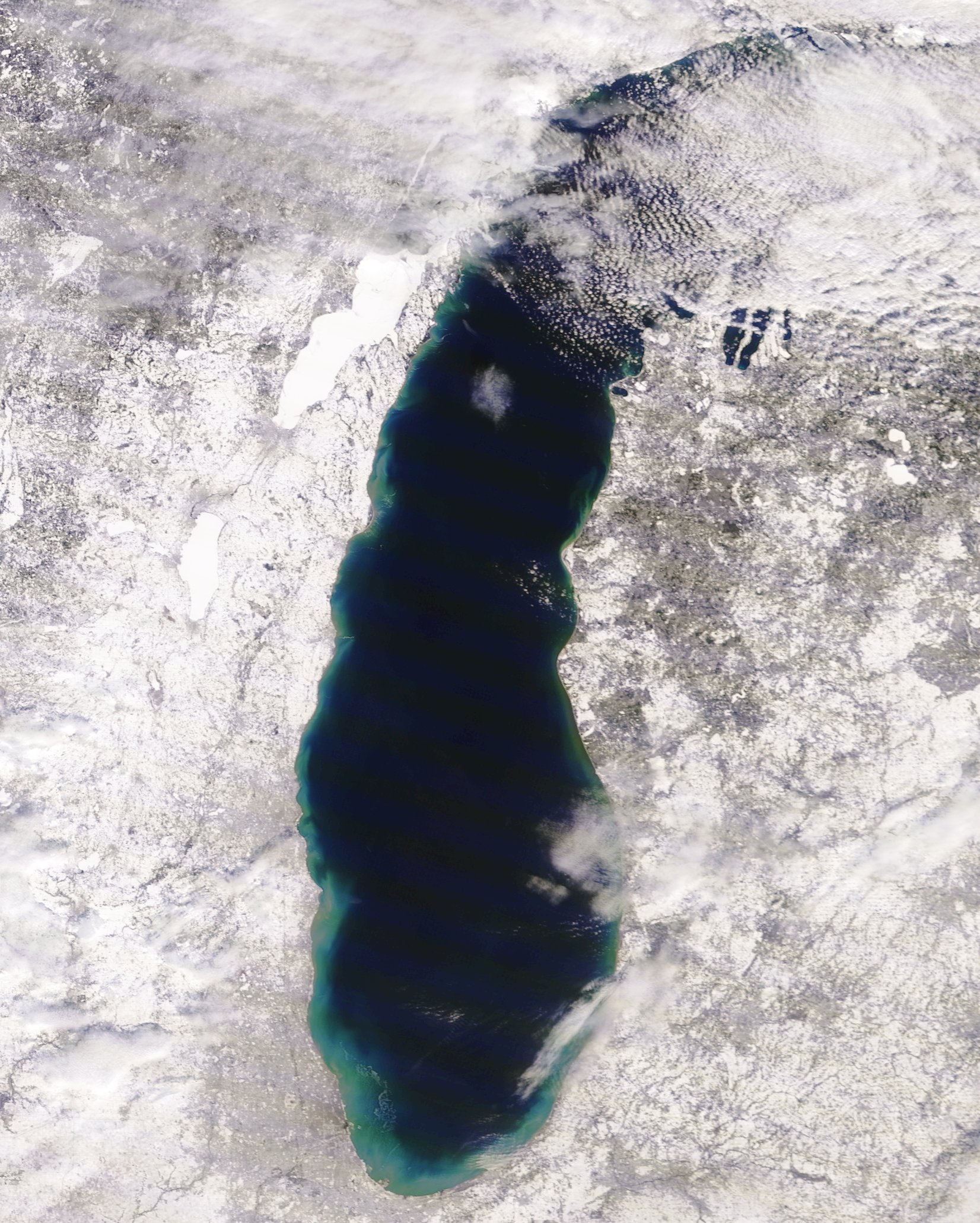 MODIS image of a rare clear February sky over Lake Michigan.
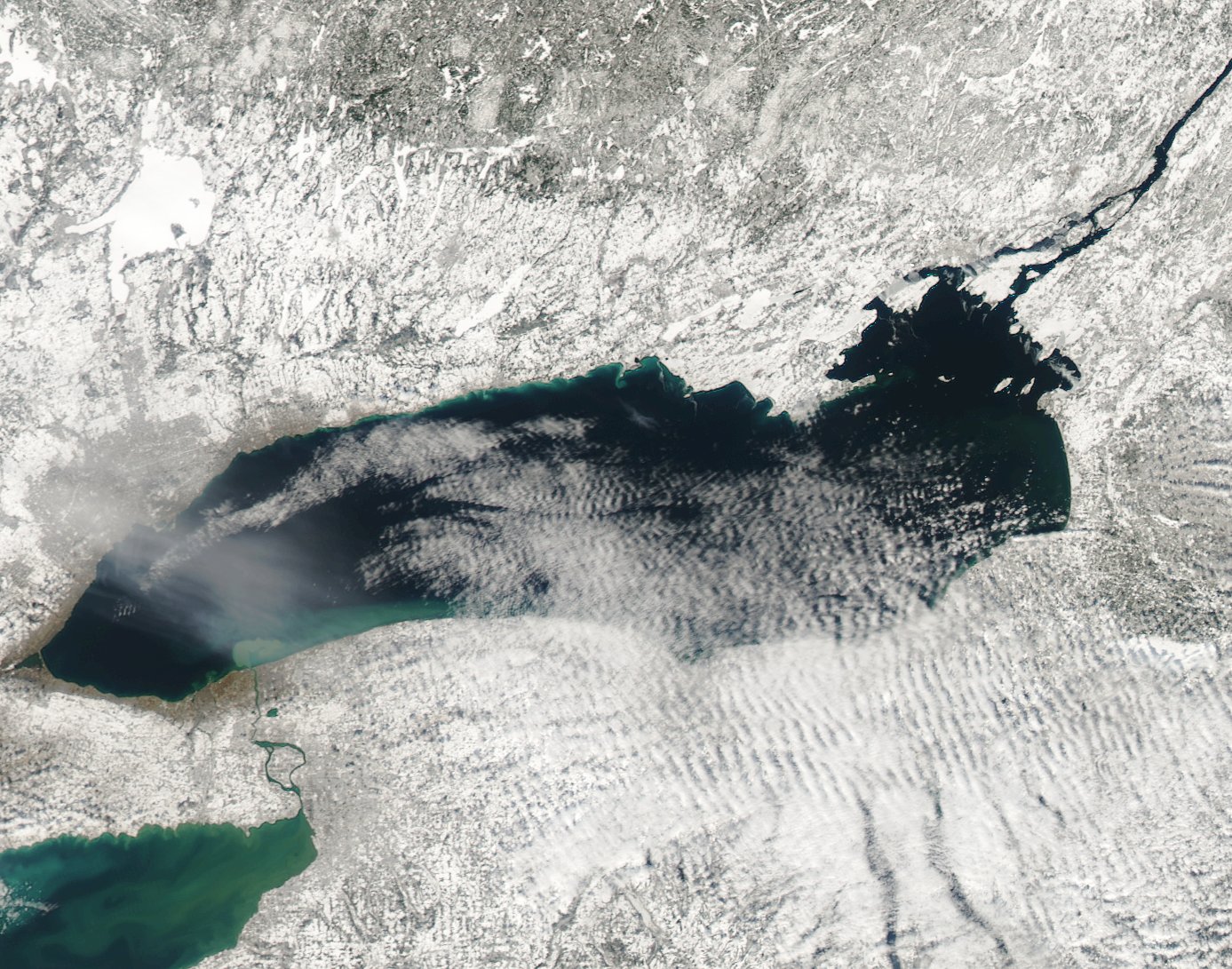 MODIS imagery of some February lake effect clouds over Lake Ontario.
Here's what you can see in the images above:
- The deep blue color in the center of each Great Lake representing deep water
- The lighter blue shades on the outside of the lakes representing shallow water
- Incredible detail of lake cloud cover
- The white color showing fresh snow on the ground, with rivers and higher elevation areas noticeable
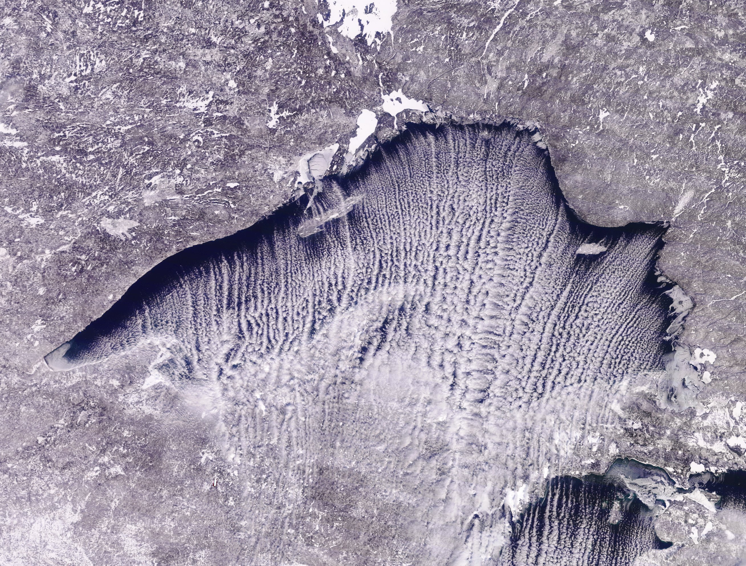 Beautiful lake effect cloud streamers on Lake Superior in February.
