Mostly dry weekend, Storm chances return Monday

-
1:38

Niles Charter Township in first phases of establishing Marijuana...
-
2:58

Elkhart officials handle slick conditions and blowing snow
-
3:42

Trustees lead backlash against bill to dissolve Indiana townships,...
-
1:27

Another round of light snow, Thursday morning
-
1:57

U.S. 20, bypass reopened Tuesday afternoon
-
0:56

Local Navy veteran organizing donations for California wildfire...
-
2:59

Culver Academies Horsemanship students to appear in Presidential...
-
2:02

Gobles Chapel closes to prevent funeral costs from rising for...
-
1:40

Consistent snowfall amidst bone-chilling cold
-
3:42

fans spend thousands along the road to the National Championship
-
1:02

Loved ones gather to honor the life of Elkhart Fire Captain Adam...
-
2:30

Mike Braun officially sworn in as Indiana’s 52nd Governor

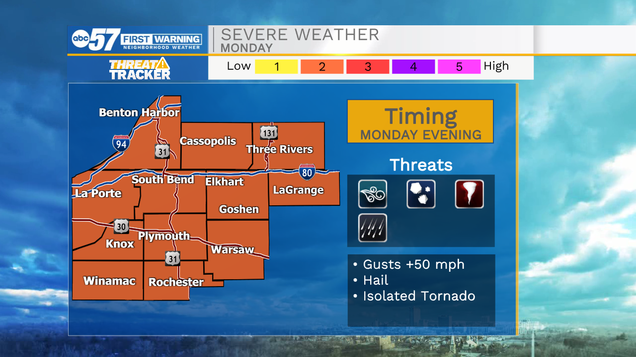
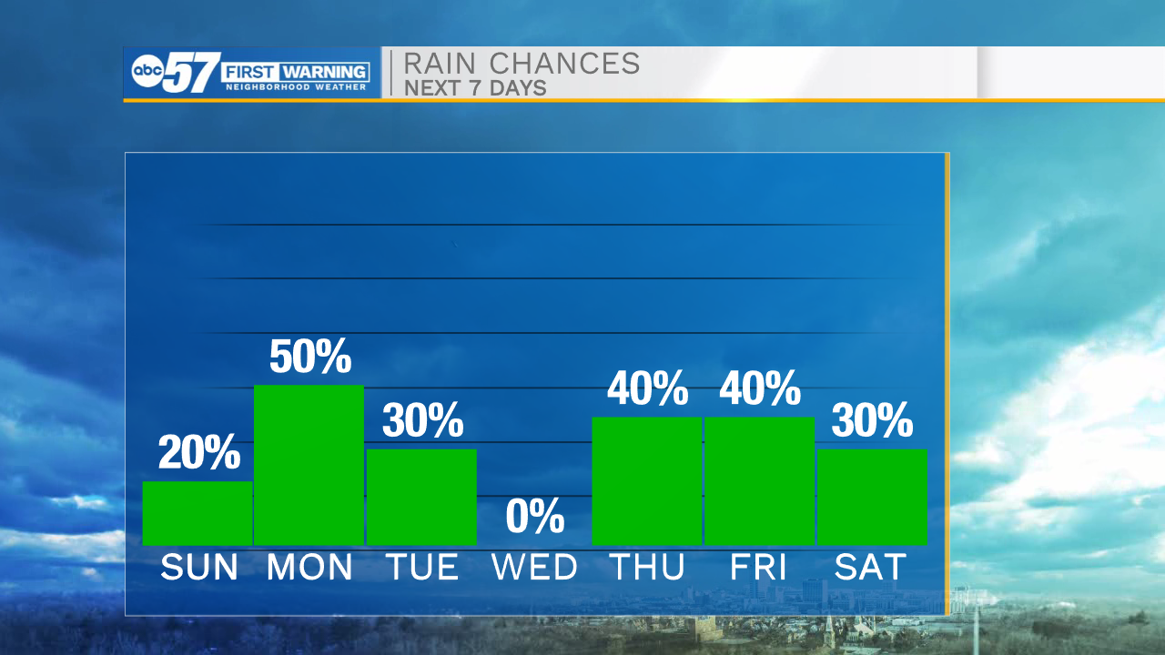
It will be a beautiful evening throughout Michiana with warm temperatures and dry conditions. We will see a little cloud cover build in overnight along with a few isolated rain showers. Most will stay dry. Showers will clear by the mid-morning hours tomorrow, and then sunshine returns for the afternoon. It will be another warm one to wrap up the weekend with highs in the mid 80s. Rain and storm chances return Monday by late afternoon/early evening. Strong to severe storms are possible. Some storms could produce gusty wind, large hail, and an isolated tornado or two. More rain and storm chances are possible for mid to late week as a few systems swing through our region. Next weekend high temperatures look to drop into the 60s.
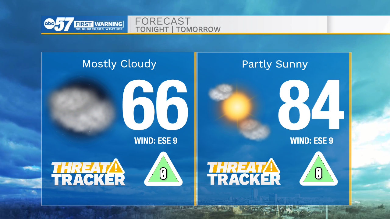
Tonight: Partly cloudy. Low 66.
Tomorrow: Partly cloudy/mostly sunny. High 84.
Monday: PM thunderstorms. High 72.
Tuesday: AM Rain. High 72.