More wintry precip will impact Michiana heading into the weekend

-
3:15

Saint Mary’s College hosts sports clinic for girls in honor...
-
4:12

The Red Event celebrating in South Bend
-
1:55

MAAC Foundation’s S50 K9 fund strengthens local police K9 units
-
1:47

Freezing rain moves in tonight, expecting slick roads tomorrow...
-
1:24

Happy feet hit the floor at 24th Annual Daddy Daughter Dance
-
3:35

New house bills could reorganize local school corporations
-
1:58

New era underway at Knollwood Country Club
-
3:51

Local Police Departments concerned over House Bill 1186
-
2:55

’Save Lakeside Woods’ successfully buys land back from developer,...
-
3:26

SBCSC announces community partnership to improve school literacy
-
2:21

Freezing rain reaches Michiana Wednesday night
-
2:25

Potential ice jamming in New Buffalo

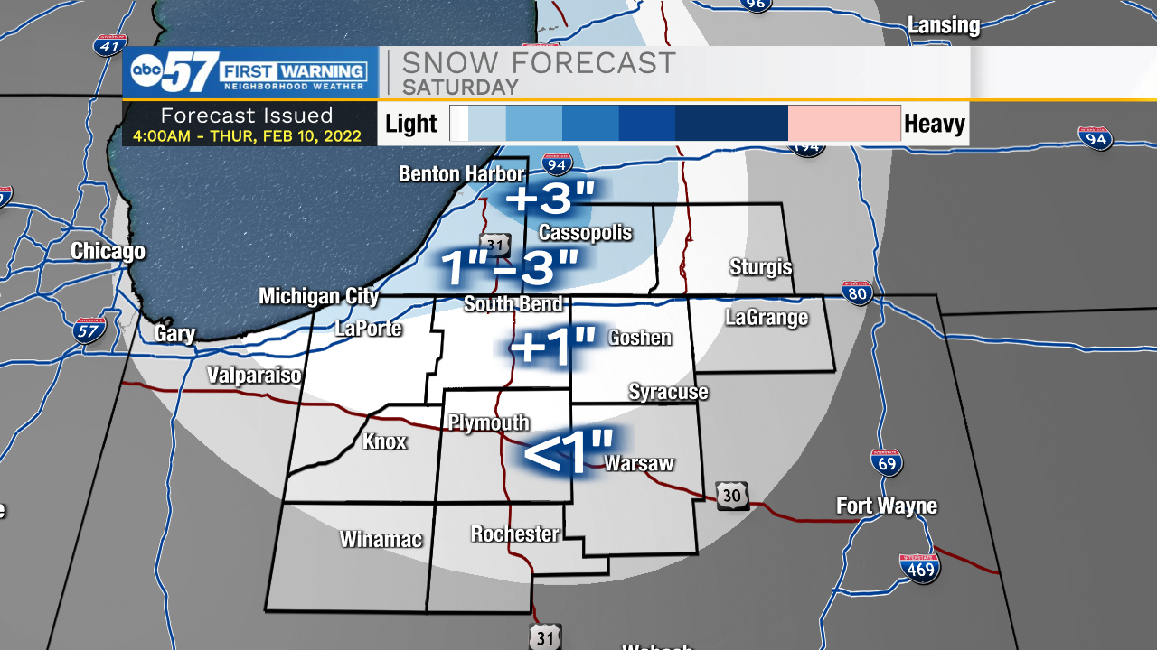
Mixed wintry precip will impact most portions of Michiana this morning as temperatures fall near freezing. Temperatures will warm into the upper 30s this afternoon leading to all rain. Along with the rain, conditions will be very windy as gusts push into the 25-35mph range. Tonight, temperatures take a nose dive into the 20s, leading to lake effect snow throughout Saturday morning and afternoon. We could see an additional 1-3” throughout northern and central Indiana. Sunday morning will be bitter cold with temperatures in the single digits to lower teens. Overall weather looks mostly quiet for Sunday and the beginning of next week. Mild temperatures arrive during the middle of the week with highs pushing into the upper 40s.
Today: Mixed wintry precip/windy/rain. High 40.
Tonight: Lake effect snow. Low 20.
Tomorrow: Lake effect snow. High 22.
Sunday: Cold/Mostly cloudy. High 22.