
-
0:25

City commission approves new downtown paid parking plan
-
3:41

Community shares concerns at board meeting over offensive language...
-
2:03

Staying safe around downed power lines
-
3:10

Former players share stories of Lou Holtz before his burial
-
3:02

Trust, Love, and Commitment: Lou’s Life Lessons
-
1:32

Notre Dame ready for funeral traffic
-
3:23

Notre Dame community says their final farewell to Coach Lou Holtz
-
5:58

Remembering Lou Holtz: Broadcasters reflect on Holtz’ role...
-
16:25

ESPN’s Rece Davis remembers the life and legacy of Lou Holtz
-
1:17

Cold, snowy and breezy overnight
-
2:15

’Political vengeance,’ Drake, GOP leaders respond to swatting...
-
3:14

The snow sticks around

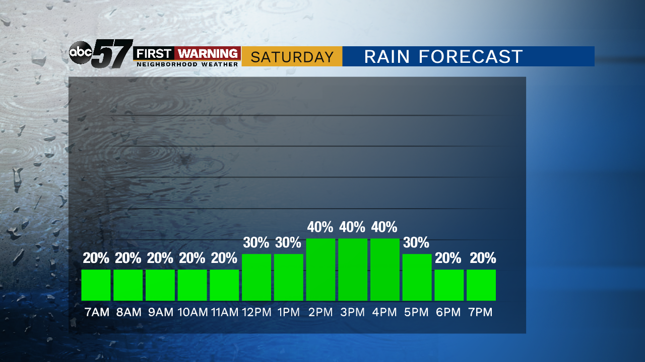
Scattered showers and thunderstorms are possible this evening with heavy rain.
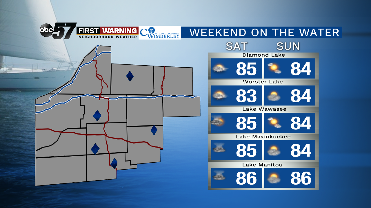
The humidity will drop this weekend when cold front slides through Saturday. Saturday will still be fairly humid with a chance of scattered storms in the afternoon. Skies clear and the dewpoint drops into Sunday with highs in the lower 80s. Fair and less steamy summer weather will last through the beginning of next week.
Tonight: Chance of storms, mostly cloudy, low of 70.
Saturday: Chance of storms, partly to mostly cloudy, high of 85.
Sunday: Mostly sunny, high of 82.
Monday: Sunny, high of 80.
Sign up for the ABC 57 Newsletter