
-
1:50

Showers and storms this afternoon
-
0:20

One person injured in shooting
-
0:36

Eddies Circuit Robotics holds competition Saturday
-
0:32

21st annual Nappanee Model Train Show
-
0:38

Local boys basketball team headed to IHSAA state finals
-
3:49

Midwest Meowfest brings kitten advocacy to attendees, new homes...
-
1:52

Mild tonight, showers tomorrow
-
1:43

Pleasant to start the weekend
-
3:06

Pulaski County weighs stricter solar rules amid resident concerns
-
0:40

Marian High School hosts World Down Syndrome Awareness Walk
-
2:33

South Bend leaders call for an end to gun violence
-
2:01

Tae Johnson, Notre Dame secondary stands out as Irish open spring...

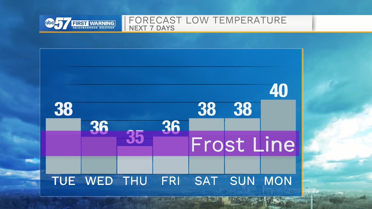
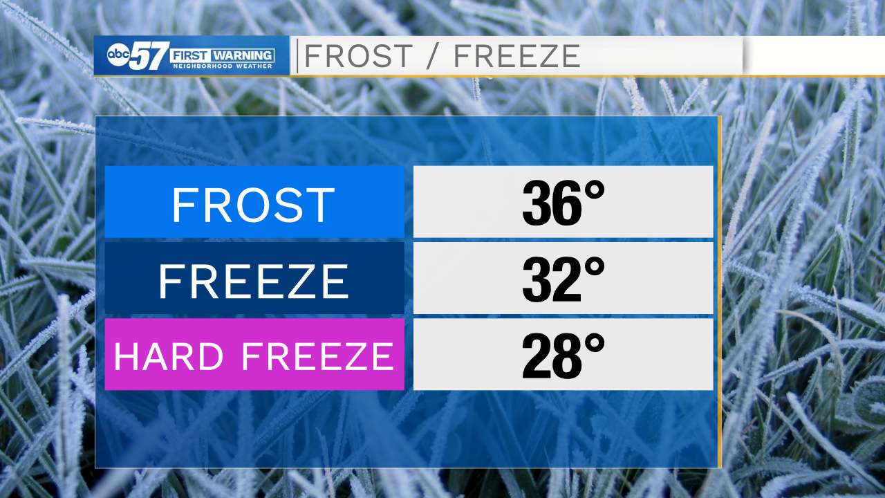
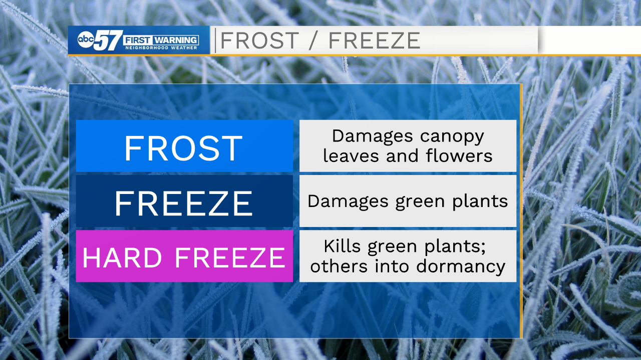
Temperatures fall midweek, as temperatures struggle to break 50 Wednesday and Thursday, and the wind chill will be in the 40s to upper 30s. Most nights will fall into the 30s, a few into the mid-30s which brings the concern for patchy frost. Friday morning has the greatest potential for frost, but still not a high risk. There's little change through the weekend, high temperatures range 55 to 60.
Tonight: Partly cloudy. Low 38.
Wednesday: Mostly sunny. High 52.
Thursday: Mostly cloudy, isolated shower possible, breezy. High 48
Friday: Mostly sunny. High 56.
Sign up for the ABC 57 Newsletter