


While we have a little more clarity regarding Monday's potential winter storm, there's still a lot we don't know as we head into the weekend.
There has been a definite northerly shift in our long-range forecast models over the past 24 hours. Still, as of Friday night, Michiana still looks like the bullseye in terms of heavy snow.
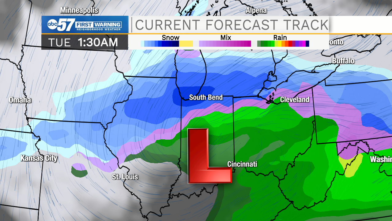
However, a slight change in the track of the low has a big impact on what type of precipitation Michiana will see, and how much snow we'll get.
If the low tracks even 50 miles farther to the north, that could mean Michiana would deal with an icy mix as well as rain and snow.
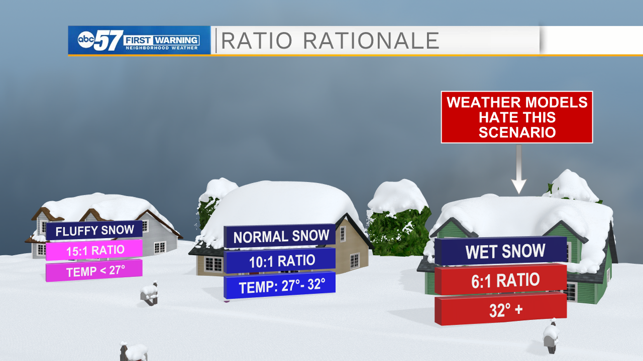
Another factor to consider is the temperature, and as a result, the snowfall ratio. Typically, we deal with around a 10:1 snow ratio. This means 10 inches of snow is produced for every inch of water that falls.
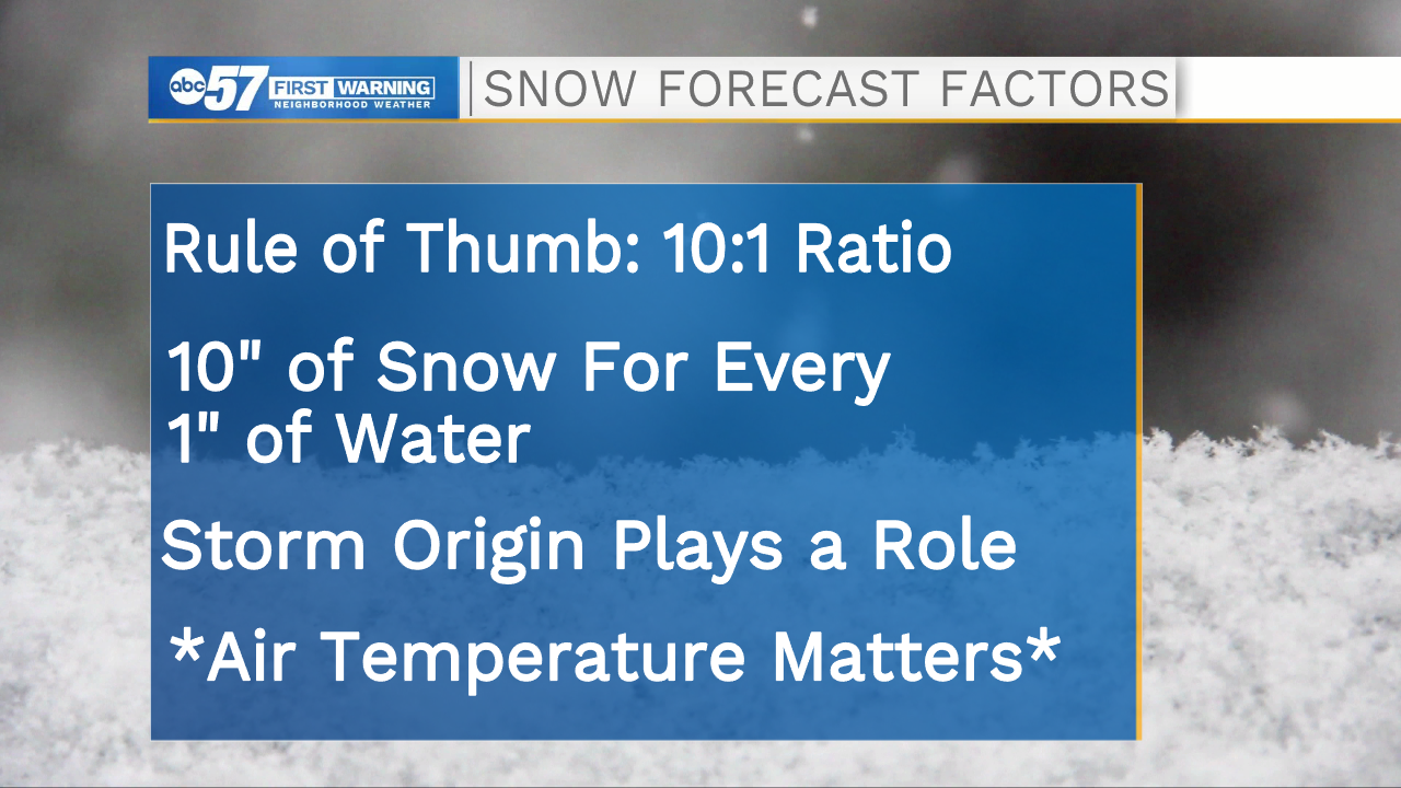
However, meteorologists have to study where the storm is coming from closely, as that can affect the air temperature that snow will fall through.
Our storm has southern origins, meaning it will have warmer air. Most likely, this means we'll be dealing with heavy, wet snow and may have to watch out for freezing rain as well.
Another thing: forecast models do not do well with a wet snow scenario. So while you may have seen the doomsday snow scenario on social media, odds are that most models are overdoing snow totals.
However, IF the high snowfall amounts do verify, this will be a major deal for Michiana. Wet snow not only can cause slippery roads, but also power outages and tree and roof damage if totals approach a foot.
Stay with ABC57 News throughout the weekend and early next week for up-to-the-minute weather updates, on-air, online and on social media.