Lake effect snow and bitter cold temperatures this weekend

-
1:43

Rain returns today, but quieter weather ahead this weekend
-
3:12

SBCSC hires attorney and outside investigators
-
0:16

New station for Dowagiac Fire Department
-
1:04

STEM night at LaSalle Elementary in Mishawaka
-
2:30

Local aviation expert weighs in on DC plane crash
-
1:20

When will lake effect snow come to an end?
-
0:33

Two police injured in Martin’s shooting released from hospital
-
2:21

Crows descend upon downtown South Bend for another winter
-
1:48

Rainy tonight with downpours and snowflakes possible Friday
-
0:33

Elkhart Clinic closed Thursday after unidentified vapor found...
-
0:15

How you can support victims’ families and wounded officers...
-
3:20

Gov. Braun ends DEI initiatives, sparks debate among local leaders

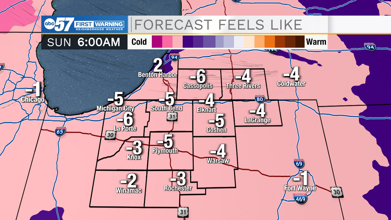
Lake effect snow will impact portions of Michiana throughout the morning before moving further north into the early afternoon. Temperatures today will only top out in the lower 20s. With breezy winds still in the mix, feel like temperatures will hold steady in the teens and single digits. Tomorrow morning will be another cold one with lows near the single digits and feel like temperatures around 0. A few isolated lake effect snow showers are possible again tomorrow afternoon. Overall impacts will remain very low. The big story for next week is the brief warm up on Wednesday and Thursday. Highs will push into the mid to upper 40s and lower 50s. With the warmer air, rain showers will develop and impact all of Michiana. After the cold front moves through we will likely see rain turn to snow. This could develop some flooding issues for portions of Michiana.
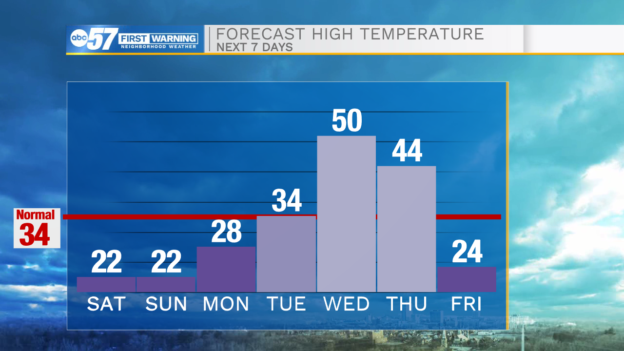
Today: Lake effect snow/cold. High 22.
Tonight: Extremely cold. Low 10.
Tomorrow: PM Lake effect. High 22.
Monday: Partly cloudy. High 28.