Tuesday, November 12th, 2019
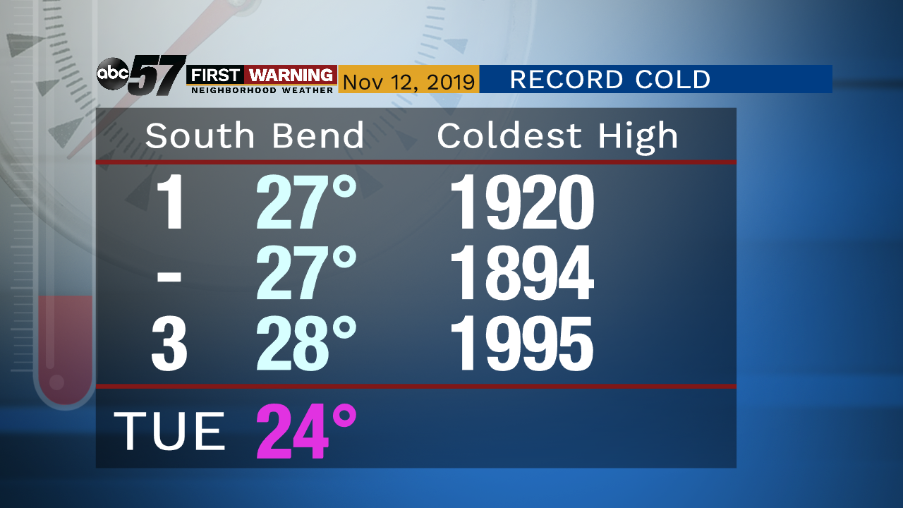
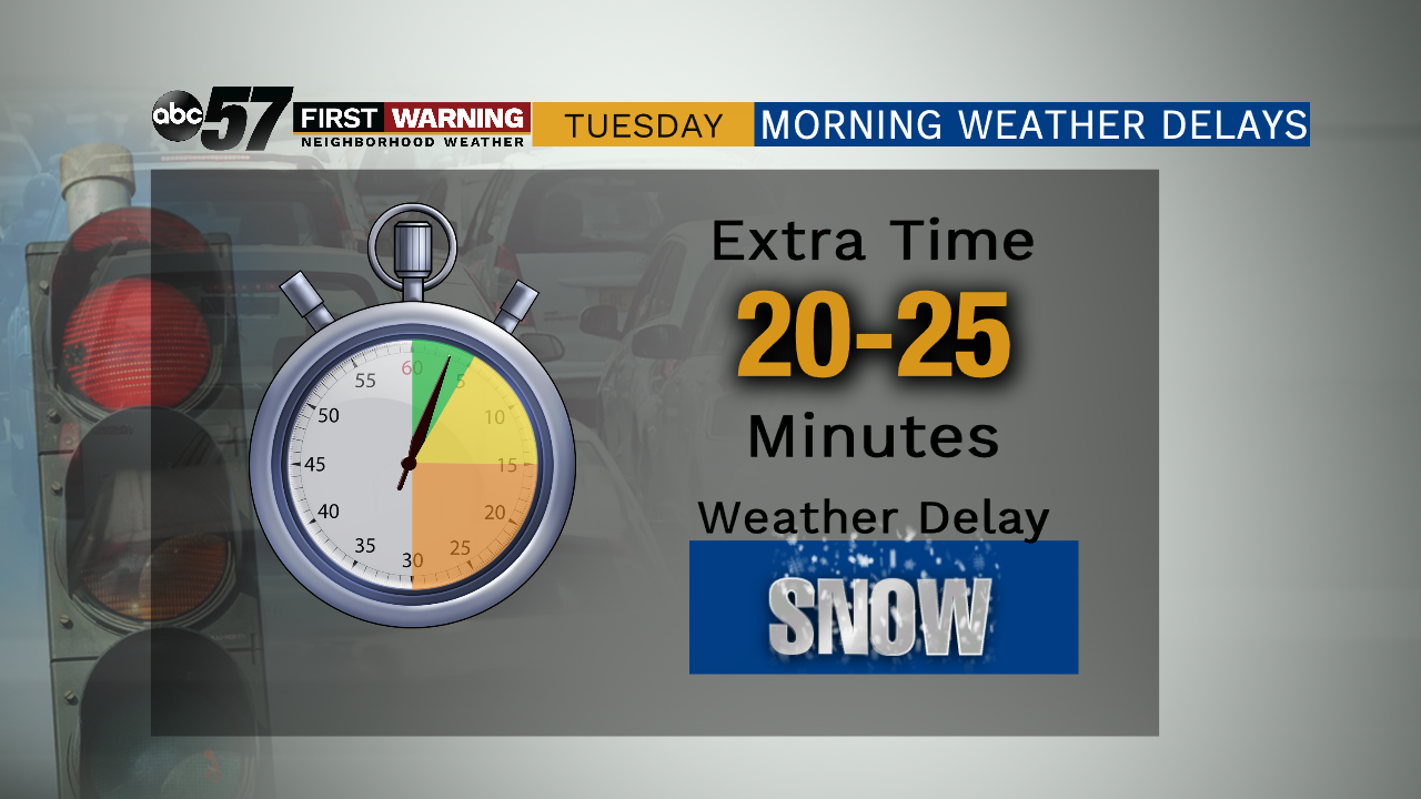
Lake effect snow showers persist this morning, heavy in spots. Plan on slow going commutes as delays in travel are likely. Lake effect starts to taper down later this evening but it stays bitter cold. So cold in fact that we will likely break the record cold high as we only top out at 24 degrees today. It’s going to feel even cold as it will be breezy today. It bottoms out tonight, falling into the single digits. It’s another cold one Wednesday but thankfully without the snow. Temperatures slowly start to improve into the weekend.
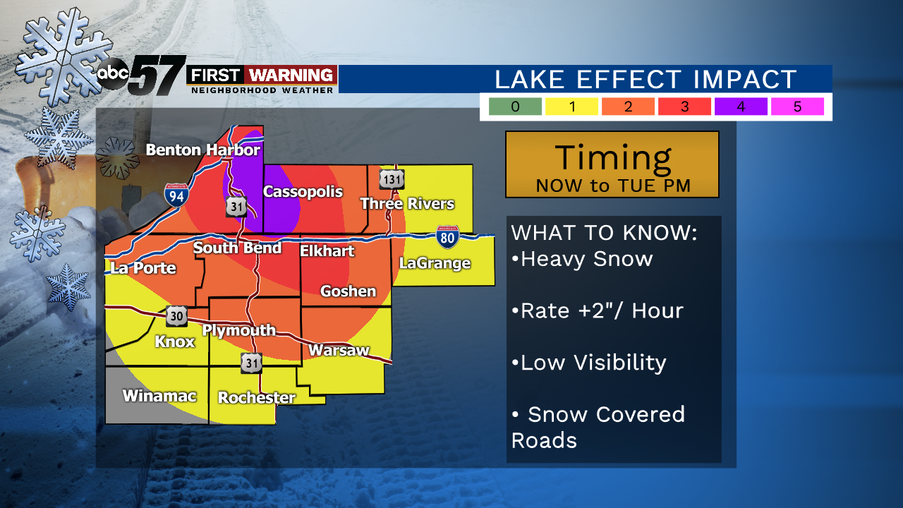
Today: Lake effect snow showers, record-breaking cold. High of 24.
Tonight: Lake effect snow tapering off. Low of 8.
Wednesday: Mostly to partly cloudy. High of 28.
Thursday: Mostly cloudy, slight chance of snow. High of 32.