
-
2:15

Severe weather likely for portions of Michiana later today
-
2:34

Open House for a new pedestrian bridge leaves Riverside Residents...
-
2:16

Notre Dame’s CJ Carr embraces growing expectations while leading...
-
2:34

Injuries sideline key linebackers as Notre Dame leans on depth...
-
0:58

U.S. Army increases maximum enlistment age from 35 to 42
-
2:08

Large hail, damaging winds and tornadoes possible Thursday
-
1:40

Nicholas Stanley appears in court, prosecutors push to prevent...
-
3:18

Expert breaks down high gas prices and factors impacting price...
-
2:08

Westview community rallies around boys’ basketball team headed...
-
2:06

The threat for severe weather has increased
-
2:16

More sunshine today with a severe risk tomorrow
-
0:32

Granger residents share input on proposed S.R. 23 roundabout

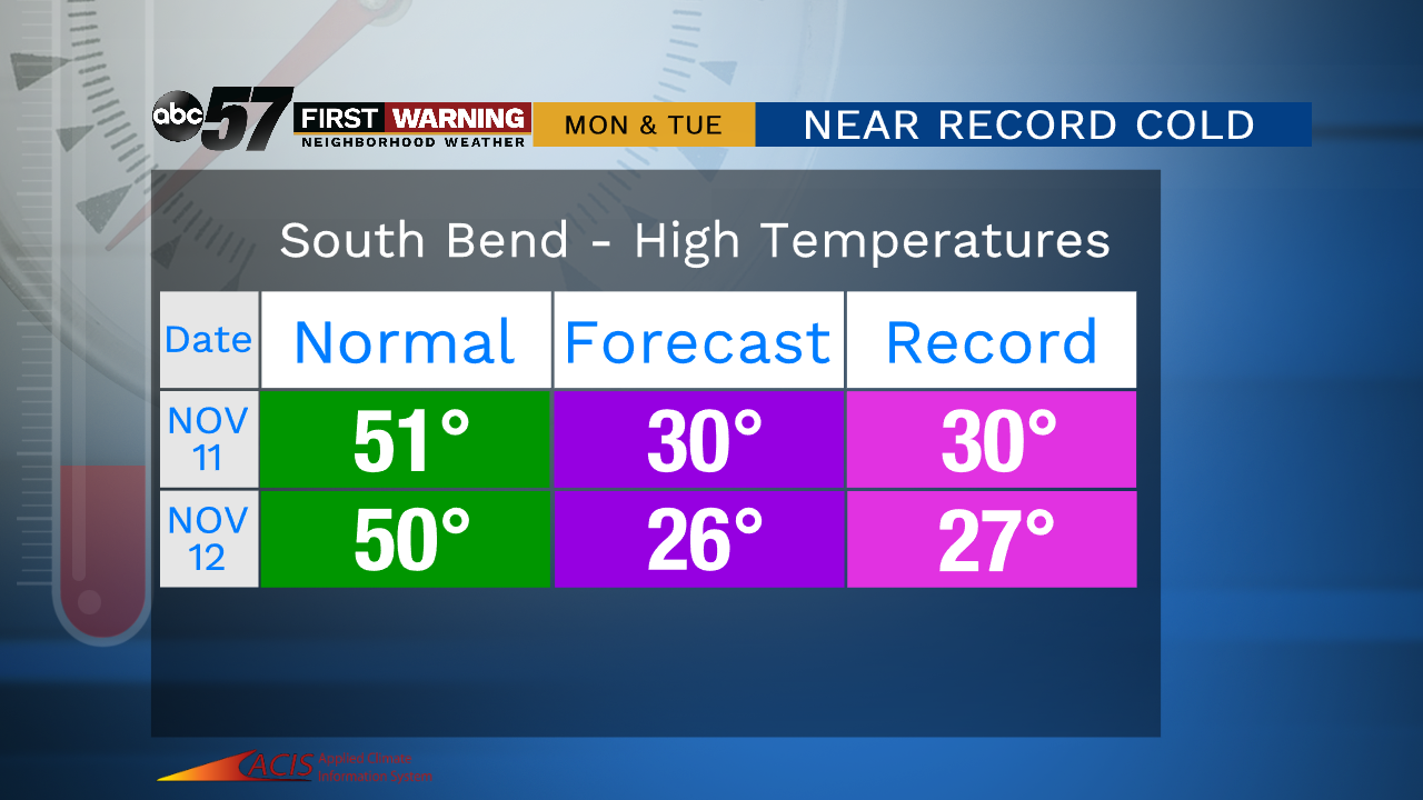
Cold weather lasts through Friday as temperatures struggle to break the freezing mark. A few flurries are possible off the lake in the morning with clouds breaking through the afternoon. The weekend is fair and a little warmer, with highs in the 40s. Temperatures crash again next week with record cold for mid-November. Snow also looks likely Monday through Wednesday morning with a lake effect set-up peaking Tuesday.

Tonight: Mostly cloudy, a few flurries / light snow near the lake. Low of 25.
Friday: Mostly cloudy to mostly sunny. High of 34.
Saturday: Partly cloudy. High of 42.
Sunday: Mostly cloudy. High of 44.
Monday: Snow showers. High of 30.
Sign up for the ABC 57 Newsletter