How temperatures impact snow totals


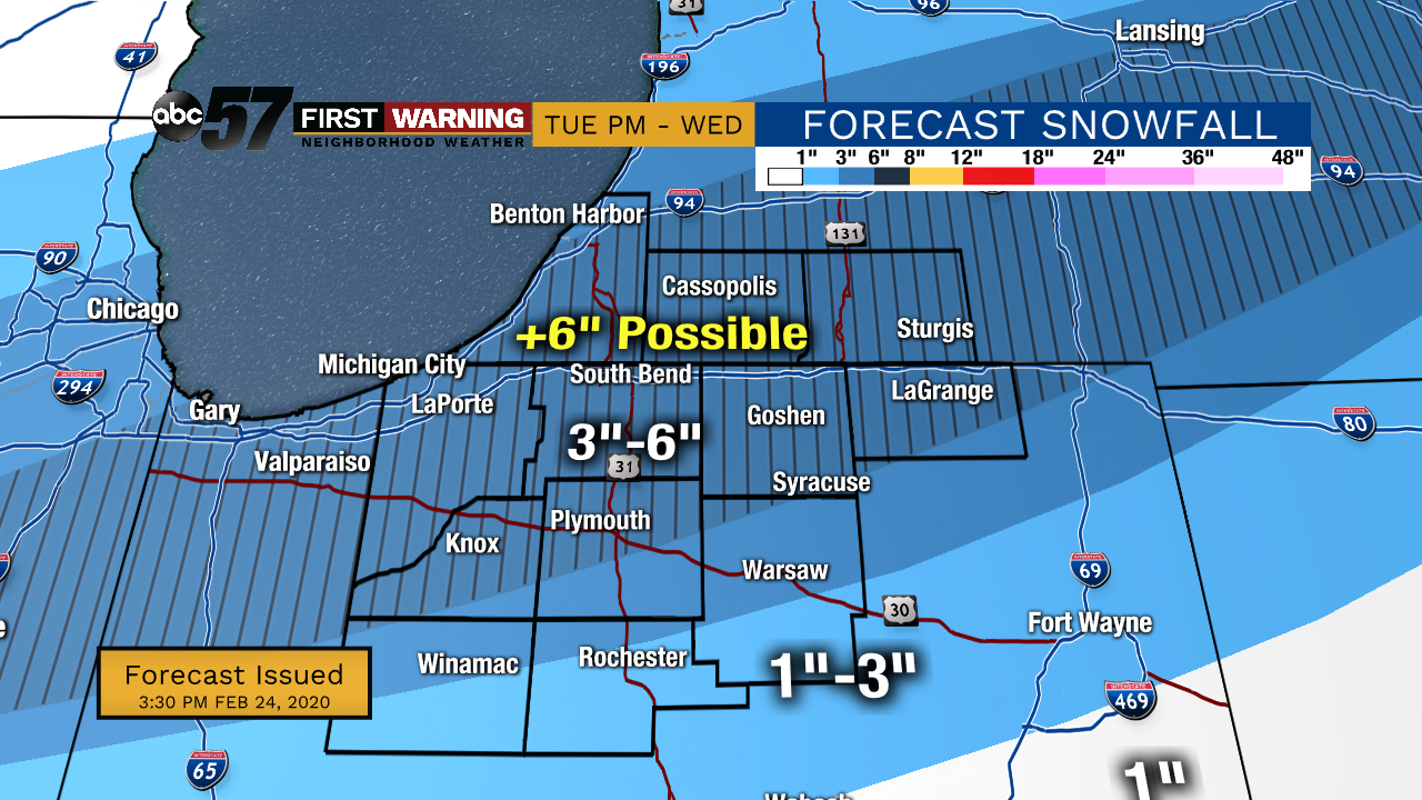
SOUTH BEND, Ind. -- Several inches of snow is on the way for Tuesday evening and Wednesday, but just how much snow we get is impacted by temperature.
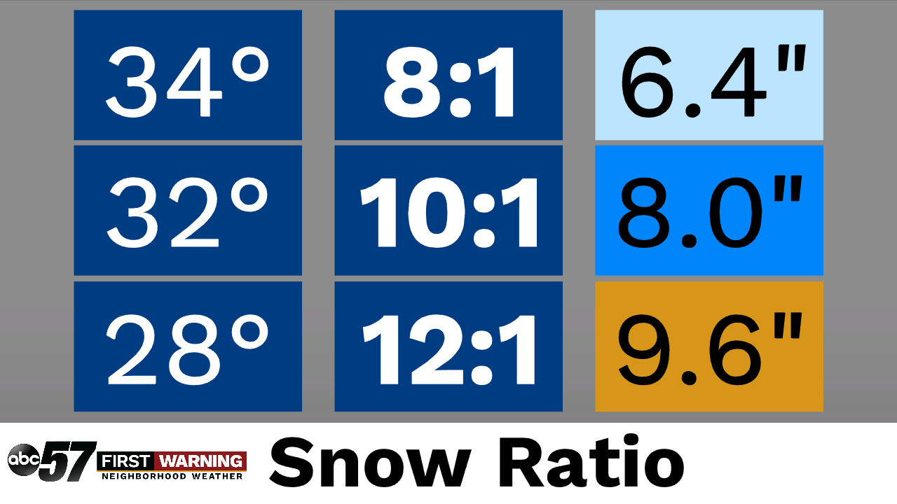
A snow ratio is the ratio of snow to liquid water. For example, if a snow ratio was 10:1, we would see 10 inches of snow for each inch of water. The ratio is higher for colder temperatures.
Let’s talk about snow ratios❄️
— Tom Coomes (@TomCoomes) February 24, 2020
What the temperature is dictates not just precip type but also how big and fluffy the flakes are.
The colder it is the higher the snow ratio. Right now about 0.5” of precip could fall as snow TUE-WED
8:1 ~ 34°
10:1 ~ 32°
12:1 ~ 28°#inwx#miwxpic.twitter.com/68jZW02ZKj
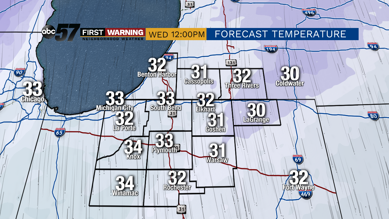
Warmer temperatures lead to a heavier snow. This also means a smaller accumulation on the ground. Wednesday afternoon, we will likely see snow like this as temperatures are around 33 degrees.
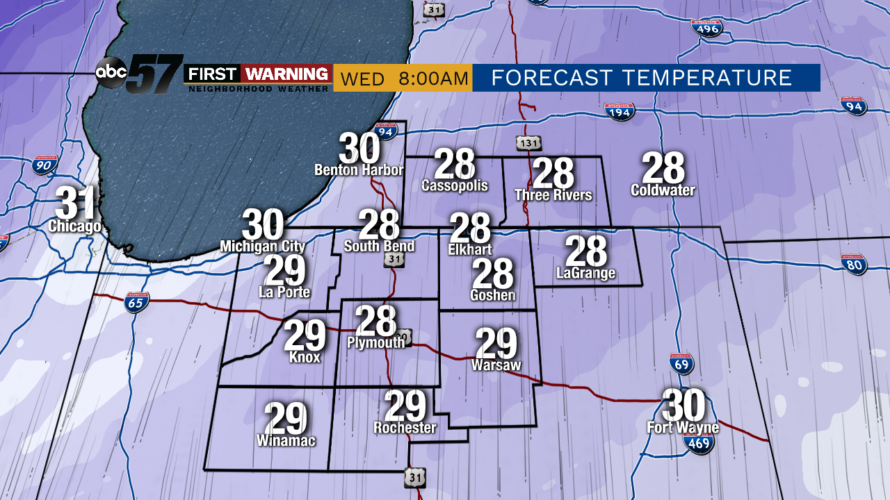
If temperatures are cooler, we see a light, fluffy snow. This snow is packed with plenty of air, which leads to a larger accumulation on the ground. This is the case for Wednesday morning.
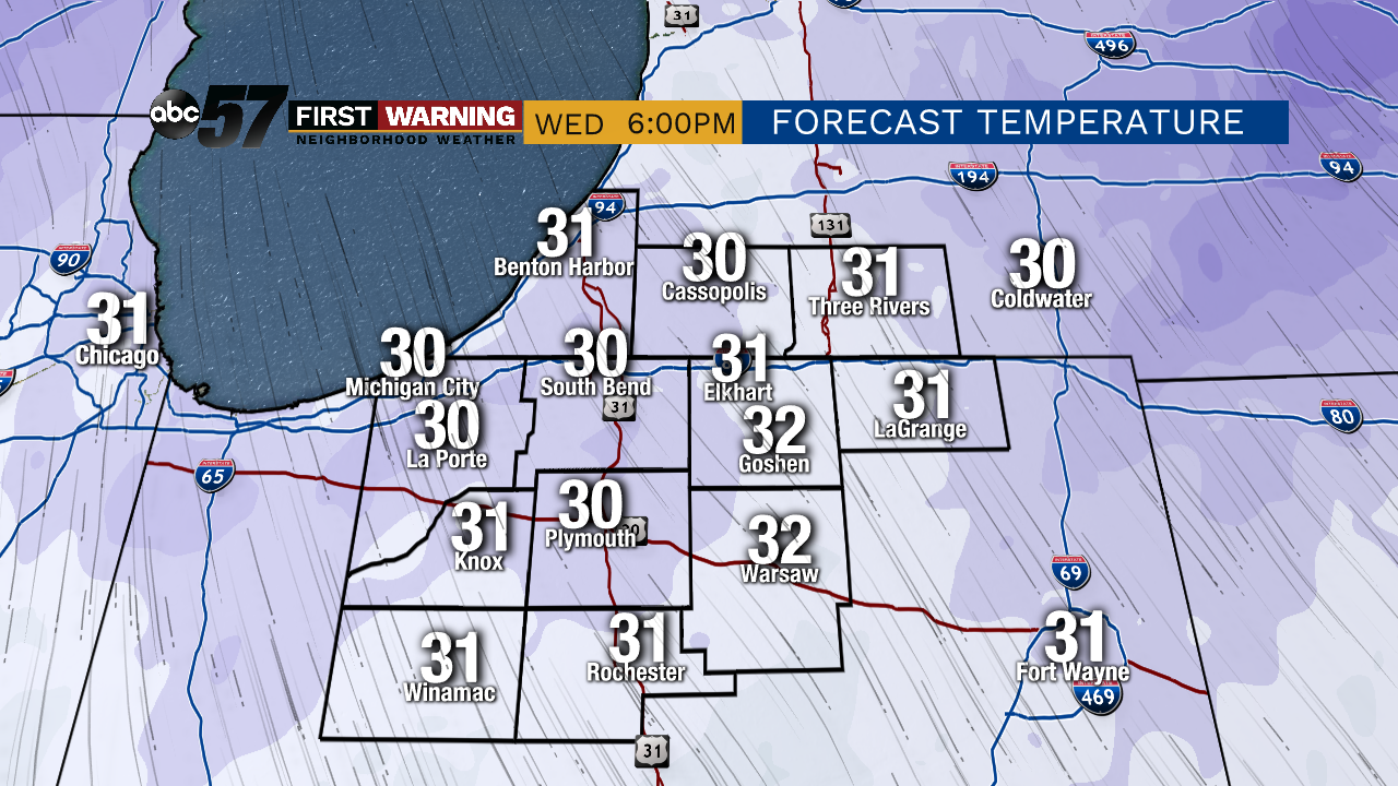
Wednesday evening will be a mix between light and heavy snow, as temperatures around around 30 degrees.
As of right now, the forecast calls for 0.8 inches of snow. A simple math problem determines the snowfall: just multiply 0.8 by the ratio.
If we stay mostly warm, we could see 6.4 inches of snow on the ground. If temperatures stay in the middle, around 32 degrees, then we could see around 8 inches of snow. If temperatures stay around 28 degrees, we could see over 9 inches of snow.
As forecasts and temperatures change, snowfall totals will also change until we reach Wednesday. This is the most recent outlook.