Hot weekend with storms possible Saturday

-
3:15

Saint Mary’s College hosts sports clinic for girls in honor...
-
4:12

The Red Event celebrating in South Bend
-
1:55

MAAC Foundation’s S50 K9 fund strengthens local police K9 units
-
1:47

Freezing rain moves in tonight, expecting slick roads tomorrow...
-
1:24

Happy feet hit the floor at 24th Annual Daddy Daughter Dance
-
3:35

New house bills could reorganize local school corporations
-
1:58

New era underway at Knollwood Country Club
-
3:51

Local Police Departments concerned over House Bill 1186
-
2:55

’Save Lakeside Woods’ successfully buys land back from developer,...
-
3:26

SBCSC announces community partnership to improve school literacy
-
2:21

Freezing rain reaches Michiana Wednesday night
-
2:25

Potential ice jamming in New Buffalo

Storms from the overnight hours will be wrapping up early this morning. There’s a dry period through the early afternoon, then we will watch for another round of showers and thunderstorm in the second half of the day.
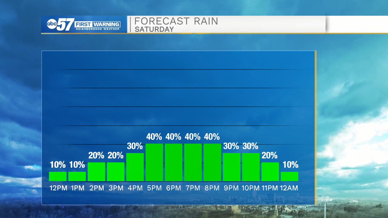
Some of this afternoon’s showers could have periods of heavy rain or gusty winds. No severe weather is expected.
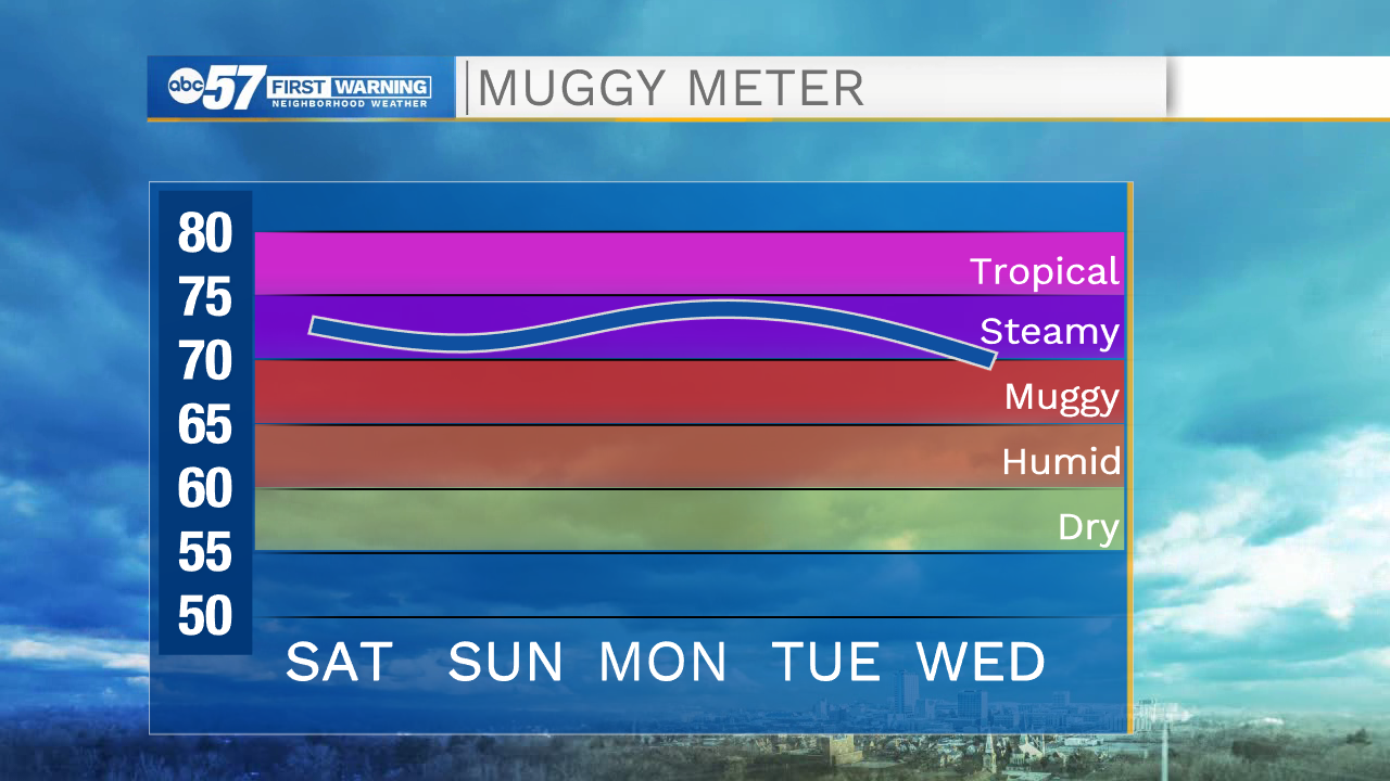
While a few showers or storms could linger into the overnight hours, Sunday is trending mostly dry. If you have plans to get outdoors, keep in mind it is hot and humid. While Sunday’s high is around 90, it may feel like the mid 90s with humidity. Stay hydrated!
Beach forecast this weekend looks good to go; green flag is expected both days. There are additional storm chances this week and the heat stays high.
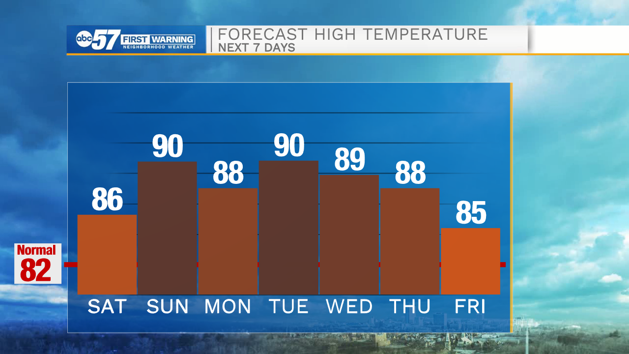
Today: Partly to mostly cloudy. Afternoon storms. High 86.
Tonight: Storms early. Low 70.
Sunday: Mostly sunny and hot. High 90.
Monday: Scattered thunderstorms. High 88.