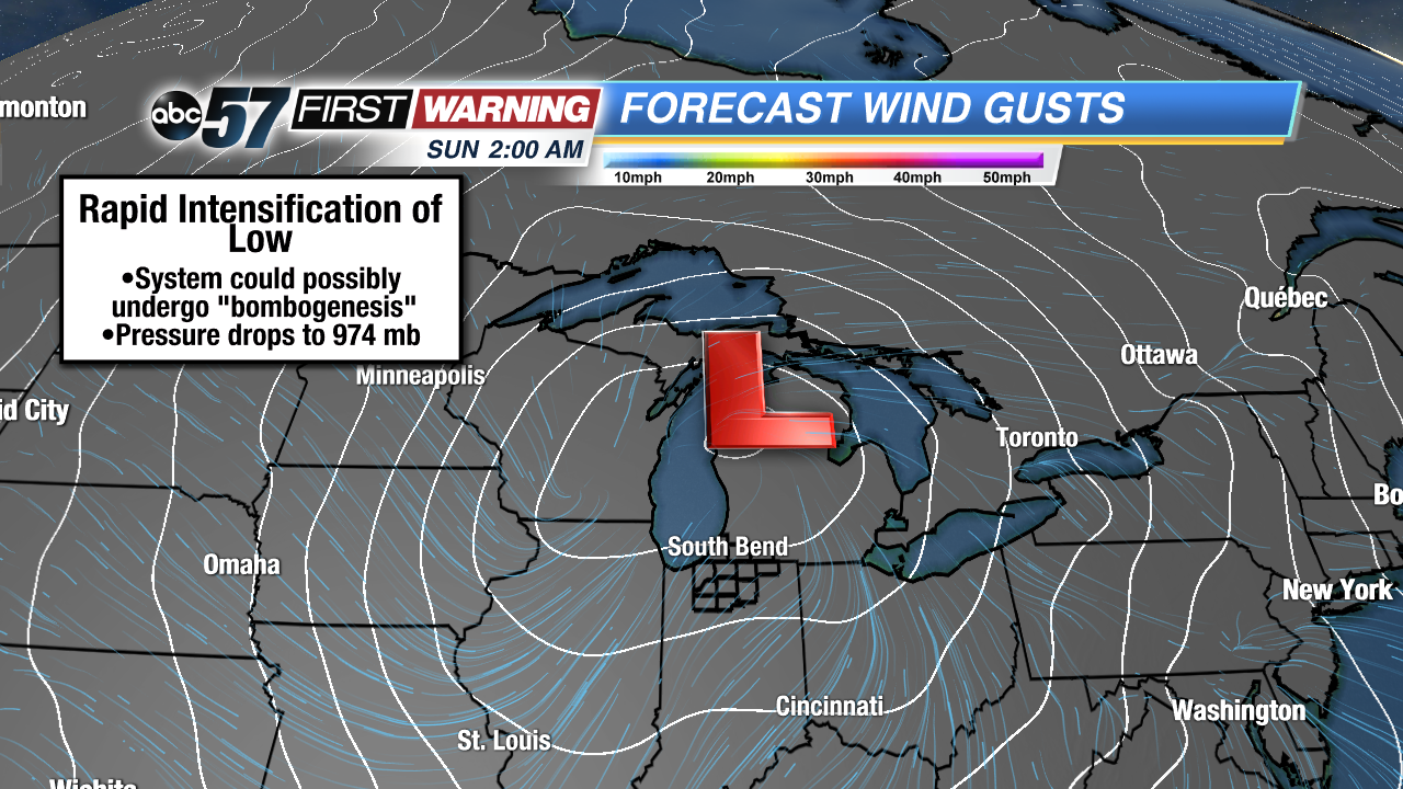
The much-discussed storm system set to slam the Midwest, Great Lakes and Ohio Valley with strong to damaging winds could very well undergo a process called "bombogenesis." What that means is the low pressure will intensify rapidly Saturday into Sunday as it moves from Oklahoma to the Upper Peninsula of Michigan. By definition, a low pressure system has to have its central pressure fall 24 millibars in less than 24 hours to officially undergo bombogenesis. It's something that certainly does happen, but it's on the rarer side of the spectrum of meteorological phenomena.
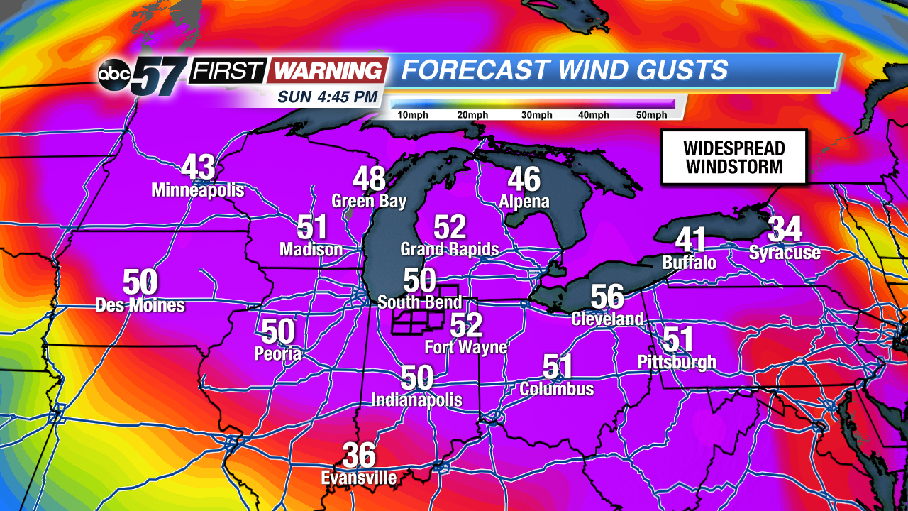
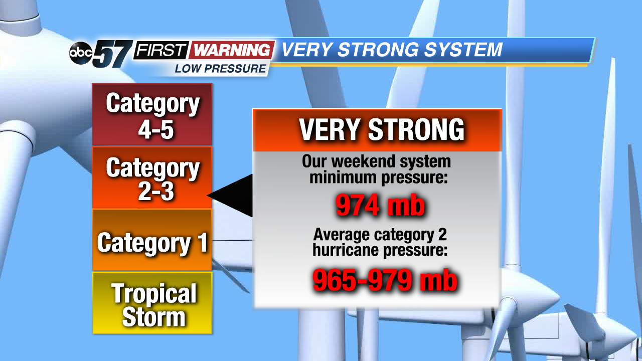
Most forecast models show this weekend's storm system going from roughly 996 millibars to 974 millibars, give or take. Technically speaking, that wouldn't qualify as bombogenesis. It's very close, though. So if the low eventually strengthens just a tad more than what's forecasted, bombogenesis will occur. What a rapidly strengthening low pressure system means for us is very strong to perhaps damaging winds; not just here, but all across the Midwest and Great Lakes. Peak wind gusts will likely reach 50-60 mph from Minnesota and Iowa to Michigan, Indiana and New York!
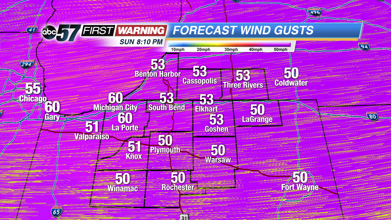
That, of course, places Michiana smack dab in the middle of the show. While the varying forecast models don't agree 100% regarding the maximum wind gusts for Sunday, they are pretty close. Right now, with a High Wind Watch in place, peak wind gusts in Michiana will likely reach 55 mph. Some spots will see a gust or two reach or even eclipse 60 mph. These kinds of gusts have the potential to knock out power, damage trees and power lines and cause minor structural damage to homes and businesses.
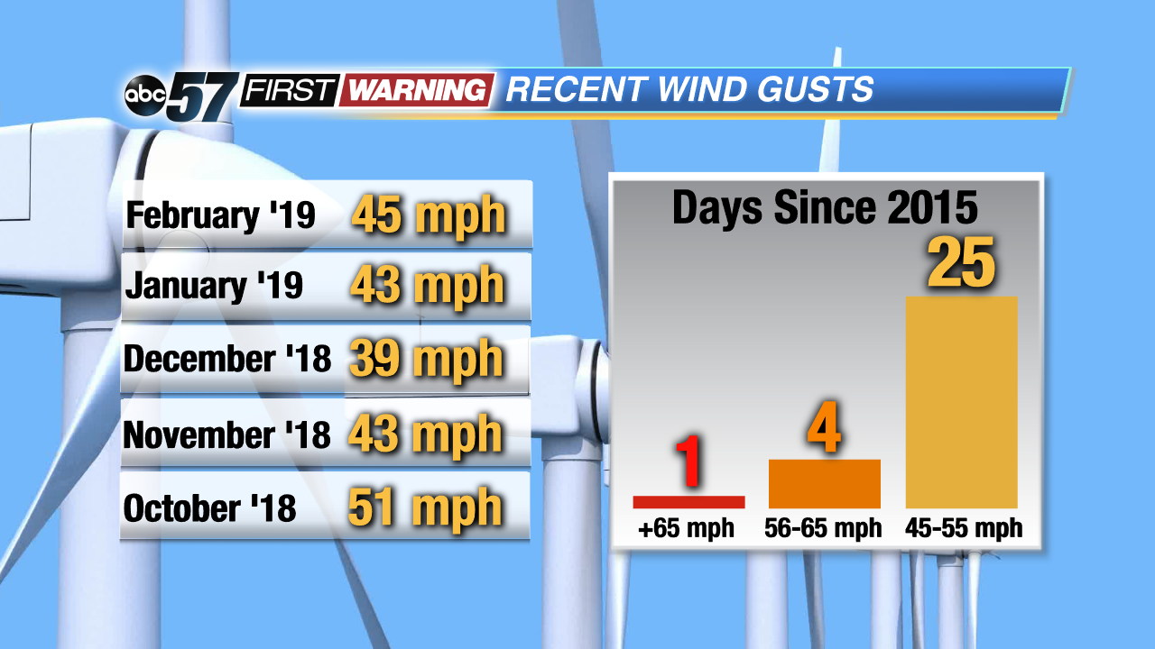 Wind gusts of this magnitude don't happen all that often in Michiana. Only 5 times since 2015 have we recorded a gust over 55 mph in South Bend.
It's the kind of wind that simply doesn't happen that often in this area. Since October 1st of last year, we've only had one wind gust over 50 mph in South Bend. Looking back even further, South Bend has only seen a wind gust over 55 mph
five times since January 1st, 2015! What's even crazier is the fact that all five of those wind gusts occurred courtesy of thunderstorms. It's very, very rare to see a wind gust exceed 50 mph without rain or storms. That's exactly what will occur on Sunday.
Let's break this system down in a different way to put in perspective just how strong it'll be. If the low pressure's minimum pressure drops to 974 millibars, like it's currently forecast to do, it will be comparable to the pressure of a category 2 hurricane! Let that sink in. No, our system isn't a hurricane over land. Hurricanes and systems that form over land are different in many ways. However, the fact that the pressure will be similar to a category 2 hurricane is remarkable. That is why we're talking an extended period (12-24 hours) of strong to locally damaging winds. Hunker down, folks!