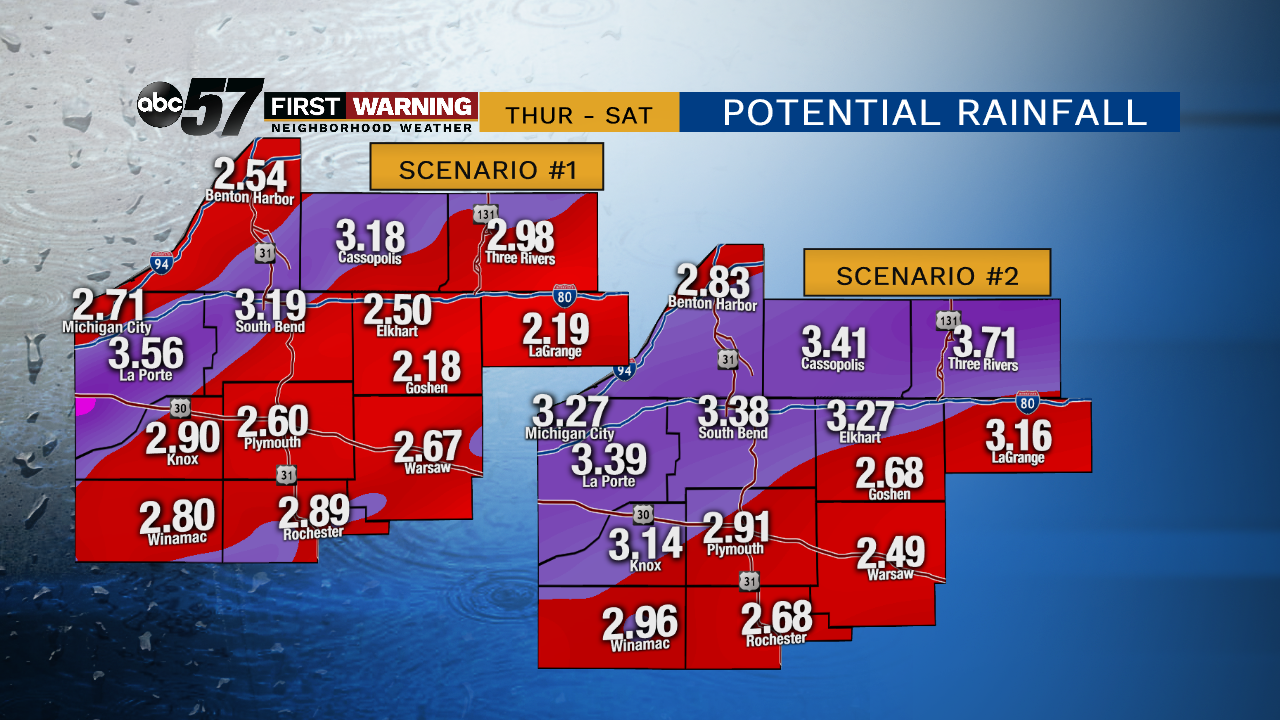
Heavy rain still the biggest threat with messy end of week storm

-
1:55

Temperatures going up along with our storm threat and wind gusts
-
1:48

Summer-like stretch ended by thunderstorms late Friday night
-
2:15

South Bend Police honors department members in 2024 awards ceremony
-
0:48

Women’s Impact Panel at Saint Mary’s College celebrates local...
-
3:07

Residents voice concerns over new sewer district
-
2:43

Fire crews spend hours working to put out flames at The Mill...
-
2:03

Head Coach of Washington High School Girl’s Basketball Team...
-
3:03

South Bend Walmart addresses parking lot potholes
-
0:39

Motorcyclist and passenger dead Wednesday afternoon after collision...
-
1:54

Very warm end to the week with storms and wind ahead
-
3:15

One currently hospitalized after reported explosion at Lock...
-
1:10

St. Joseph County Sheriff files motion to dismiss lawsuit brought...

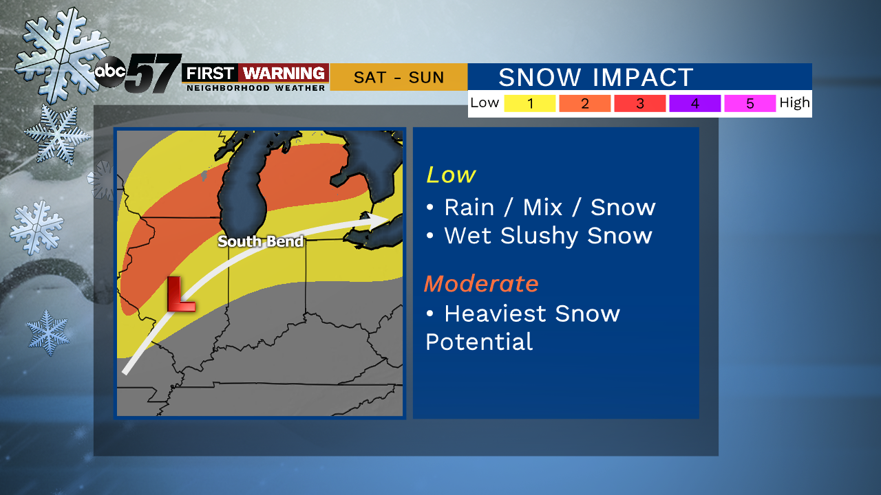
A one day cold snap, Wednesday. Temperatures will fail to reach 30 for a high, then the warm-up begins to end the week. Thursday will be breezy, gusts topping 30 mph as temperatures climb into the mid-40s. The forecast remains mild through Friday with widespread rain. The heavy rain threat may be greater than the snow threat, with more than two inches possible through midday Saturday. Rain changes to mix/snow Saturday afternoon as temperatures fall. The forecast remains slushy and sloppy.
Tonight: Mostly cloudy, chance of flurries. Low of 20.
Wednesday: Partly cloudy to mostly sunny. High of 27.
Thursday: Mostly cloudy, breezy, PM rain. High of 46.
Friday: Rainy. High of 48.
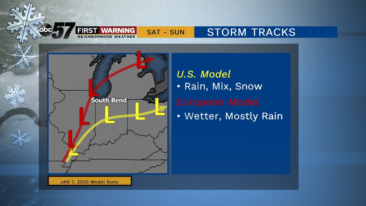
There is some model disagreement on the [day 4] forecast track of the low. Even with a disagreement in track both solutions trend less on a snow impact and more on rain, keeping the area in the ‘wet zone’ longer.