
-
1:55

Comfortable temperature brings life to the Elkhart Jazz Festival
-
0:28

LGBTQ community celebrates pride month at Potawatomi Park
-
2:35

Plymouth Motor Speedway’s Home Run Street Stock race brings...
-
1:19

Timing out your Father’s Day rain showers
-
1:09

The beautiful conditions continue through the evening
-
0:59

’Dad Strong 5k’ event advocates for men’s mental and physical...
-
0:54

Fairly nice morning
-
2:47

6th Annual Juneteenth Celebration held today in Niles
-
3:07

Thousands of people across the country pour into Chicago for...
-
2:28

Local street art murals promote water quality awareness
-
2:51

59th annual Leeper Park Art Fair returns
-
1:39

South Bend Chapter of Indiana Black Expo hosts 27th annual Juneteenth...

Lake effect snow will ramp-up overnight, intense snow bands, with snowfall rates of more than two inches per hour. Areas under the bands for the longest period of time could see in excess of a foot of snow through Tuesday evening.
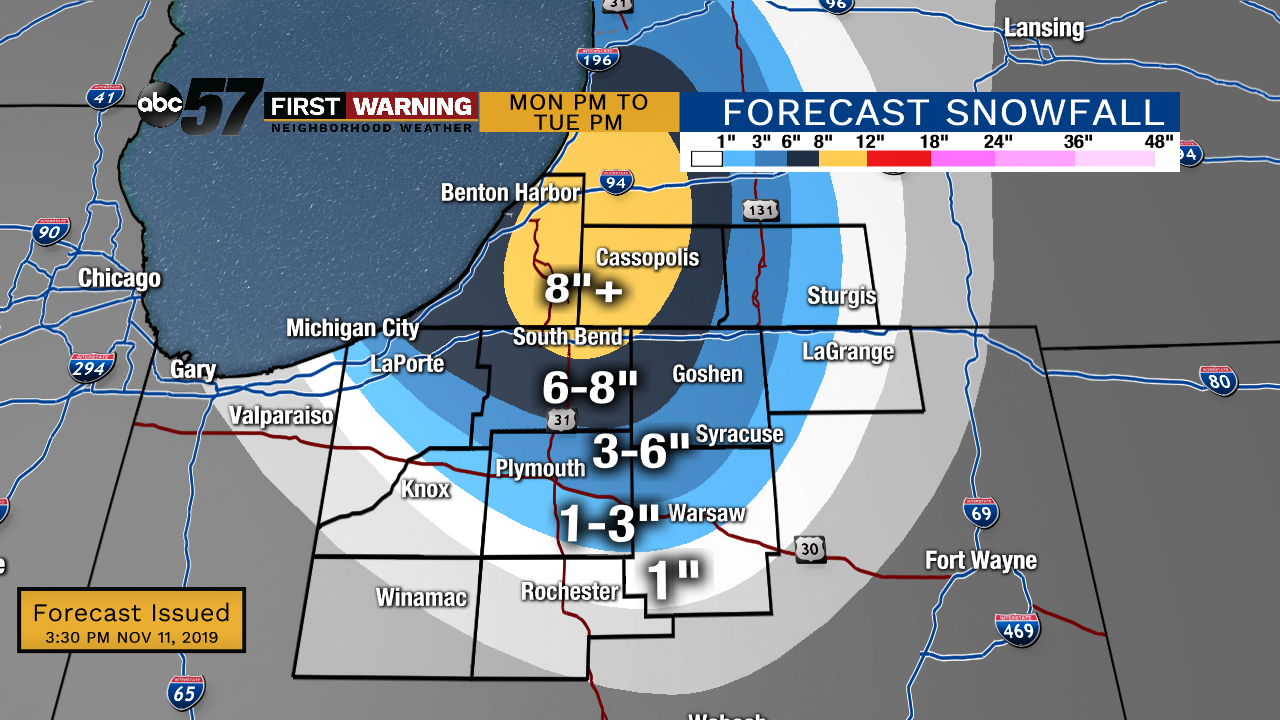
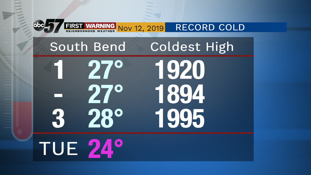
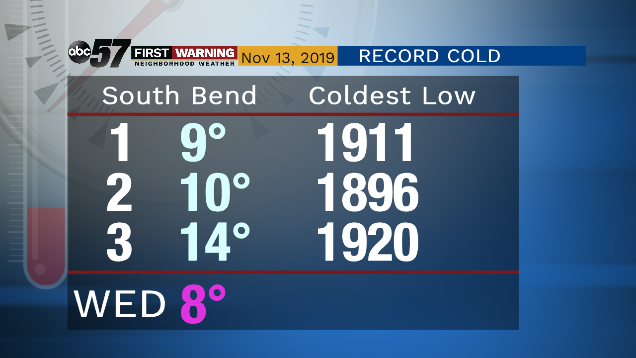
Lake effect snow and record cold in the forecast through Tuesday as high temperatures struggle to warm above 25 degrees. Snow will continue through Tuesday and gradually wind-down by early Wednesday morning. Driving in the lake effect zones will be difficult. Low temperatures fall into the single digits by early Wednesday.
Tonight: Heavy lake effect snow, breezy. Low of 18.
Tuesday: Lake effect snow showers. High of 24.
Wednesday: Mostly to partly cloudy. High of 28.
Thursday: Mostly cloudy. High of 32.
Sign up for the ABC 57 Newsletter