Heating up with evening showers and storms

-
1:08

Elkhart residents fight unauthorized mobile home
-
2:40

Fairfield breaks ground on $7 million athletics and band facilities...
-
0:50

One person dead after crashing into pole on S.R. 933
-
0:42

Dan Schaetzle approved for 2026 re-election
-
1:02

YWCA receives donation to support women’s economic advancement
-
1:02

Local high schoolers learn about construction during Building...
-
3:38

Michigan synagogue attack hits home for ABC57’s Leo Goldman
-
1:29

What’s leading to higher gas prices right now
-
2:06

EF-2 tornado leaves half mile path of damage
-
2:49

St. Joseph County property assessments will see four percent...
-
2:04

South Bend locals take matters into their own hands as they wait...
-
2:16

The fierce March weather continues, wind, storms, snow ahead

ABC57 First Warning Neighborhood Weather
Wednesday, July 15th, 2020
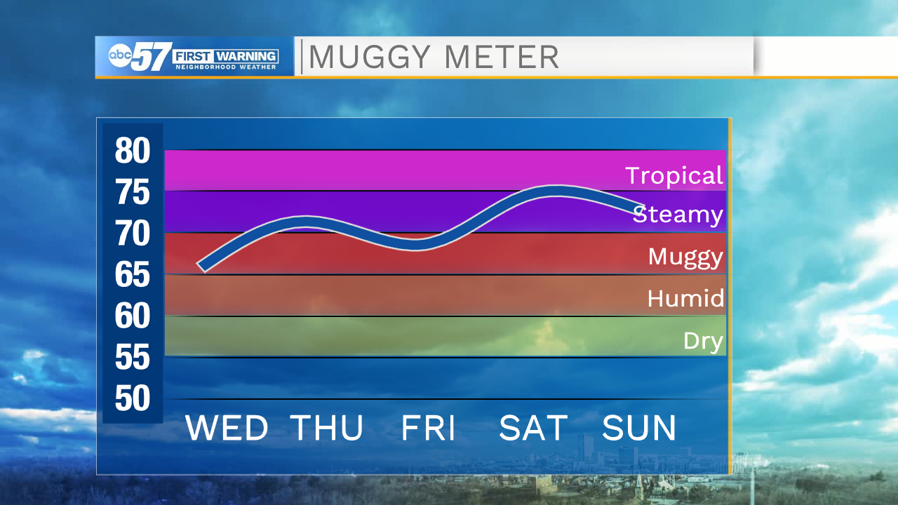
Clouds increase as we head into the afternoon with rain and a couple of thunderstorms after 7pm. A few thunderstorms tonight could have gusty wind but the severe threat is low. Heavy rain is the main threat. A few showers could linger into early Thursday morning, otherwise clouds begin to clear out.
Friday brightens back up but we are hot and humid heading into the weekend! Heat indices will climb to the mid 90s to possibly 100. The heat and humidity will make for a good recipe of isolated thunderstorms over the weekend.
Today: Increasing clouds. Evening showers/storms. High 90.
Tonight: Showers and thunderstorms. Low 70.
Thursday: Early AM shower then clearing skies. High 84.
Friday: Mostly sunny. High 90.