SOUTH BEND, Ind. -- Here we go again. There's yet another wintry storm system for our meteorologists to track this week. While most of wintry systems have been minor regarding impacts, this one could be a little more impactful.
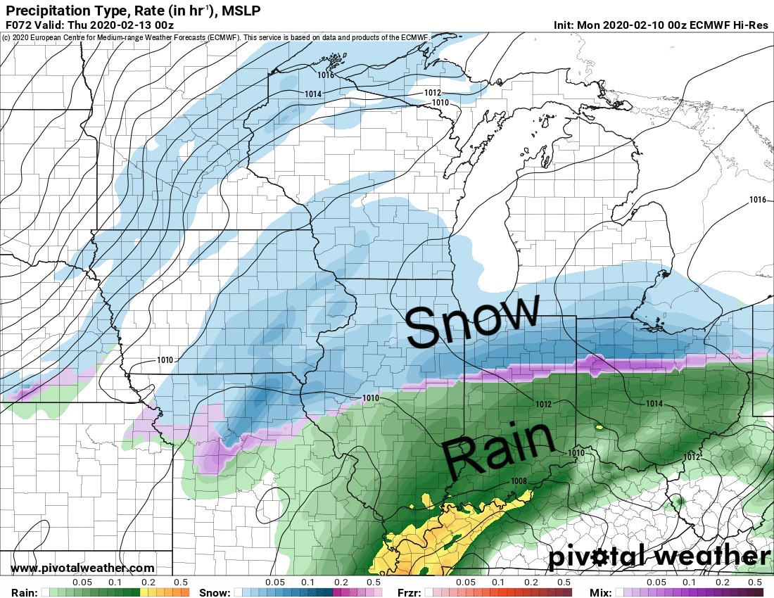 Potential radar imagery at 7 p.m. EST Wednesday as snow begins moving in.
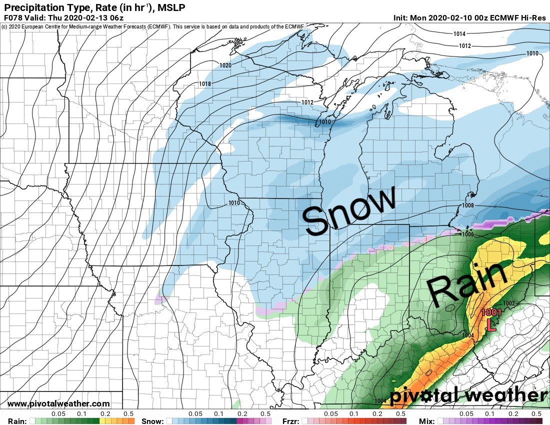 Potential radar imagery at 1 a.m. Thursday morning.
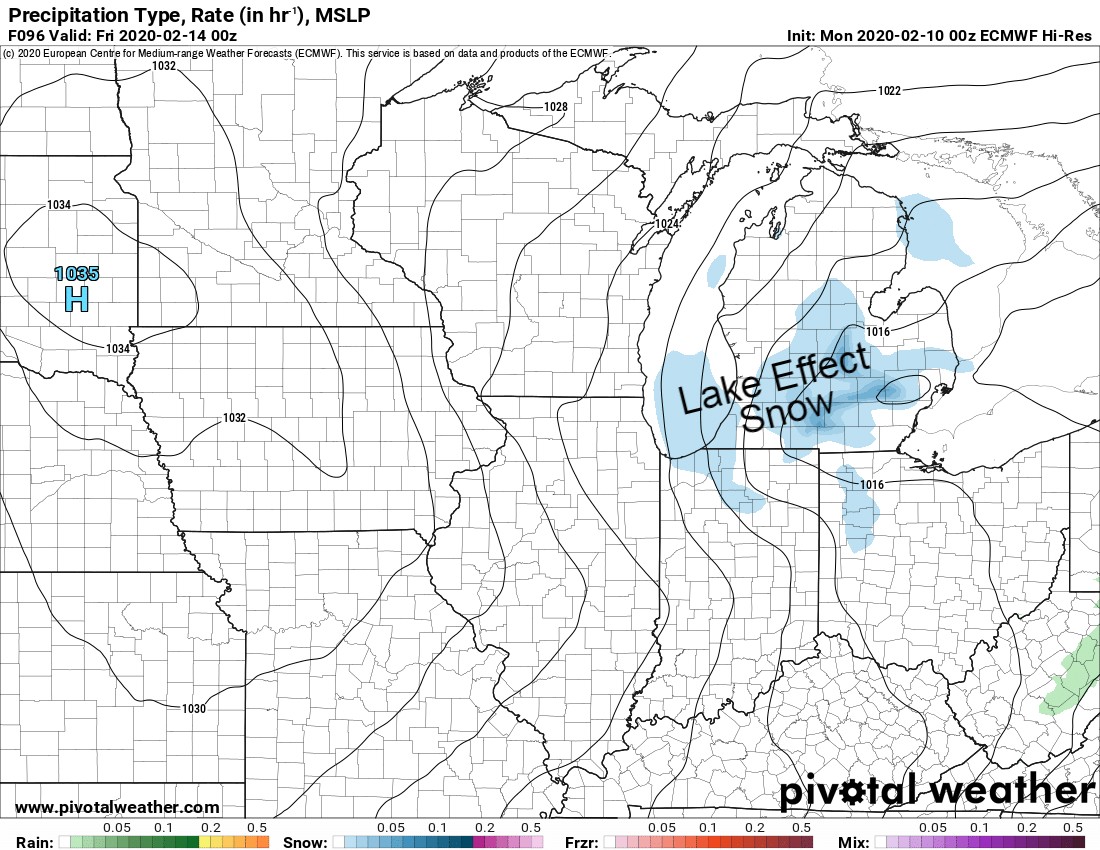 Potential radar imagery at 7 p.m. EST Thursday evening.
It'll also be a tricky and hazardous commute Thursday morning. Friday morning's commute may also be impacted as lake effect snow showers fall Thursday into Friday.
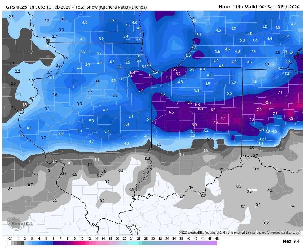 The GFS forecast model's total snowfall by Friday evening. This includes both system snow and lake effect snow.
The model above is the American GFS, which shows a general 3-6" across the northern half of Illinois, Indiana and Ohio, in addition to much of Lower Michigan.
Some higher totals are also depicted in the purple and pink shades.
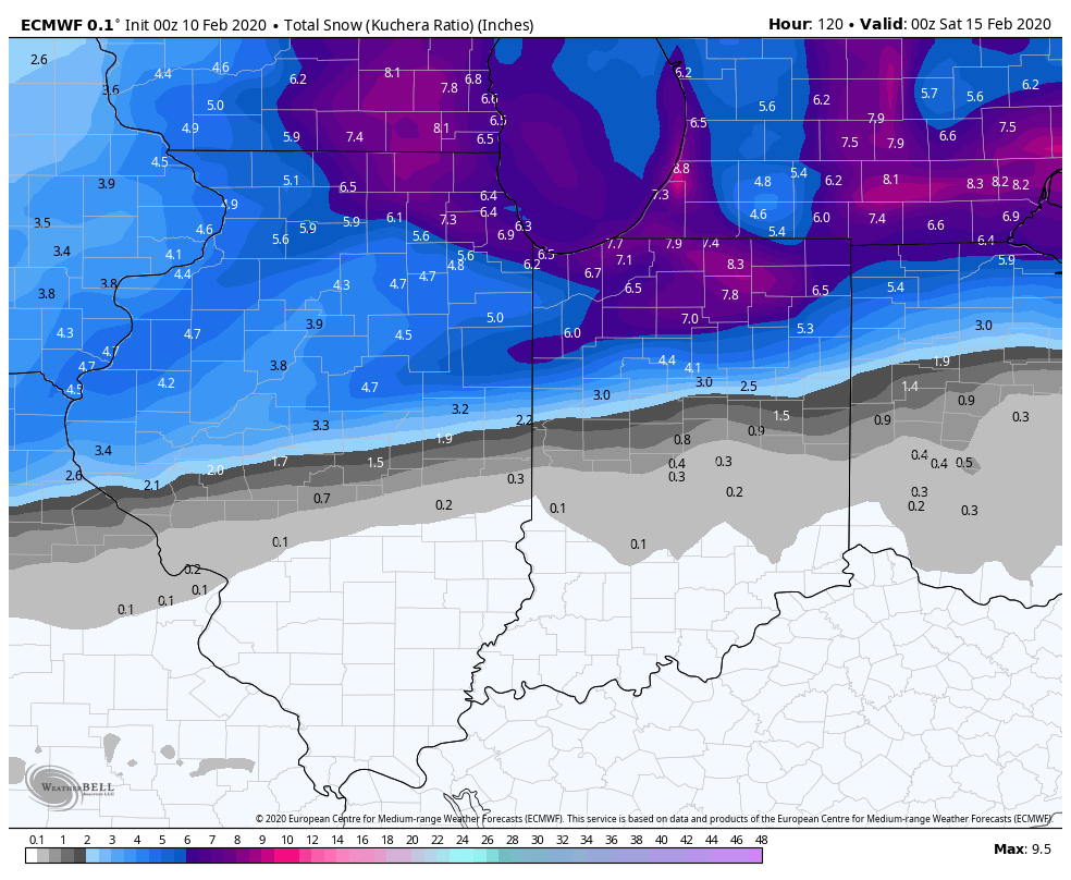 The European forecast model's total snowfall by Friday evening. This includes both system snow and lake effect snow.
There is pretty good agreement on a healthy snow by the time everything winds down late Friday.
Since we are still a few days away from the event getting underway, our initial thoughts on total snow are a general 3-6" for most of us. With lake effect, some of us could see more than that.
