
-
1:38

Snow Wednesday, rain Thursday, mild Friday
-
2:11

Snow wrapping up today, returns tomorrow
-
4:39

The Morris debuts its 2026-27 season lineup
-
2:25

Lake effect snow through this morning
-
0:25

City commission approves new downtown paid parking plan
-
3:41

Community shares concerns at board meeting over offensive language...
-
2:03

Staying safe around downed power lines
-
3:10

Former players share stories of Lou Holtz before his burial
-
3:02

Trust, Love, and Commitment: Lou’s Life Lessons
-
1:32

Notre Dame ready for funeral traffic
-
3:23

Notre Dame community says their final farewell to Coach Lou Holtz
-
5:58

Remembering Lou Holtz: Broadcasters reflect on Holtz’ role...

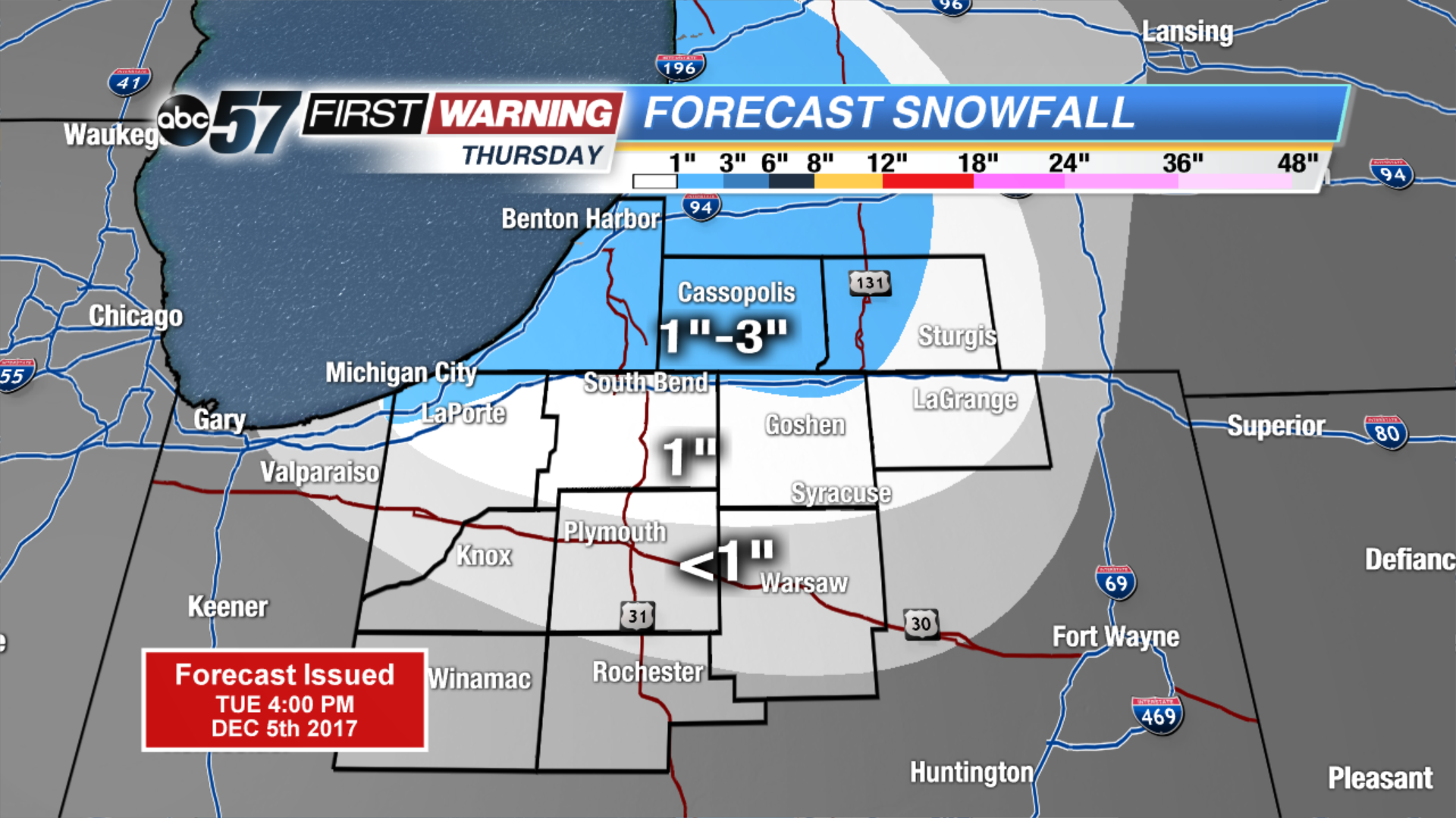
Winter is here to stay as the forecast stays near or below freezing for the next two weeks. Wednesday will still be breezy but the wind does gradually calm into the evening. Lake effect snow is likely to start Wednesday night and last through Thursday. Lake effect zones will see measurable snowfall of one inch or more, some could see up to three inches. The next focus for widespread snow will be Saturday.
Tonight: Partly cloudy, breezy, low 24.
![]()
Wednesday: Mostly cloudy, breezy, chance of lake effect snow, high of 34.
Thursday: Lake effect snow showers, high of 28.
Friday: Partly cloudy, highs in the upper 20s.
Sign up for the ABC 57 Newsletter