-
2:34

Open House for a new pedestrian bridge leaves Riverside Residents...
-
2:16

Notre Dame’s CJ Carr embraces growing expectations while leading...
-
2:34

Injuries sideline key linebackers as Notre Dame leans on depth...
-
0:58

U.S. Army increases maximum enlistment age from 35 to 42
-
2:08

Large hail, damaging winds and tornadoes possible Thursday
-
1:40

Nicholas Stanley appears in court, prosecutors push to prevent...
-
3:18

Expert breaks down high gas prices and factors impacting price...
-
2:08

Westview community rallies around boys’ basketball team headed...
-
2:06

The threat for severe weather has increased
-
2:16

More sunshine today with a severe risk tomorrow
-
0:32

Granger residents share input on proposed S.R. 23 roundabout
-
2:59

Seven local boards unanimously approve fire territory merger...

ABC57 First Warning Neighborhood Weather Forecast
Friday, July 23rd, 2021
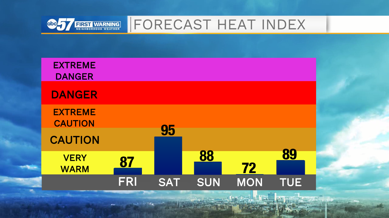
Scattered showers and thunderstorms possible today, mainly before midday. A stray shower or storm could linger into the evening hours. It dries out overnight but the heat and humidity increase as we head into the weekend.
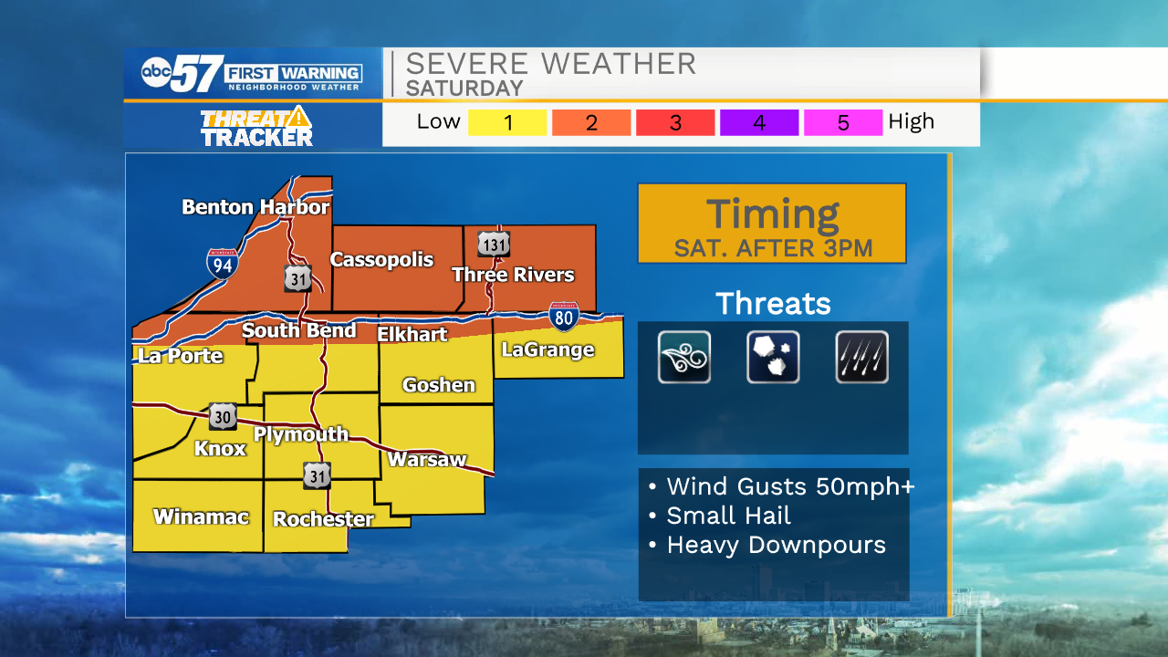
Another round of storms is likely Saturday after 3pm. This round could be strong to severe with the greatest threat being straight-line wind and heavy rain. It brightens back up Sunday with sunshine continuing for the start of the new work week. The heat and humidity stick around as well.
Today: Scattered thunderstorms, mainly before midday. High 84.
Tonight: Partly cloudy. Low 72.
Saturday: PM thunderstorms. High 88.
Sunday: Party cloudy. High 88.