Cold temperatures to start Easter Sunday

-
1:43

Rain returns today, but quieter weather ahead this weekend
-
3:12

SBCSC hires attorney and outside investigators
-
0:16

New station for Dowagiac Fire Department
-
1:04

STEM night at LaSalle Elementary in Mishawaka
-
2:30

Local aviation expert weighs in on DC plane crash
-
1:20

When will lake effect snow come to an end?
-
0:33

Two police injured in Martin’s shooting released from hospital
-
2:21

Crows descend upon downtown South Bend for another winter
-
1:48

Rainy tonight with downpours and snowflakes possible Friday
-
0:33

Elkhart Clinic closed Thursday after unidentified vapor found...
-
0:15

How you can support victims’ families and wounded officers...
-
3:20

Gov. Braun ends DEI initiatives, sparks debate among local leaders

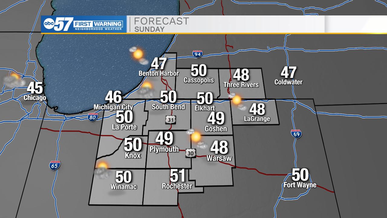
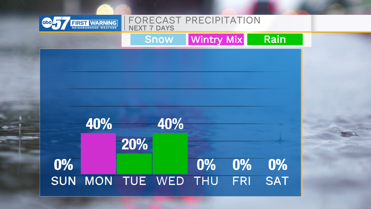
Temperatures tonight will fall into the upper 20s for Easter Sunday morning. If you are up early with the kids to go out and hunt Easter eggs, make sure to be bundled up. High temperatures tomorrow afternoon will top out in the lower 50s under partly cloudy skies. Rain chances return tomorrow night. We will see some of that rain flip over to a wintry mix and snow heading into Monday morning. We could see a light dusting in portions of Michiana, but overall impacts will remain slim to none. Highs Monday afternoon will warm into the mid 40s. Isolated rain chances remain in the forecast for Tuesday, with scattered chances again on Wednesday. High temperatures Thursday and Friday will warm into the mid to upper 60s. Next weekend looks dry for now, but that could change if moisture becomes more progressive northward.
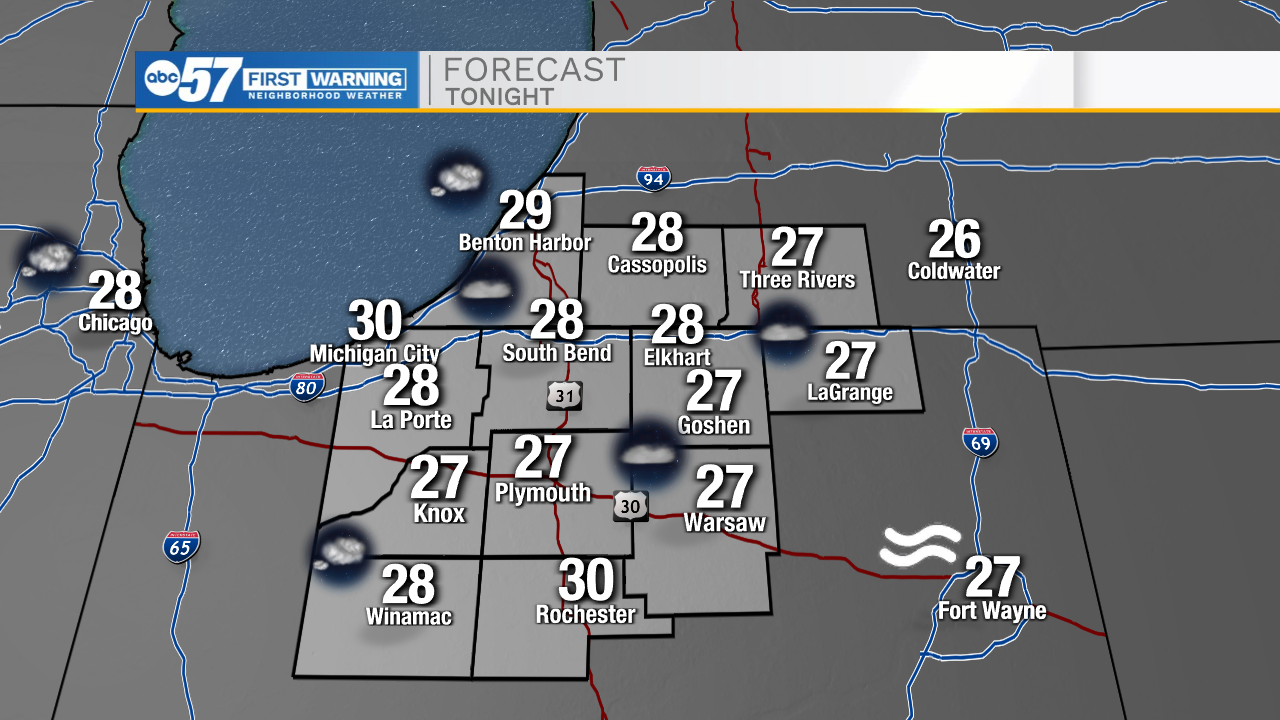
Tonight: Mostly clear. Low 28.
Tomorrow: Partly cloudy. High 50.
Monday: AM Rain/snow. High 46.
Tuesday: Isolated showers. High 46.