
-
1:26

Wet, warm & windy this weekend
-
4:24

Michiana Crime Stoppers shredding event
-
1:16

’IvyCares’ program setting students up for success in and...
-
1:45

Windy and wet this weekend, but unseasonable warmth as well
-
3:13

Local players react to $3 million investment in Byer Softball...
-
0:32

Layoffs at Whirlpool could affect workers in Benton Harbor
-
1:03

Annual District Sisterhood Conference at Ivy Tech empowers students
-
1:49

Back home in downtown South Bend, YMCA to open new location
-
2:16

This week’s ABC57 Cub Reporter is Nicholas Zentz
-
3:05

Amazon Web Services invests $11 billion to build data center...
-
4:05

Riley High School student center stage at the NFL Draft
-
1:35

Rain, wind, and milder temperatures forecast this weekend

Lake effect snow showers continue Monday night as temperatures fall through the 20s. Lake effect zones could pick up an additional one to three inches through Tuesday evening.
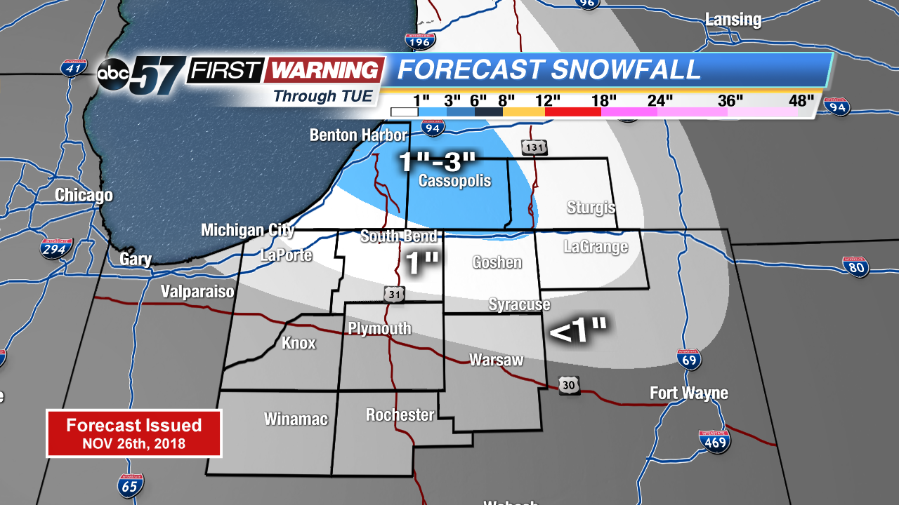
Cold and snowy Tuesday. Temperatures will stay in the 20s and light snow showers continue off of Lake Michigan. Temperatures fall into the teens Tuesday night . Temperatures start to rise to end the week with a chance of wintry mix Thursday and rain Saturday with the next thaw.
Tonight: Lake effect snow showers, cloudy, low of 22.
Tuesday: Mostly cloudy, lake effect snow showers possible, high of 26.
Wednesday: AM flurries, mostly to partly cloudy, high of 28.
Thursday: Cloudy, wintry mix possible, high of 34.
Sign up for the ABC 57Newsletter