Blast of heat this week, but summer comes right back next week
Wednesday and Thursday will be similarly hot with highs again in the upper 80s each day (possibly middle 80s Thursday).
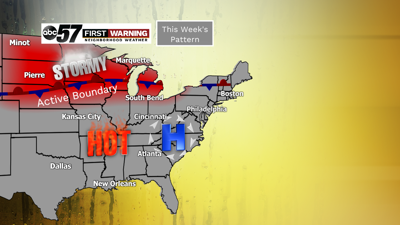
It's courtesy of a "ring of fire" pattern that has developed across the eastern two-thirds of the United States. An area of high pressure is situated in North Carolina, pumping hot and humid conditions into the Midwest, Ohio Valley and southern Great Lakes.
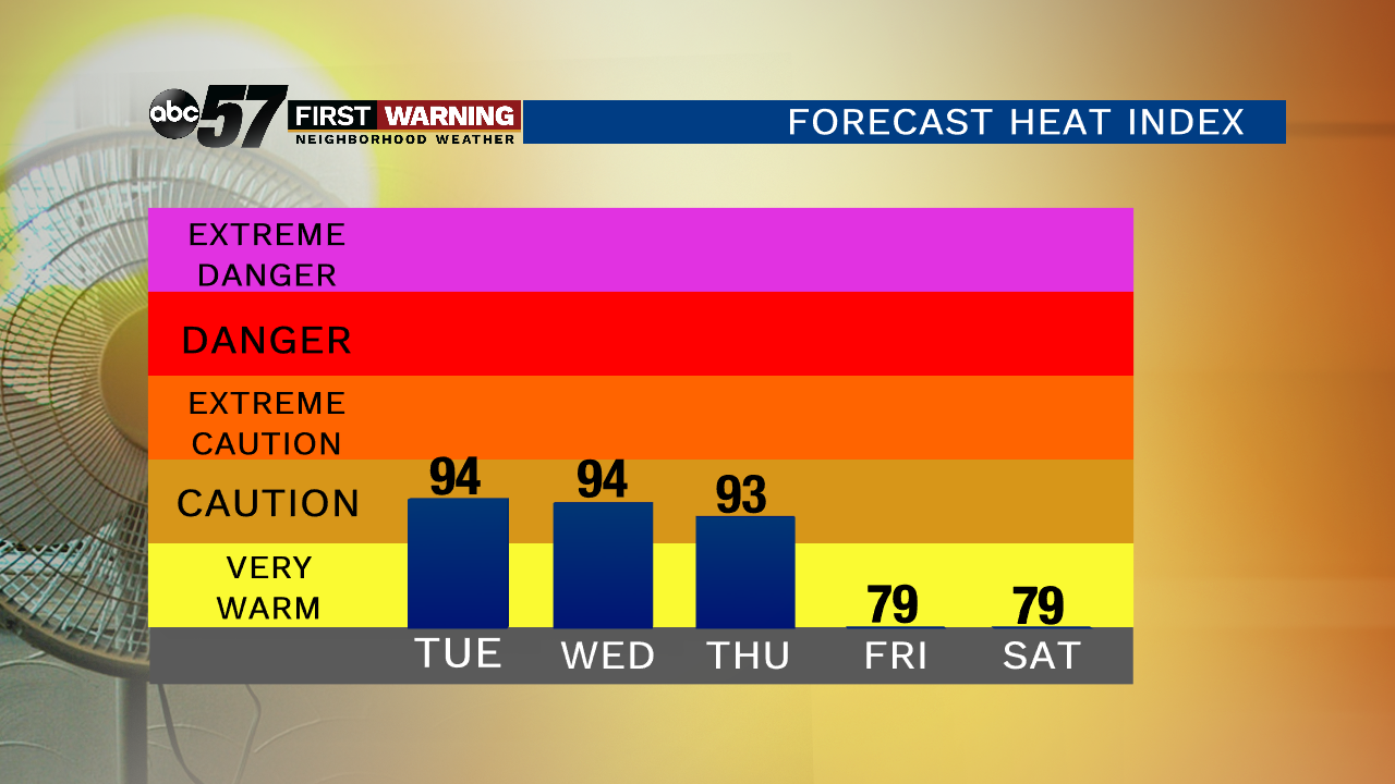 Heat index forecast for South Bend.
Michiana is essentially right on the line between seeing very hot weather and not-so-hot, but very stormy weather. While we will be quite hot and humid, there will also be at least a chance of showers and storms Wednesday, Thursday and Friday.
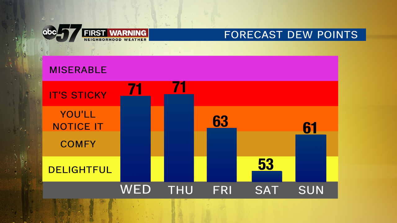 5-day dew point forecast for South Bend.
The "feels like" temps could get as hot as 95-96° if enough sunshine is present. For perspective, South Bend has only recorded a "feels like" temperature at or above 95° in September a total of 11 times since 2000.
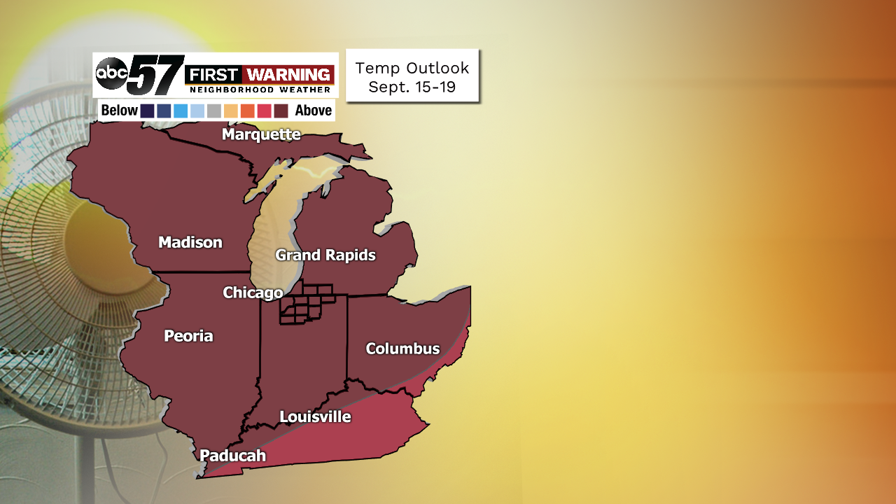 The outlook for September 15-19 favors above average temperatures (80-90% chance).
The latest outlook from the Climate Prediction Center says we have a 80-90% chance of above normal temperatures during the period September 15-19.
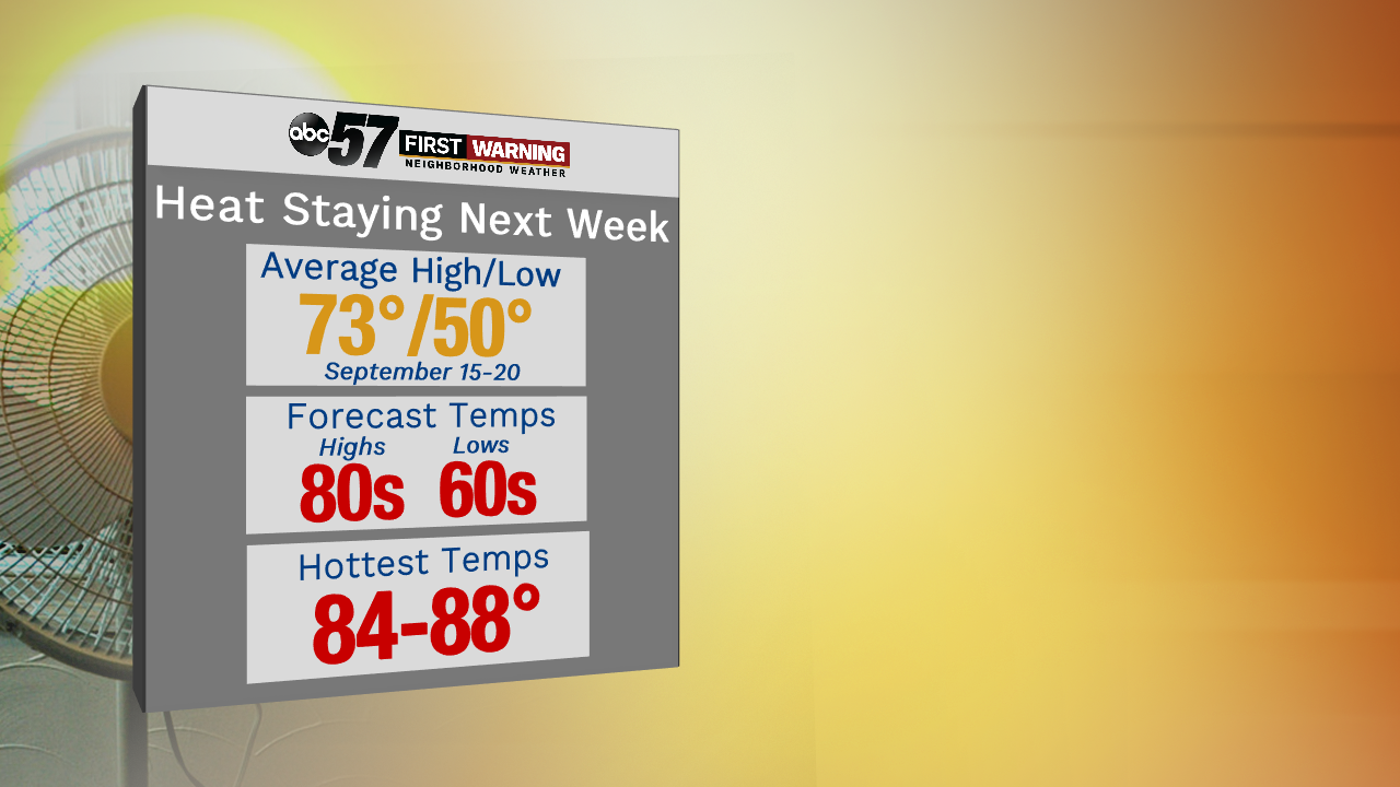
And it's possible that we surge well into the 80s on a few of those days. Basically we're saying summer is by no means over yet.
Technically speaking, fall doesn't begin until September 23rd!
