
-
2:18

Winter weather causing treacherous travel conditions today
-
1:56

Wellfield Botanic Gardens’ Winter Wonderland enters final days...
-
2:02

More storms this evening, Wintry tomorrow
-
3:01

Severe storm potential this afternoon
-
1:55

Dash Away 5K lets families run through holiday lights at Elkhart...
-
2:19

Showers arrive overnight, Soggy Sunday
-
0:25

SBFD responds to carbon monoxide call Friday
-
0:45

Settlement reached in data privacy lawsuit against Goshen Health
-
2:20

Mild and cloudy start to weekend
-
3:14

New South Bend social house adds to downtown entertainment hub
-
1:23

Winter returns Monday
-
2:22

University Park Mall packed with shoppers after Christmas

Light snow overnight into early Friday, in general 1” to 3” of snow in Southwest Michigan, less in Northern Indiana. Everyone will see bitter cold temps, where skies clear, lows drop below zero.
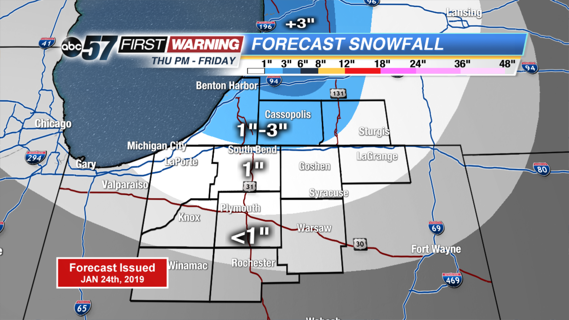
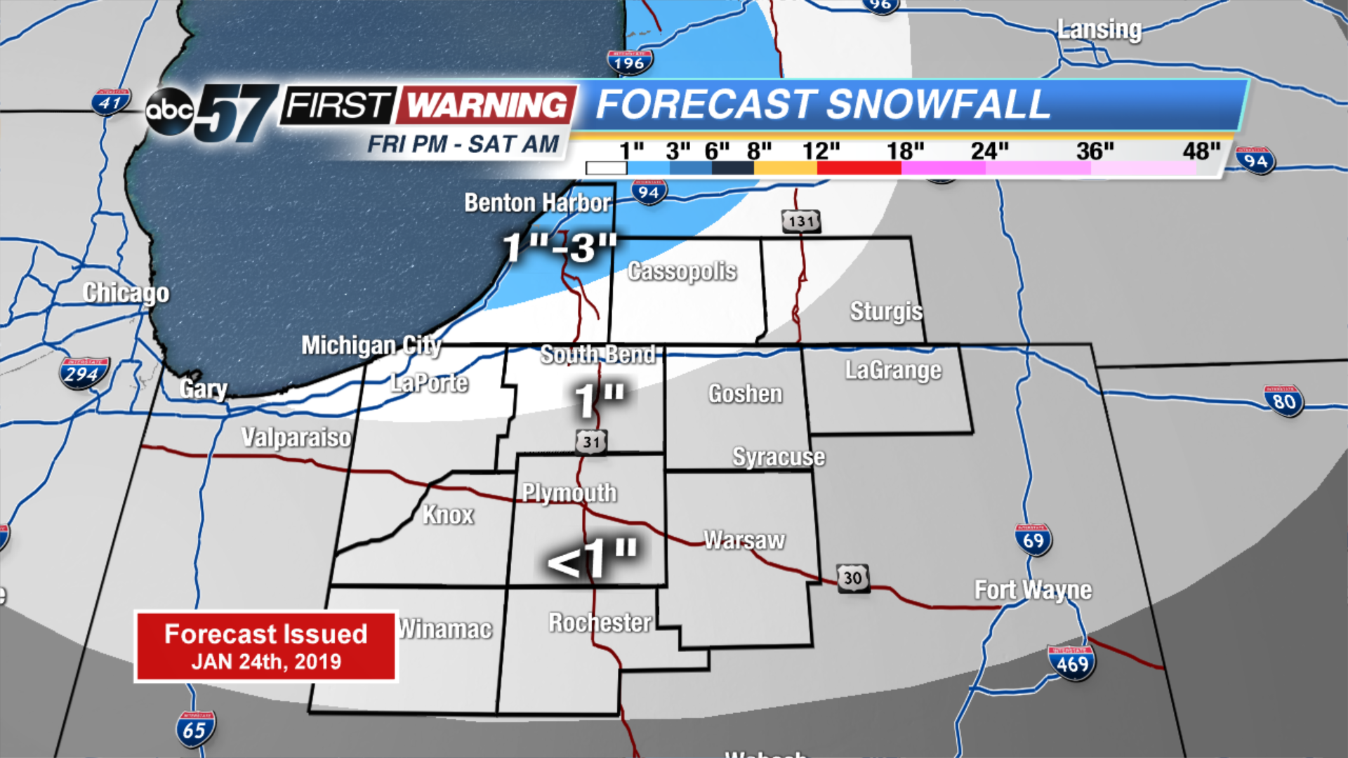
Friday is a very cold day, highs will be lucky to reach the double digits. Another round of light snow is likely Friday night into early Saturday. The cold and snowy pattern continues through Sunday, with mostly light accumulation. Monday could be the most significant snowfall with widespread accumulation. The middle of next week looks extremely cold, as high may not even rise much above zero.
Tonight: Mostly cloudy, lake effect snow showers. Low of 2.
Friday: Morning snow showers, mostly cloudy. High of 8.
Saturday: Morning flurries, mostly cloudy. High of 16.
Sunday: Chance of snow, mostly cloudy. High of 16.