Barry brings heavy rain threat Tuesday, then tropical humidity

-
1:24

Happy feet hit the floor at 24th Annual Daddy Daughter Dance
-
3:35

New house bills could reorganize local school corporations
-
1:58

New era underway at Knollwood Country Club
-
3:51

Local Police Departments concerned over House Bill 1186
-
2:55

’Save Lakeside Woods’ successfully buys land back from developer,...
-
3:26

SBCSC announces community partnership to improve school literacy
-
2:21

Freezing rain reaches Michiana Wednesday night
-
2:25

Potential ice jamming in New Buffalo
-
2:31

The History Museum’s ’Worker’s Home’ brings 1950s African...
-
1:39

Cloudy and cooling down today with a wintry mix tomorrow
-
0:52

Mishawaka High School holds signing day for student athletes
-
2:47

Local Latin markets concerned about possible tariffs

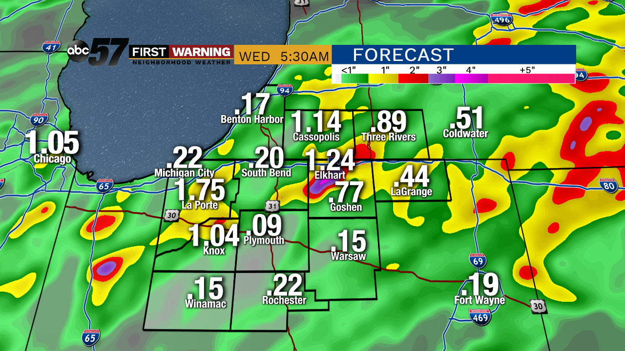
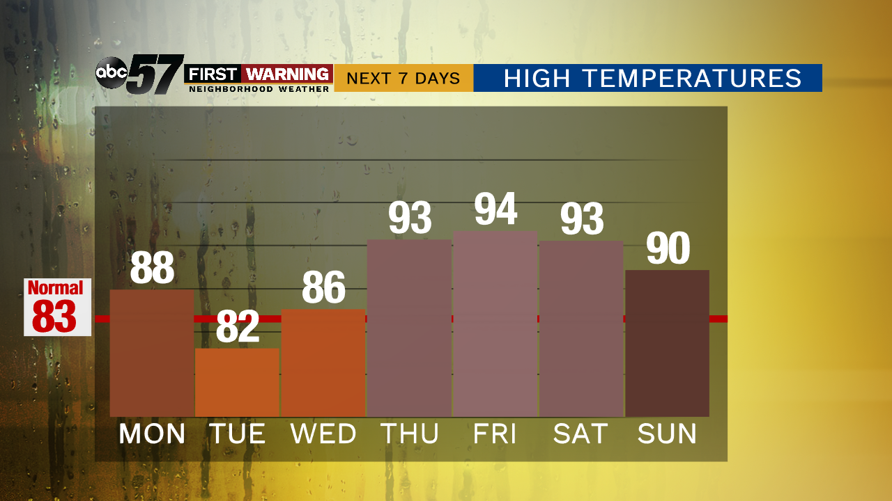
The remnants of Barry will bring scattered showers and thunderstorms with the potential for tropical downpours, as a surge of humidity also arrives. The heavy rain threat will last through Wednesday morning. As the chance of rain decreases to end the week the sweltering heat will soar. A heat wave, the warmest stretch since August of 2013 will last from Thursday, through the weekend. The combination of heat and humidity will make this stretch dangerous, especially for at risk groups, the very young / old and those with health conditions.
Tonight: Mostly cloudy, chance of rain late, low of 70.
Tuesday: Scattered showers and storms, heavy rain possible, high of 82.
Wednesday: Partly to mostly cloudy, slight chance of a shower, high of 86.
Thursday: Hot and very humid, high of 91.