
-
3:05

South Bend Police Tapes ordered to be destroyed after 14-year...
-
0:12

Excavator catches fire at demolition site of old Elkhart County...
-
3:25

Beloved board game comes to life at the Morris Performing Arts...
-
4:58

Notre Dame releases external findings detailing sexual abuse...
-
1:06

Nothing but sun and warm weather this weekend
-
2:10

Last one to Mentone Egg Fest is a rotten egg
-
0:46

A peaceful sunrise on the last May weekday
-
0:39

Lakeville water tower demolished, piece by piece
-
1:13

New tennis courts dedicated to the memory of a teenage tennis...
-
3:33

Interim Cass County Prosecutor Sarah Scoggin sworn in days before...
-
2:41

Goshen wrestling coach Jim Pickard to be inducted into state...
-
1:54

This week’s ABC57 Cub Reporter is Medley Graft

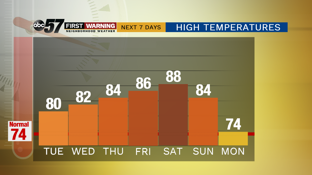
Warm and sunny weather lasts through the rest of this week. There is some relief from the humidity midweek but there’s another surge of summer steaminess by the weekend. There is little chance of rain until the weekend when a fall front approaches, bringing a widespread chance of thunderstorms, before dropping temps to start next week.
Tonight: Partly cloudy. Low of 60.
Tuesday: Mostly sunny. High of 80.
Wednesday: Mostly sunny. High of 82.
Thursday: Mostly sunny. High of 84.
Sign up for the ABC 57 Newsletter