Another round of storms overnight, sweltering Thursday
By:
Tom Coomes
Posted: Aug 11, 2021 4:55 PM EDT

-
1:55

Monday’s severe weather timing
-
0:39

At least nine injured in shooting on Kirkwood Avenue in Bloomington
-
0:44

Another pleasant day today, storms tomorrow
-
3:25

Notre Dame closes spring practice with 41-40 Blue-Gold thriller
-
2:21

St. Joseph County Assessor holds Town Hall ahead of 2026 Property...
-
3:19

Notre Dame makes history with two running backs selected in first...
-
3:18

Irish obsessed fan looks to pass on love of Notre Dame to next...
-
4:59

Giving others a second chance at life
-
2:54

Search continues for players to take over key spots left vacant...
-
2:15

2026 Blue-Gold Game
-
5:34

The Huddle Roundtable: Storylines shaping Notre Dame’s future
-
4:26

Jeremiyah Love’s rise from Notre Dame star to No. 3 NFL Draft...

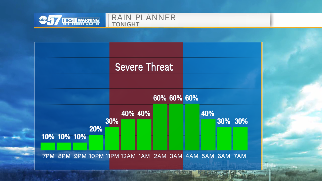
Tonight: Another round of storms overnight, likely a line between 10:00 PM and 3:00 AM, gusty wind, flooding and even a tornado is possible. A lot can change as this line evolves, important to check-in later tonight.
Thursday is the last really hot and humid day, there is another chance of storms in the evening but the severe threat is lower. The heat and humidity break to end the week, with less humidity this weekend and sunny weather.
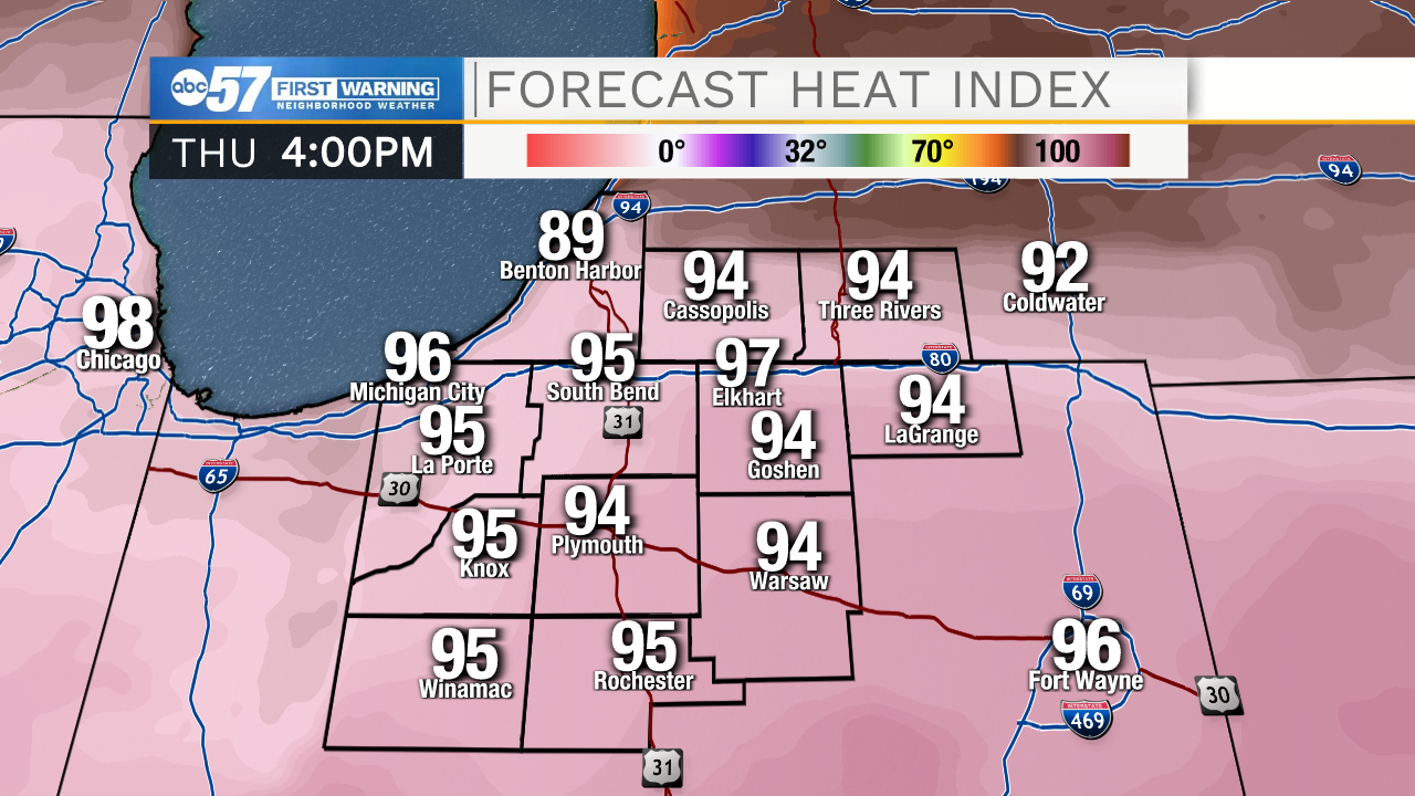
Thursday: Extreme heat, partly cloudy, scattered thunderstorms late. High 90.
Friday: Partly cloudy. High 82.
Saturday: Sunny. High 80.
Sunday: Mostly sunny. High 80.
Sign up for the ABC 57 Newsletter