


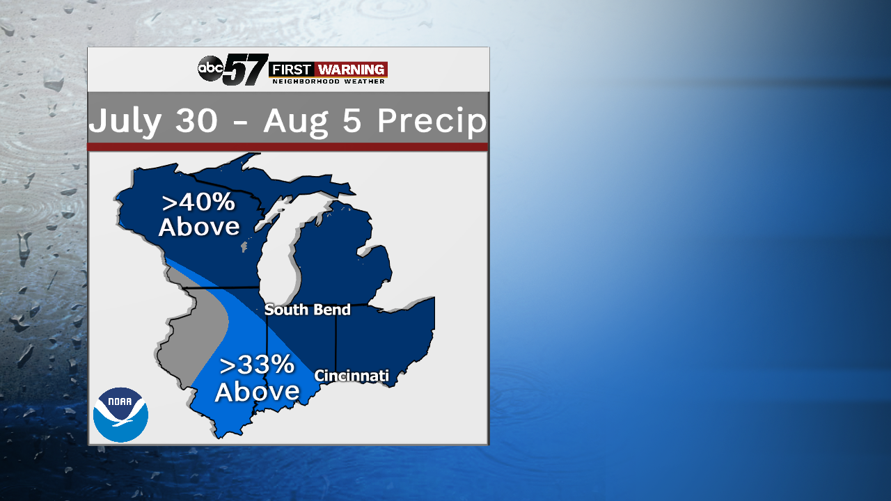
Drier weather throughout the week may cause more hassle for those of you looking out for your gardens or even your lawns. Extra watering will definitely be necessary over the coming days with this much sunshine in the forecast. We'll probably see another 5 days in a row where we don't pick up any rain at the South Bend Airport. The last time we did this was only a couple of weeks ago, from July 11th-15th. But, mother nature should lend a helping hand in the near future with some more rain showers and storms looking more likely into early August.
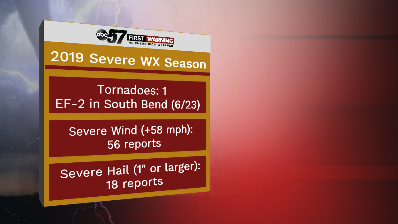
And while we had a break in the thunderstorm activity, let's take a look at the severe weather season. The season typically peaks in late June, so we're on the backside now, but we've had a busy year for sure. Starting with the June 23rd EF-2 tornado that blew through the Growing Kids Learning Center on Ireland Road in South Bend. Estimated peak winds topped out at 115 to 125 MPH as it was only on the ground for 10 minutes. 56 damaging wind reports were sprinkled in there between mid-March and late July that took down trees and power lines all over the Michiana area. 18 severe hail reports have come in so far this year as well.