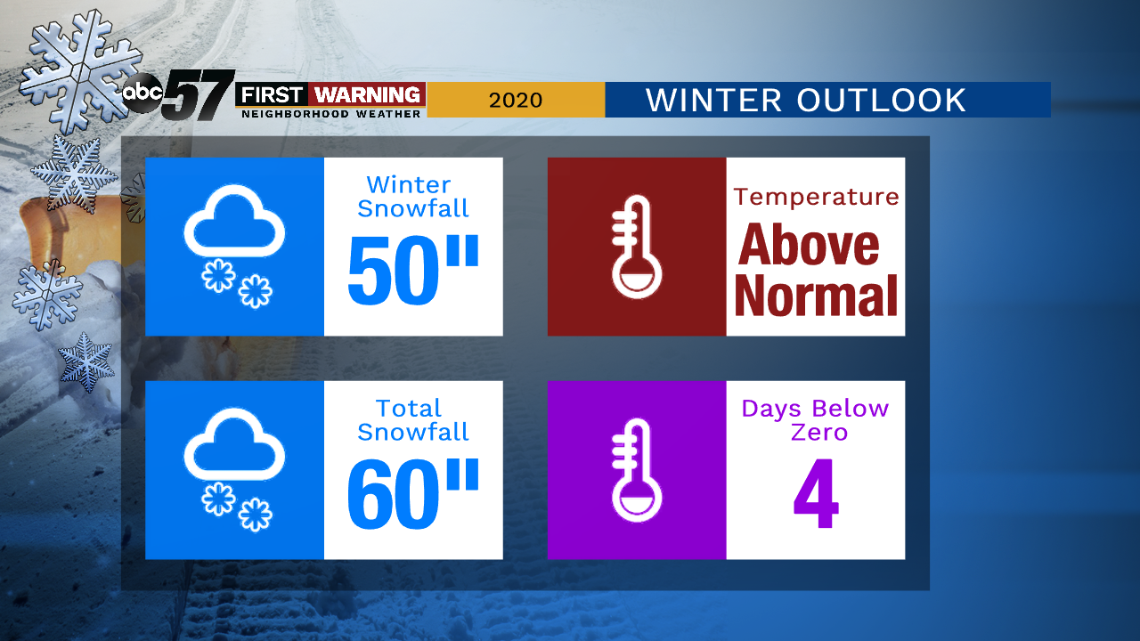
Winter Outlook 2020: No strong trend for a harsh winter


SOUTH BEND, Ind -- The November cold snap and bout of lake effect snow has many wondering what the rest of winter holds as December looms. Could we see more arctic intrusions and severe cold like last winter, when we hit -20°, twice?
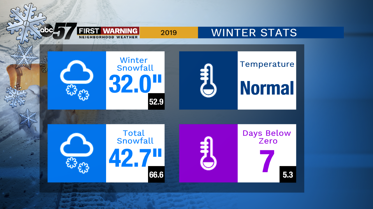
One thing many may not remember is last winter overall was mild and not very snowy, minus that bout of record cold at the end of January.
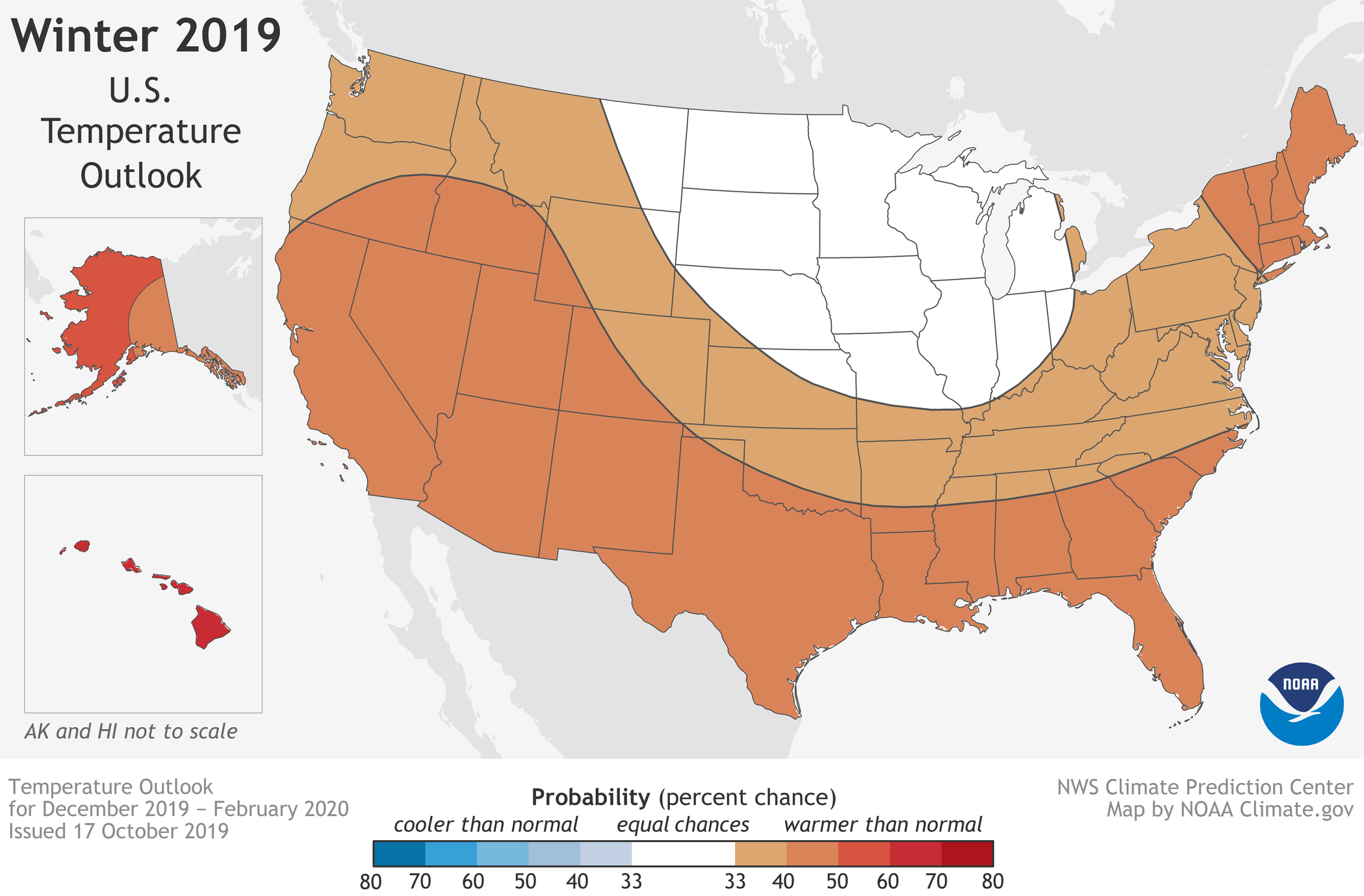
Last winter may leave us a few clues as to what to expect this year given the setup. The temperature outlook from NOAA does not favor or show a strong signal for warmer of colder temperatures.
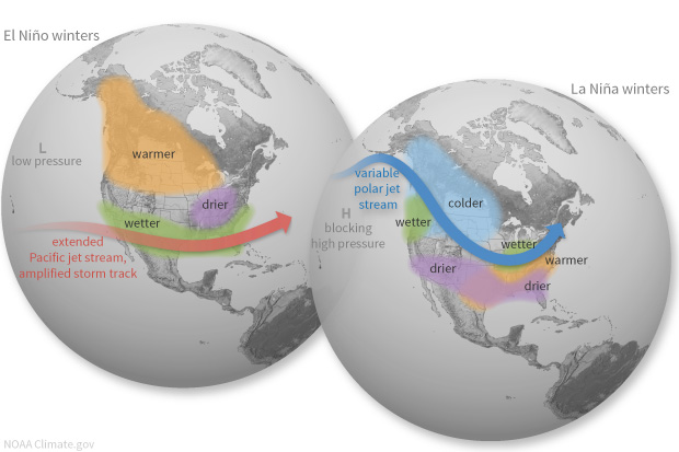
Long-range forecasts are not the same as your typical 10-day forecast. Small scale events like cold fronts can’t be seen more than a week out. It’s longer-term climate patterns, like the most notable El Nino and La Nina, that can drive seasonal trends.
The El Nino / La Nina cycle is mostly neutral, similar to last year, meaning it will play little to no impact on our winter pattern. Typically El Nino years are milder and La Nina years are colder in the Great Lakes.
It is unlikely that a large-scale seasonal pattern will dominate the weather. We’ll have to focus more on patterns seen over two to four weeks, namely the circulation around the Arctic, which is called the polar vortex.
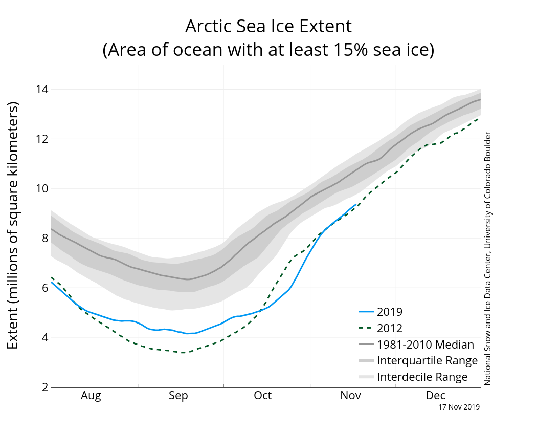
We’re already seen one plunge of polar air, and the circulation around the Arctic remains somewhat erratic. There is a link to the stability of the polar vortex and Arctic sea ice. The extent of ice through October was at an all-time minimum and remains low.
The ice acts like an anchor for the cold air. When the vortex is strong, the circulation is nearly circular and the coldest air stays closer to the Arctic. When it weakens it can wobble like a top losing momentum or even split, allowing arctic air to spill into the lower latitudes.
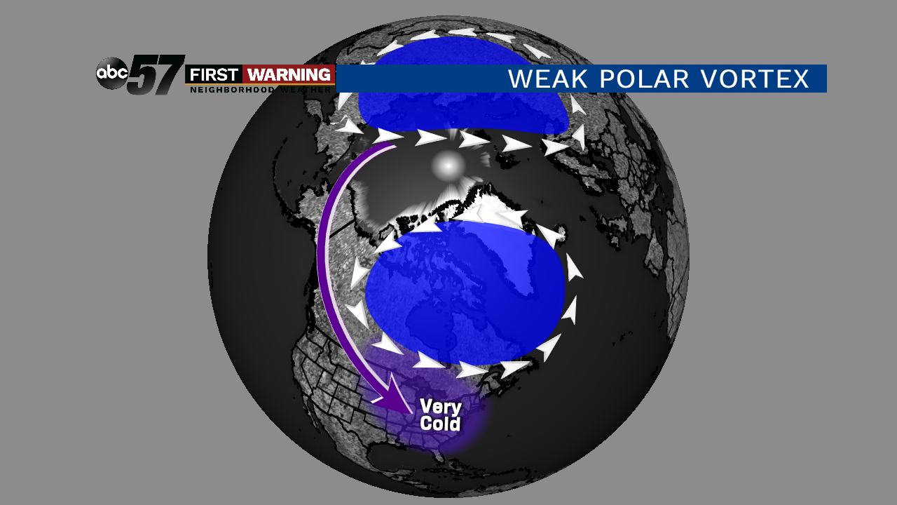
This is how the paradox of a warming climate can actually lead to severe cold outbreaks. New research shows it’s more than just warming air and water temperatures. A change in weather patterns is leading to more warming in the arctic, less sea ice, which then changes more weather patterns and the cycle repeats. This is what we call a positive feedback loop, not because it’s good, but because it builds on itself.
The pattern for winter 2020 is already playing out. The timing may be different, but there are similarities to last year: an arctic blast, then the pattern moderates and may even stabilize. Our weather pattern looks quiet-ish until at least mid-December. The deciding factor for a ‘bad’ winter is if the pattern becomes locked like in 2013-14 when we saw over 100 inches of snow. Or if the cold air mostly avoids the eastern United States like it did for most of last winter.
Without a strong signal for a warm or cold pattern I think a swinging cycle is most probable. That can still bring bouts of snow and cold but also relatively milder weather as well. You can still have near-normal snowfall, even with above-normal season temperatures, especially in the lake effect snow belt.
One more thing. Snow and cold predictions are what many look for in a winter outlook but our thinking may need to change. We should start thinking about flooding, especially as late winter is trending wetter and wetter. February 2018’s record precipitation (mostly rain) will likely be the bigger concern going forward than a terribly snowy and cold winter.
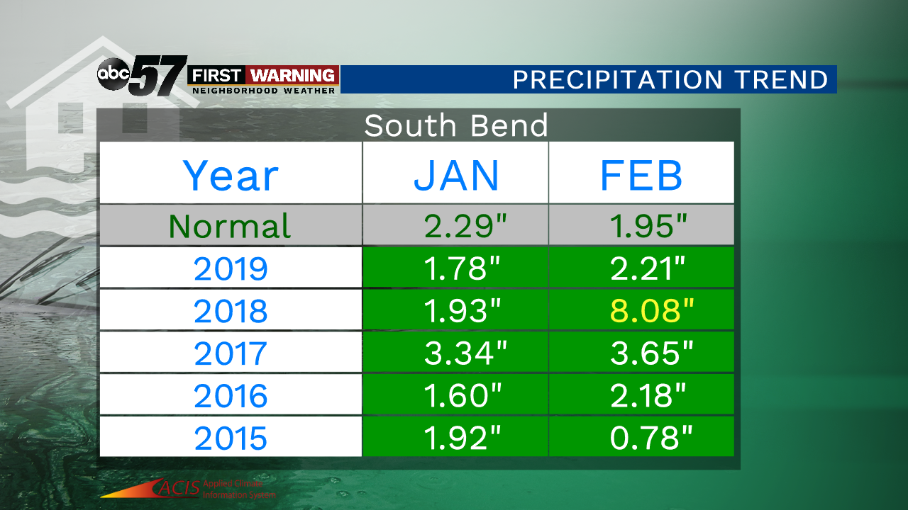
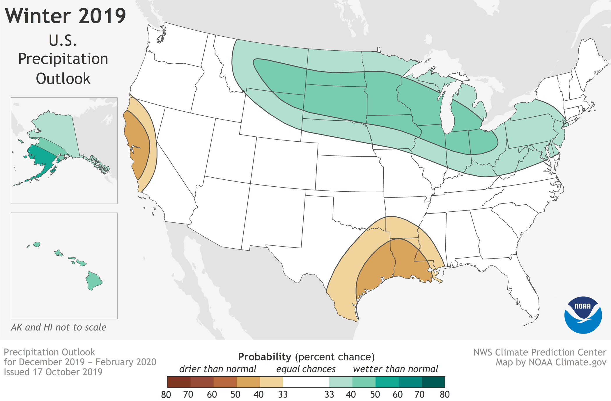
The precipitation outlook from NOAA calls for above-normal precipitation in the Great Lakes region this winter. That doesn’t mean it will be snow. It could also mean rain, depending on the temperature pattern.
Bottom line: there will be more snow and cold this winter but the monthly outlook may be a lot more telling, as it’s hard to judge the polar pattern beyond three weeks with good confidence. If we get locked in a pattern one way or another it could turn the season very cold or very mild.