Windy and colder, temperatures plummet into Friday

-
4:24

Michiana Crime Stoppers shredding event
-
1:16

’IvyCares’ program setting students up for success in and...
-
1:45

Windy and wet this weekend, but unseasonable warmth as well
-
3:13

Local players react to $3 million investment in Byer Softball...
-
0:32

Layoffs at Whirlpool could affect workers in Benton Harbor
-
1:03

Annual District Sisterhood Conference at Ivy Tech empowers students
-
1:49

Back home in downtown South Bend, YMCA to open new location
-
2:16

This week’s ABC57 Cub Reporter is Nicholas Zentz
-
3:05

Amazon Web Services invests $11 billion to build data center...
-
4:05

Riley High School student center stage at the NFL Draft
-
1:35

Rain, wind, and milder temperatures forecast this weekend
-
2:49

Joe Alt expected to be drafted in the first round of NFL Draft

Temperatures start to free-fall after 5 PM Thursday, plummeting from the 50s into the lower teens by Friday morning. The wind will howl, gusts of 45 to 50 mph. A flash freeze is possible with some wet areas turning icy by morning.
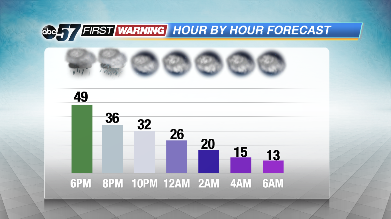
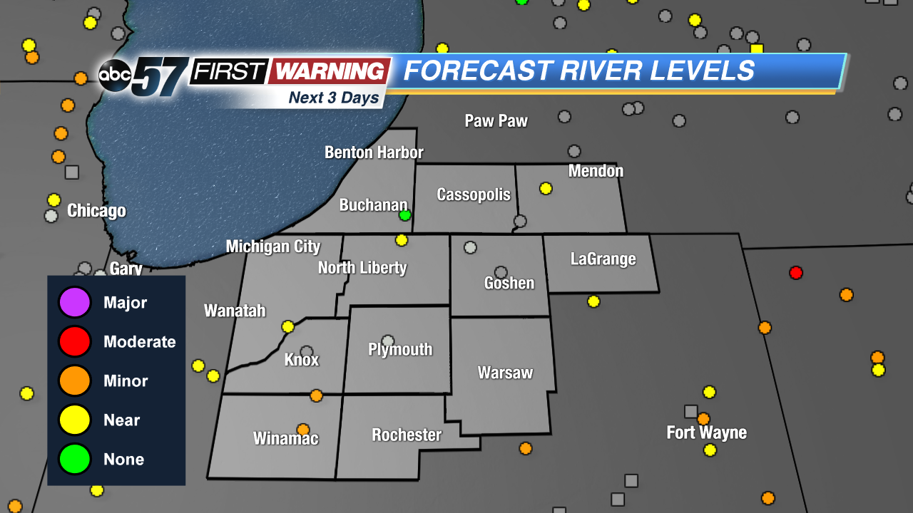
Friday is a shock to the system as winter comes barreling back into Michiana. Temperatures will struggle to break 15 degrees and areas of standing water from flooding may freeze. Rivers remain high through Saturday before waters start to recede. The most significant flooding along the Kankakee and Tippecanoe rivers. The next chance of snow is Sunday afternoon.
Tonight: Falling temps, windy, chance of flurries, low of 12.
Friday: Cold and breezy, partly cloudy, high of 15.
Saturday: Cold and sunny, high of 24.
Sunday: Snow showers by the afternoon, high of 32.