
-
2:00

A sunny Monday ahead, rainy almost every other day this week
-
2:59

Dusty May leads Michigan back to Final Four with dominant win...
-
0:37

Vendors and cosplayers showcase art at South Bend Anime Fest
-
3:06

Palm Sunday procession in South Bend unites faiths in call to...
-
0:48

2026 Auto Show brings crowd to Century Center Sunday
-
2:34

Warm to start the week, Rainy week ahead
-
2:44

Warmer, breezier, and cloudier than yesterday
-
0:46

Crowds gather for Fins and Feathers Fest at La Porte City Fairgrounds
-
0:46

Paramount School of Excellence hosts teacher fair
-
2:30

Voting advocacy, peaceful demonstrations and donations: South...
-
2:04

Warming to start the week, Showers and storms by Tuesday
-
2:10

Cool, but calm, today

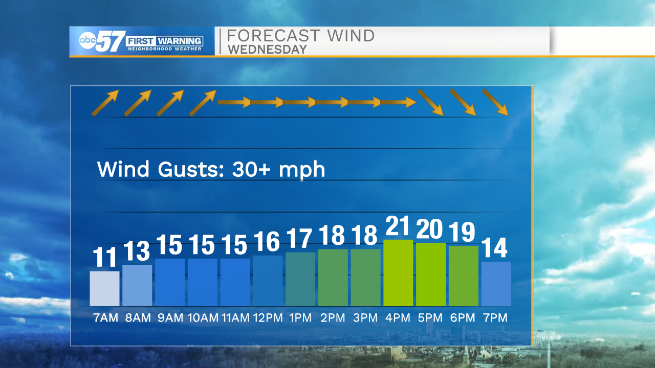
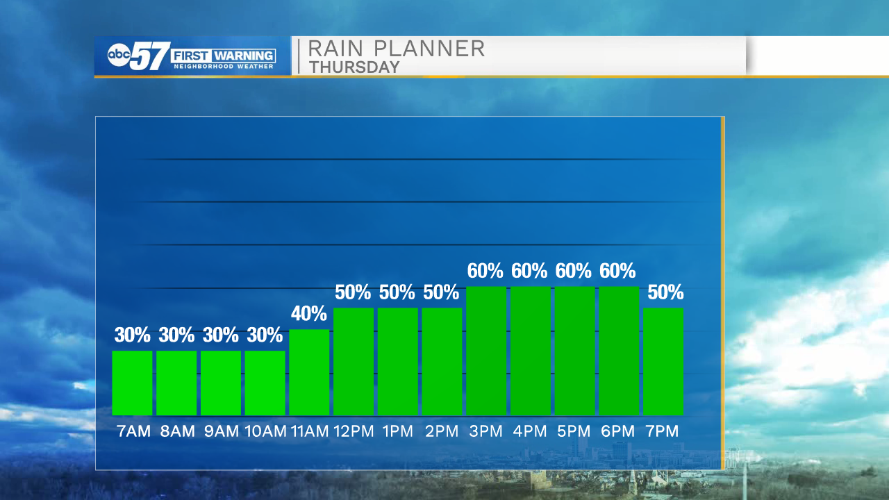
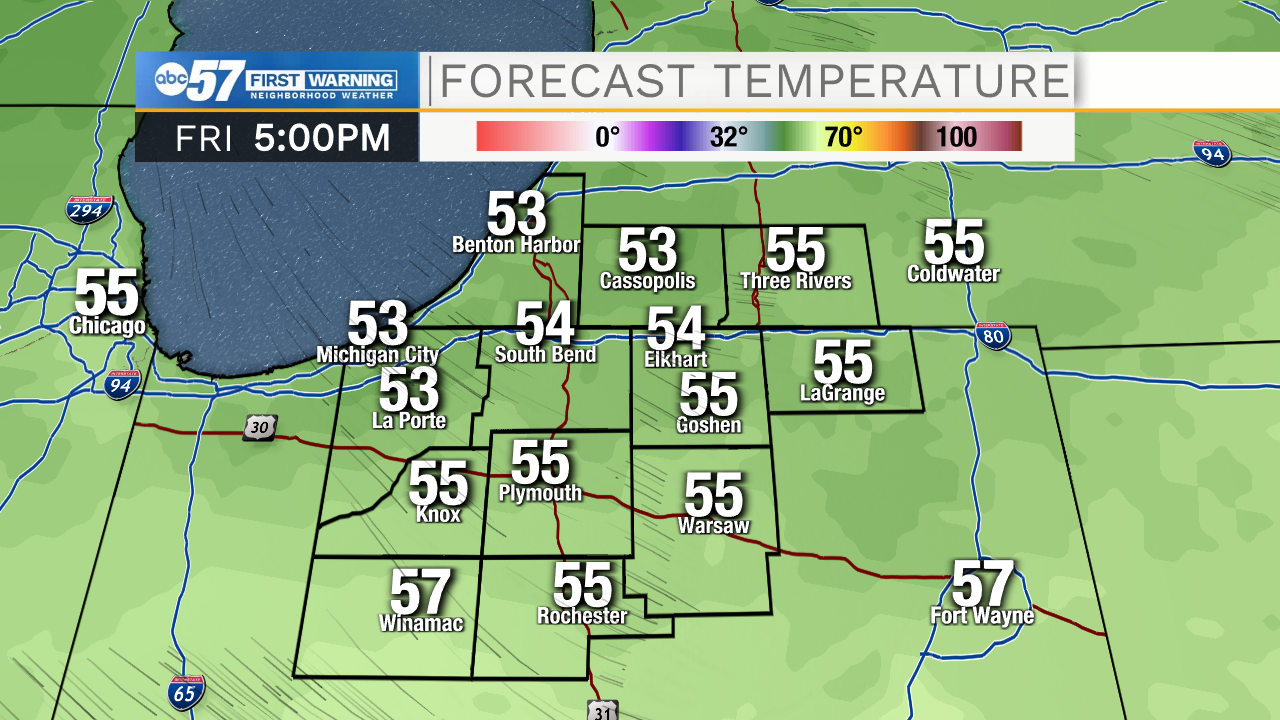
Thursday is calmer and wetter. The wind will not be as strong ahead of the second cold front, but rain is more likely and could last most the day, with a frequent scattering of showers. After the front, the wind turns northerly Thursday evening into Friday. The temperature difference between the warm lake water and cool air will produce lake effect rain showers and drizzle into early Friday. Clouds break into the weekend. Saturday is fair before another around of rain Sunday. Temperatures rise steadily next week.
Tonight: Partly cloudy, a few showers early. Low 46.
Thursday: Scattered showers. High 58.
Friday: Mostly cloudy. High 52.
Saturday: Partly cloudy. High 57.
Sign up for the ABC 57 Newsletter