Turning hotter and more humid, storm chances Wednesday evening

-
2:10

Cool, but calm, today
-
1:23

City of South Bend presents an ’Age-Friendly Plan’ to better...
-
0:54

South Bend Venues Parks and Arts hosts ’Adult Recess’
-
2:27

Why Aneyas Williams turned down the transfer portal and stayed...
-
2:21

Bourbon community rallies around Triton boys’ basketball team...
-
5:02

Dave Matthews shares details about LLC bankruptcy filings
-
1:00

Warming up this weekend before more storms next week
-
1:46

A chilly and calm start to the weekend
-
1:00

NIPSCO workers rally in South Bend for new contract
-
1:53

Severe weather threat is over, MUCH colder Friday
-
3:43

South Bend Mayor James Mueller delivers 2026 State of the City...
-
0:52

Family and friends of Adrian Cruz voice frustration in sentencing...

ABC57 First Warning Neighborhood Weather
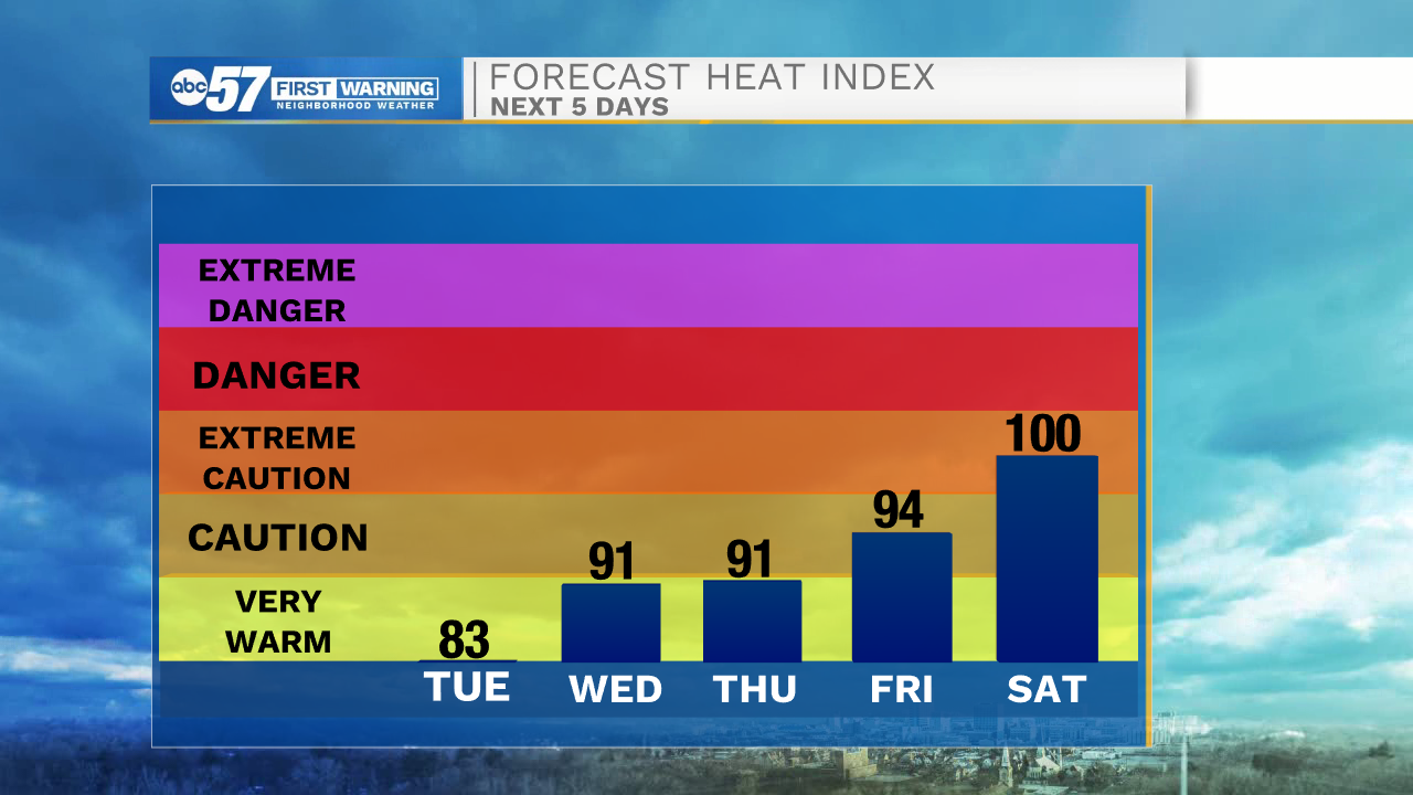
Tuesday, July 14th, 2020
Plenty of sunshine today but temperatures begin to rise, topping out in the mid-80s. The humidity builds in as well towards the middle of the week with thunderstorms moving in after midday Wednesday. These storms could be strong with gusty wind and heavy rain. A few showers could linger into early Thursday morning, otherwise clouds clear out. We wrap up the rest of the week with sunshine but it gets hot! Daytime highs return to the 90s. The heat and humidity will make for a good recipe of pop-up thunderstorms over the weekend.
Today: Mostly sunny. High 86.
Tonight: Mostly to partly clear. Low 67.
Wednesday: Partly cloudy, afternoon/evening thunderstorms. High 88.
Thursday: Early shower possible then clearing skies. High of 86.