Tuesday flurries; mild and dry week

-
2:50

Winter heating bills on the rise
-
2:11

Unveiling cancelled for Solar Farm near New Carlisle due to safety...
-
2:38

YMCA hosts Greatest Chefs of Michiana
-
2:11

Georgia Tech Head Coach Brent Key says starting QB is day to...
-
0:54

Habitat for Humanity breaking ground for new homeownership
-
1:22

Another stretch of mild, dry weather
-
2:07

Portage Township provides assistance for families during the...
-
5:07

ABC57 speaks with expert about social media platforms’ efforts...
-
5:48

A Macbeth Experience, additional show added due to demand
-
1:31

Freeze this morning ends the growing season
-
1:26

Freezing and foggy start to the day, but 70s are on their way
-
0:44

Governor Gretchen Whitmer stops in Benton Harbor for ’Blue...

Snow flurries continue tonight into Tuesday. There will not be much of an accumulation, so travel should not be heavily impacted. Some patchy black ice and trace amounts of snow are the primary concerns.
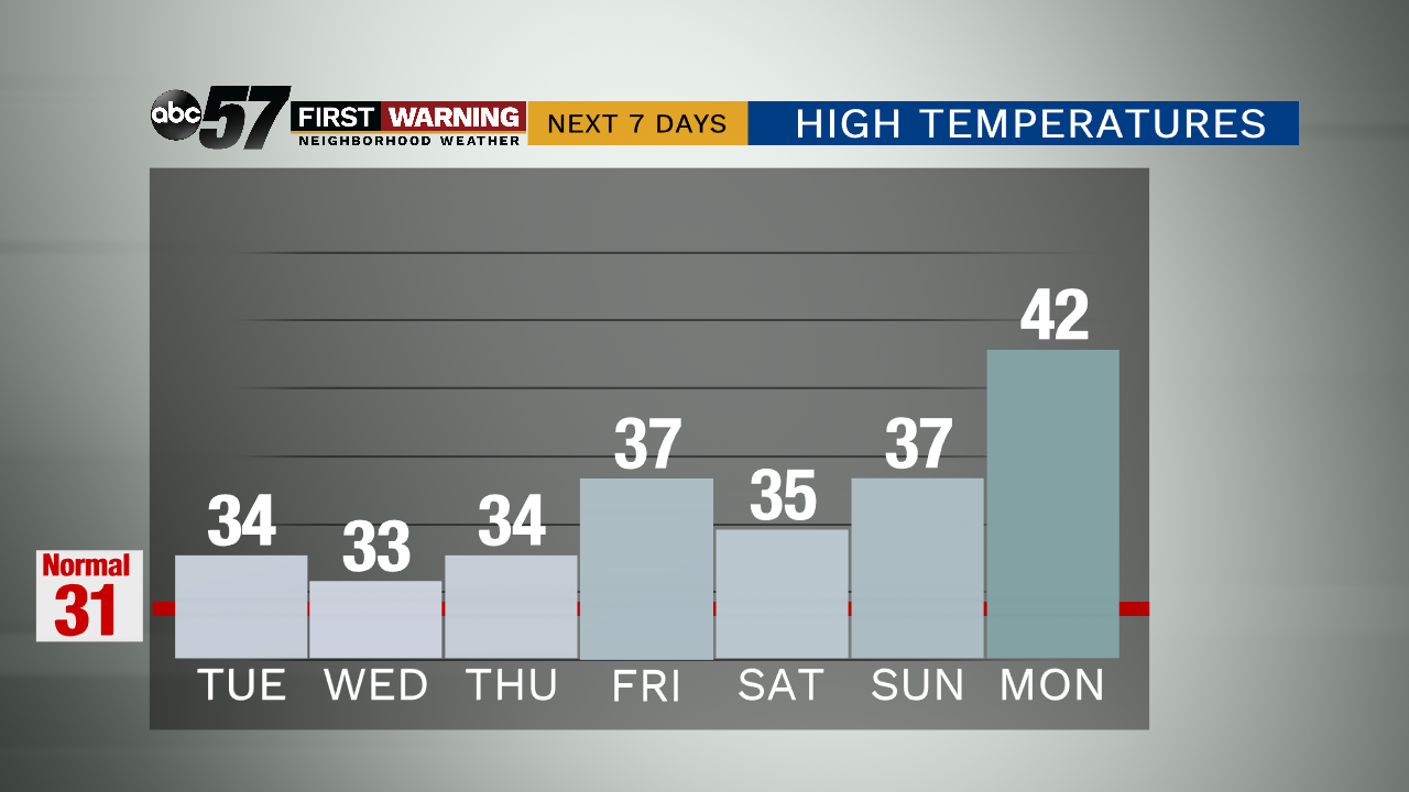
For the remainder of the week, temperatures will be in the mid to upper 30s. Overnight lows are in the upper 20s. This week should stay dry and mostly cloudy. The next chance for snow showers is Friday night and lasts through Saturday. Again, these weekend snow showers are not expected to have a serious impact on travel.
Temperatures remain above normal this week into next. By next Monday, we climb to a high temperature of 42 degrees.
Tonight: A chance of a few flurries and snow showers. Low 30.
Tuesday: A chance of late flurries and snow showers. High 34.
Wednesday: Cloudy. High 33.
Thursday: Mostly cloudy. High 34.