Tonight's temperature drop a preview of later this week

-
2:58

South Bend goes green for St. Paddy’s Day at Fiddler’s Hearth
-
2:32

St. Joseph County boards, City of Mishawaka, approve Memorandum...
-
2:40

More than just fighting fires: Warsaw fire official helps with...
-
1:38

Snow Wednesday, rain Thursday, mild Friday
-
2:11

Snow wrapping up today, returns tomorrow
-
4:39

The Morris debuts its 2026-27 season lineup
-
2:25

Lake effect snow through this morning
-
0:25

City commission approves new downtown paid parking plan
-
3:41

Community shares concerns at board meeting over offensive language...
-
2:03

Staying safe around downed power lines
-
3:10

Former players share stories of Lou Holtz before his burial
-
3:02

Trust, Love, and Commitment: Lou’s Life Lessons

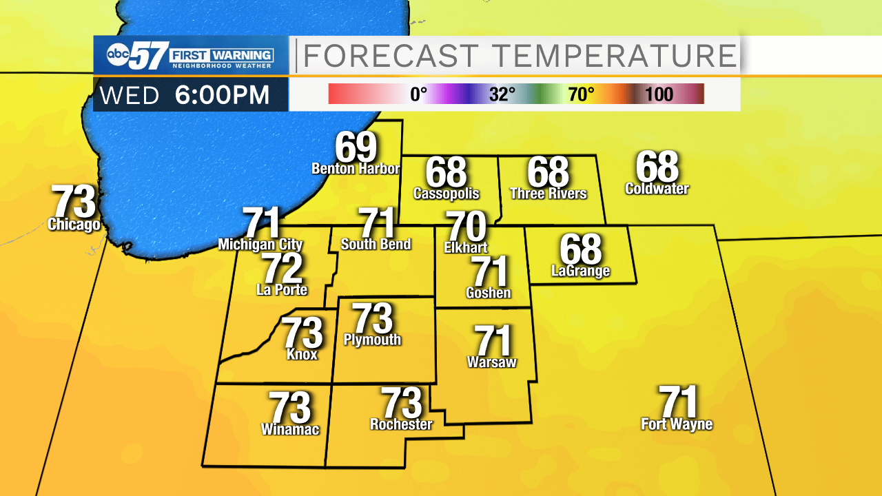
There will be a quick drop from 70s to 50s this evening as a cold front brings rain showers and a few scattered thunderstorms. Severe weather is unlikely.
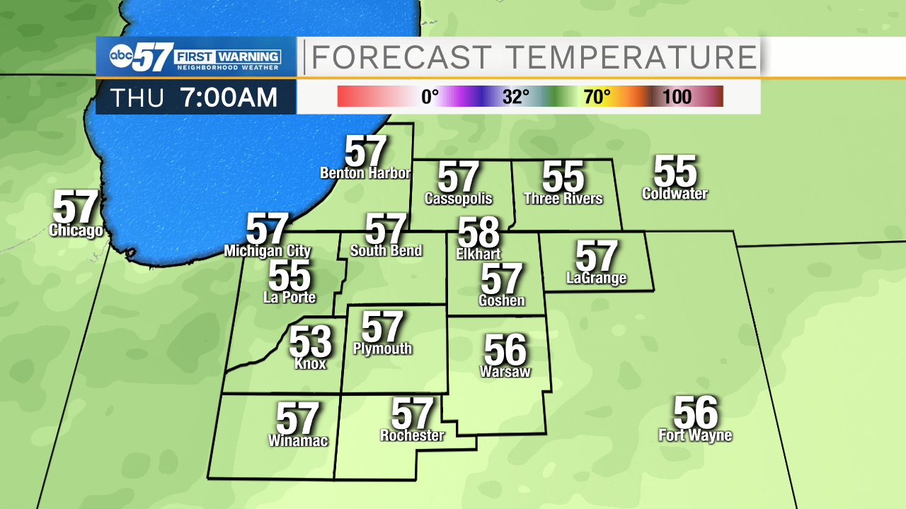
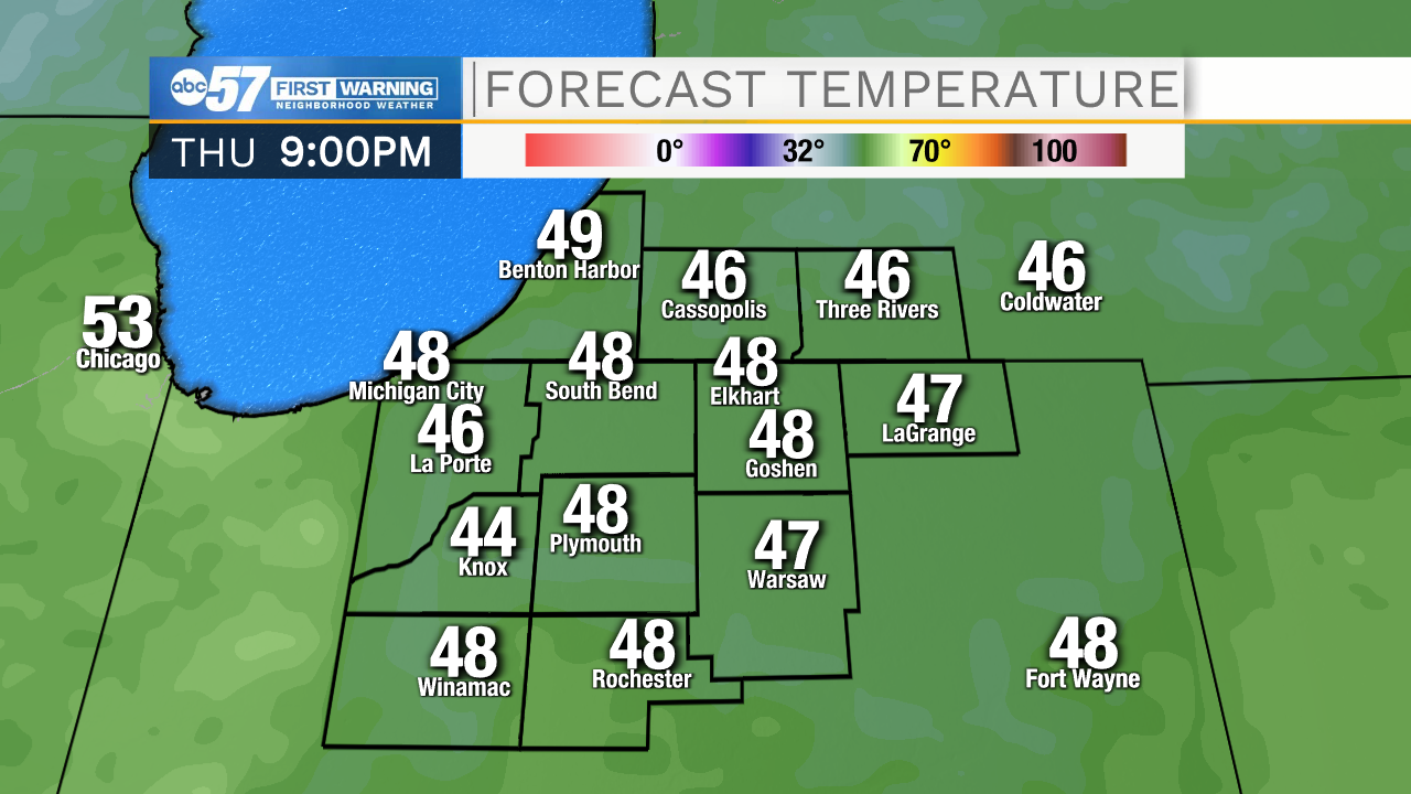
Enjoy the sunshine and mild temperatures Tuesday and Wednesday. The fall chill is on the way. Thursday is the day of drastic change and temperatures fall from 55 early in the day and end up lower 40s by the evening. A chilly northwest breeze could also produce a few rain showers. The end of the week is much cooler, highs struggle to reach 50 with lows in the 30s. Fall color will peak this weekend.
Tonight: Evening showers, clearing and cool. Low 42.
Tuesday: Sunny; breezy. High 70.
Wednesday: Mix of clouds and sun. Breezy. High 70.
Thursday: Temperatures fall from 55, breezy with a few showers possible.