
-
2:21

St. Joseph County Assessor holds Town Hall ahead of 2026 Property...
-
3:19

Notre Dame makes history with two running backs selected in first...
-
3:18

Irish obsessed fan looks to pass on love of Notre Dame to next...
-
4:59

Giving others a second chance at life
-
2:54

Search continues for players to take over key spots left vacant...
-
2:15

2026 Blue-Gold Game
-
5:34

The Huddle Roundtable: Storylines shaping Notre Dame’s future
-
4:26

Jeremiyah Love’s rise from Notre Dame star to No. 3 NFL Draft...
-
4:53

Looking ahead to Notre Dame’s next football chapter
-
4:54

Coach says spring camp has been a test for the Fighting Irish,...
-
1:17

Mild weekend, stormy Monday
-
0:47

Cooler out the door, mild today

The warm-up begins Wednesday, highs make it just above freezing for a few hours in the afternoon, and the low 40s on Thursday. The focus is on Friday, and temperatures make a run at 60, but there's a hitch. Temperature's spike close to midnight ahead of a cold front, and the high on Saturday is likely just after midnight. So, there may not be many 'useful' hours of mild weather. The front will also bring rain Friday night into early Saturday. Temperatures fall through Saturday, and clouds break into Sunday. Long-range, there is not much cold and zero snow through next week.
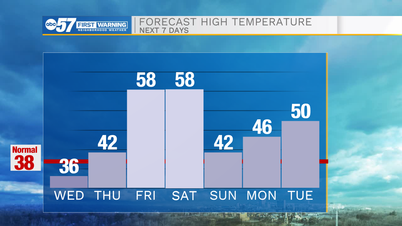
Tonight: Mostly cloudy and cold. Low 20.
Tomorrow: Cloudy in the morning, then decreasing clouds throughout the day. High 36.
Thursday: Mostly cloudy. High 42.
Friday: PM Rain showers. High 58