Temperatures in 80s this weekend; storm chances starting tonight


Enjoy comfortable temperatures this weekend, with highs in the low to mid 80s both Saturday and Sunday.
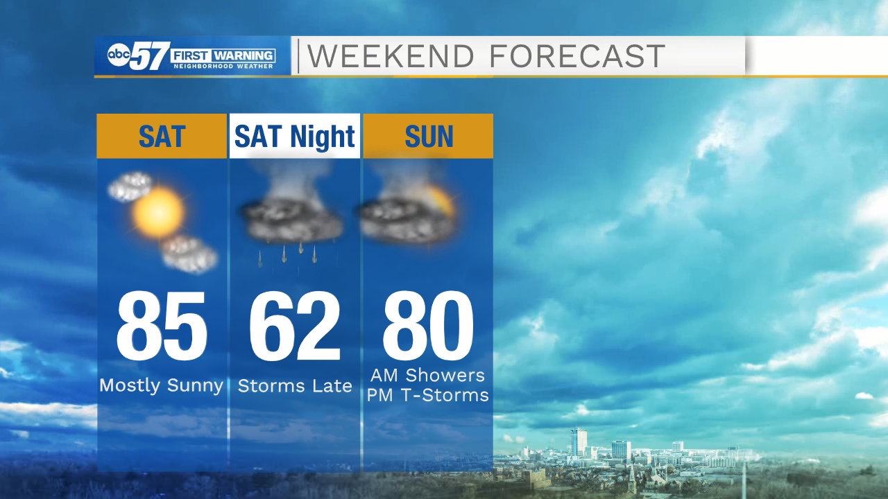
Skies are generally sunny today. Overnight there is a round of showers and thunderstorms. Temperatures will fall into the mid 60s overnight. A few showers linger into Sunday morning. Most of Sunday will be dry after these showers, but we could see an isolated thunderstorm again in the afternoon.
Temperatures stay in the 80s to start the week, but gradually warm to the 90s again by Thursday. Monday and Tuesday look dry, then there is a chance of rain Tuesday overnight and through the day Wednesday.
Today: Mostly sunny. High 85.
Tonight: Scattered thunderstorms and showers overnight. Low 66.
Sunday: Rain showers early. Isolated storms possible in the afternoon. High 80.
Monday: Mostly sunny. High 81.