
-
2:34

Warm to start the week, Rainy week ahead
-
2:44

Warmer, breezier, and cloudier than yesterday
-
0:46

Crowds gather for Fins and Feathers Fest at La Porte City Fairgrounds
-
0:46

Paramount School of Excellence hosts teacher fair
-
2:30

Voting advocacy, peaceful demonstrations and donations: South...
-
2:04

Warming to start the week, Showers and storms by Tuesday
-
2:10

Cool, but calm, today
-
1:23

City of South Bend presents an ’Age-Friendly Plan’ to better...
-
0:54

South Bend Venues Parks and Arts hosts ’Adult Recess’
-
2:27

Why Aneyas Williams turned down the transfer portal and stayed...
-
2:21

Bourbon community rallies around Triton boys’ basketball team...
-
5:02

Dave Matthews shares details about LLC bankruptcy filings

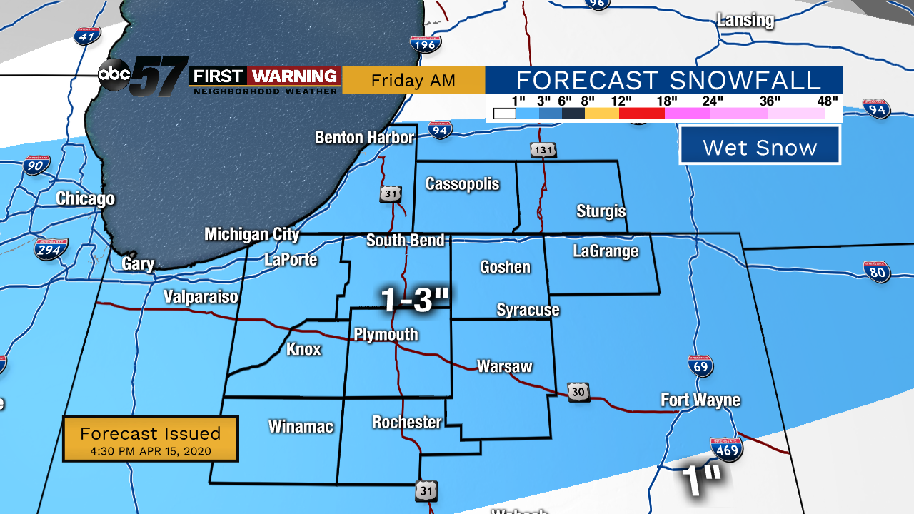
Thursday is sunny, Friday is sloppy, temperatures remain chilly. Thursday is the best weather day of a dismal week of weather. Snow is likely starting early Friday morning and as with most spring snows it's going to be wet, which really plays with totals because of melting and compaction. It's most likely a range of one to three inches falls through Friday morning, accumulating mostly on the grass, decks and roofs, wet on the pavement. There could be a brief period around 7:00 a.m. Friday when snow could coat roads before it starts to melt, the overall impact is low, especially with Stay-At-Home orders. The weekend is fair with highs in the 50s.
Tonight: Partly to mostly clear. Low 26.
Thursday: Mostly Sunny High of 44.
Friday: AM snow/mix, mostly cloudy. High 40.
Saturday: Mostly sunny. High of 50.