
-
1:44

Warming up through Wednesday
-
2:34

From Niles to South Bend: Jays 2 Keeps the Spirit Alive for basketball...
-
0:46

44th annual Tri Kappa Antique Show boosts charities and scholarships
-
1:48

Scattered showers this evening, Much cooler overnight
-
1:50

Showers and storms this afternoon
-
0:20

One person injured in shooting
-
0:36

Eddies Circuit Robotics holds competition Saturday
-
0:32

21st annual Nappanee Model Train Show
-
0:38

Local boys basketball team headed to IHSAA state finals
-
3:49

Midwest Meowfest brings kitten advocacy to attendees, new homes...
-
1:52

Mild tonight, showers tomorrow
-
1:43

Pleasant to start the weekend

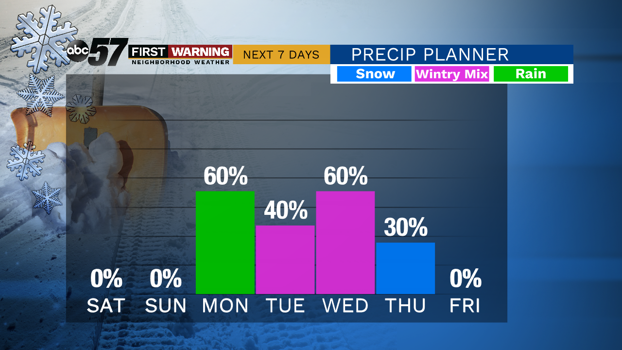
Tonight will be mostly clear. Temperatures will fall through the 30s and 20s this evening before bottoming out in the lower 20s overnight.
The weekend is shaping up to be spectacular. Highs will reach the middle 40s on Saturday and near 50 on Sunday with plenty of sunshine. A few more clouds are likely on Sunday compared to Saturday. Our next system moves in Monday, bringing rain showers with a wintry mix possible by Tuesday morning. More chances for snow are likely on Wednesday and Thursday as well as temperatures fall back into the 20s for highs.
Tonight: Clear. Low 22.
Saturday: Sunny. High 46.
Sunday: Mostly sunny to partly cloudy. High 50.
Monday: Cloudy with rain. High 43.
Sign up for the ABC 57 Newsletter