As if the rounds of rain and storms this week weren't enough, additional bouts of thunderstorms are expected into the big Memorial Day weekend. The first wave is expected Friday evening into Friday night.
 Severe weather outlook for Friday and Friday night.
SPC
Severe weather outlook for Friday and Friday night.
SPC
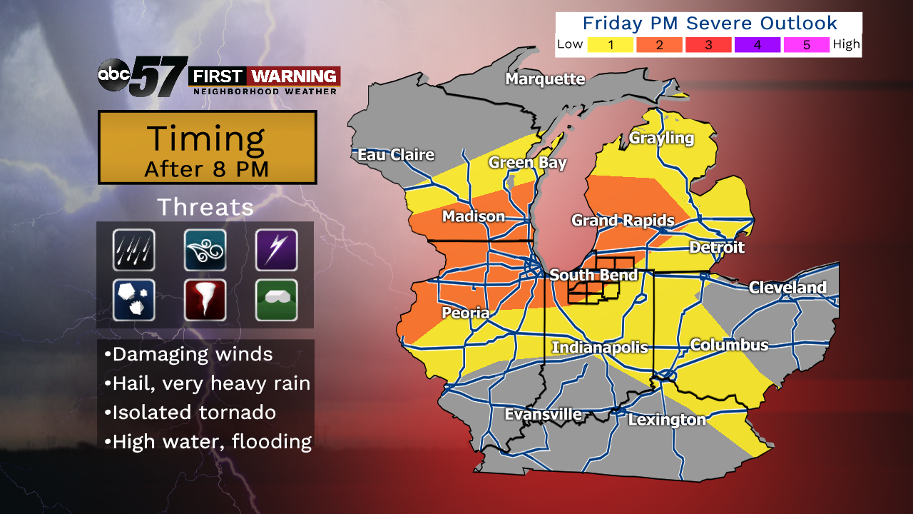
The Storm Prediction Center has all of Michiana under a threat for severe weather for Friday and Friday night. In fact, much of the area falls under the level 2 of 5 risk, which is noteworthy. All threats are possible with any storms that develop and move through late Friday. The main hazards, though, will be damaging winds, hail, lightning, and very heavy rain. If any isolated storms develop, the threat for a tornado does exist.
 Future radar at 10 p.m. Friday.
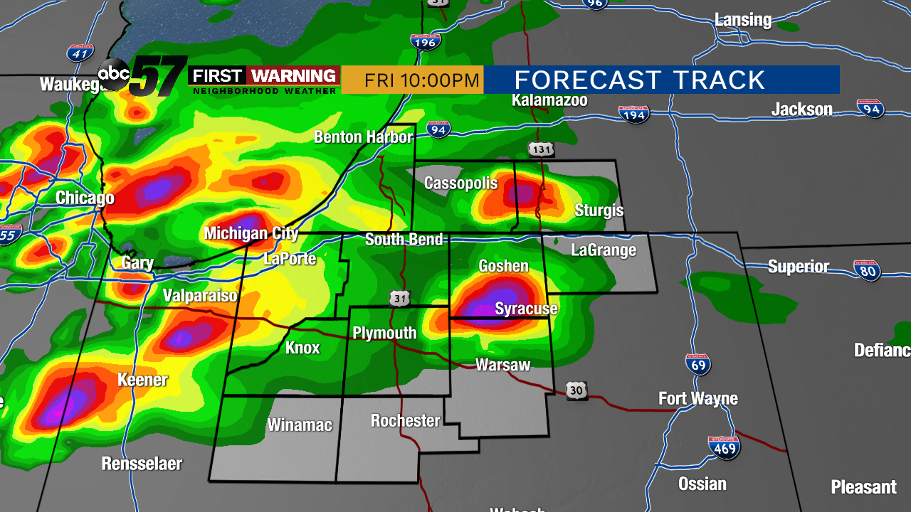
Note the forecast radar image at 10 p.m. showing the potential for several strong to severe storms across the area. Will the radar look exactly like this? No. Will every storm that moves through the region be severe? No. This simply suggests that the threat for strong to severe thunderstorms does exist Friday evening and night.
 Future radar at 1 a.m. Friday night/Saturday morning.
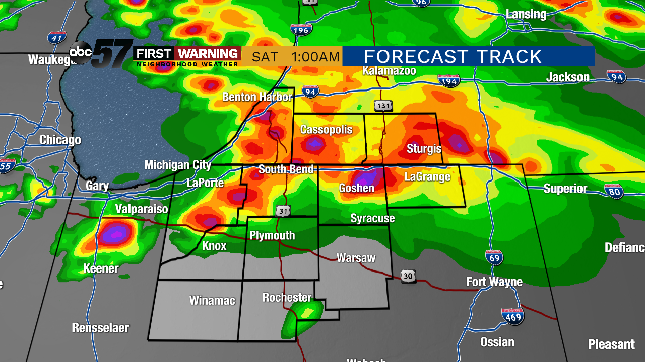
The same is true for the image showing the future radar at 1 a.m. Friday night. While the radar likely won't look exactly like that, there will exist the threat for strong to severe storms into the early overnight hours. The setup is very similar to what occurred Wednesday night when severe winds caused damage in LaGrange, Kosciusko and Fulton Counties.
 Heavy rain and flash flood threat thru 8 a.m. Saturday.
WPC
Heavy rain and flash flood threat thru 8 a.m. Saturday.
WPC
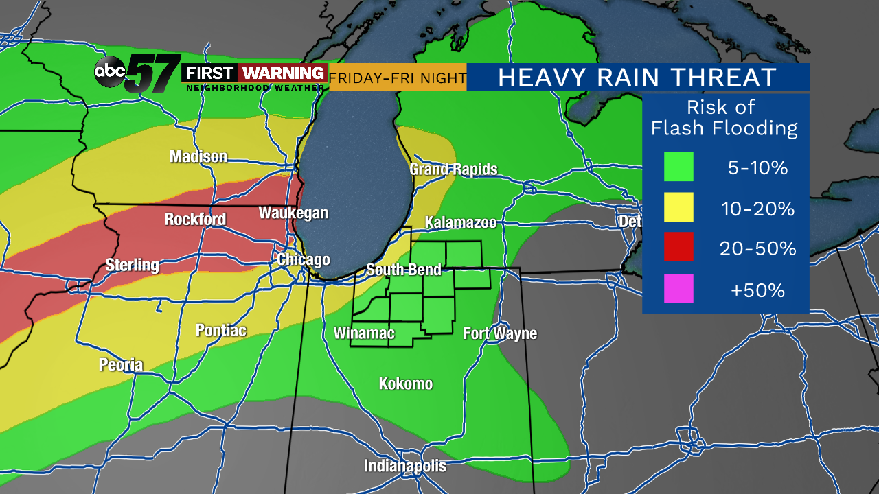
The area is also in a risk for heavy rain that could lead to flash flooding. With the rain that has already fall this week, any additional heavy rain could lead to high and standing water, in addition to instances of flooding. The threat for both severe weather and flooding will continue Saturday and Saturday night as well.
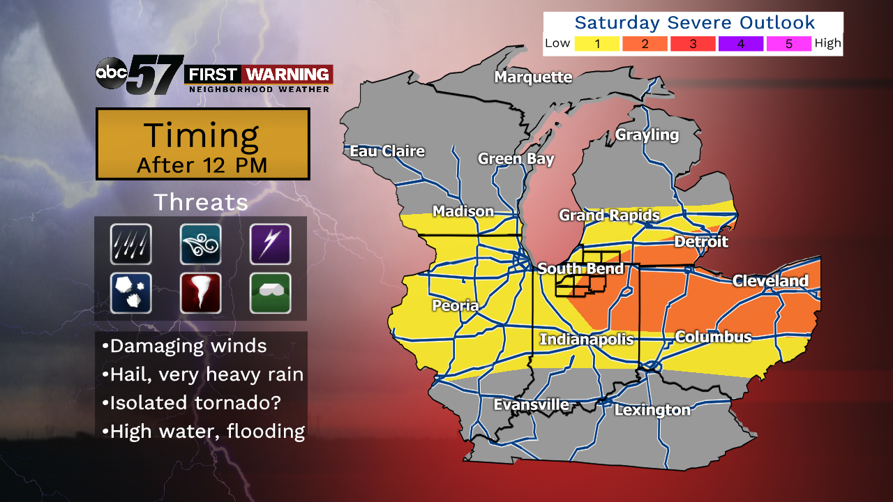 Severe weather outlook for Saturday.
SPC
Severe weather outlook for Saturday.
SPC
Above is the severe weather outlook for Saturday. Notice the entire area is in the threat zone for severe weather. For Saturday, locations with the best chance of seeing stronger storms will be east of U.S. 31. That's where the orange level 2 of 5 severe risk zone is. Similar to Friday evening's severe potential, the hazards on Saturday will be damaging winds, hail, heavy rain and flooding, lightning, and perhaps a weak tornado.
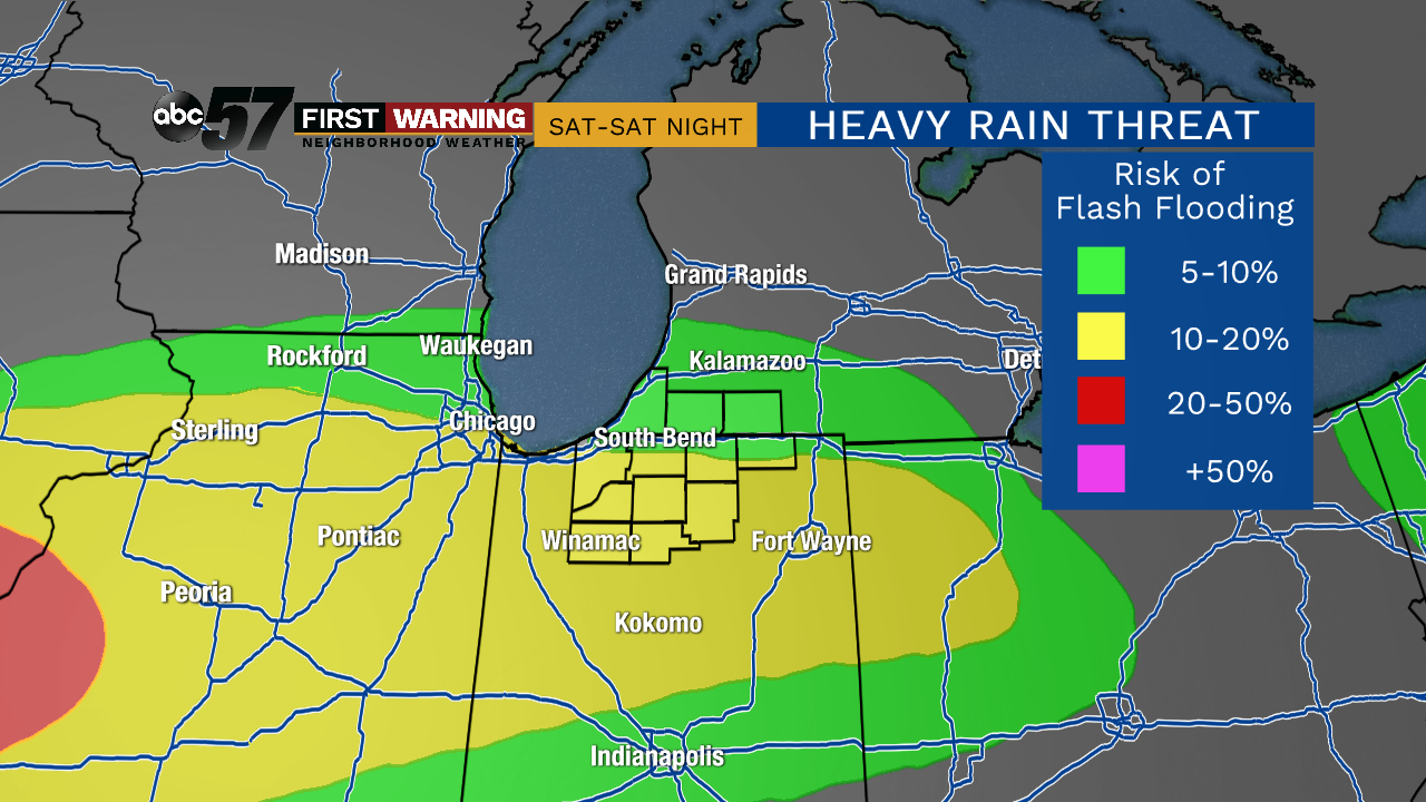 Heavy rain and flash flooding risk for Saturday and Saturday night.
WPC
Heavy rain and flash flooding risk for Saturday and Saturday night.
WPC
The heavy rain and flash flood risk for Saturday and Saturday night is shown above, and you can see that once again all of Michiana is included. The story is very similar: any heavy rain and storms that move through will pose the threat of standing water, lowland flooding and instances of flash flooding. That will especially be true if any one location sees repeated rounds of heavy rain and storms over the next few days. Unfortunately, the risk for storms will continue throughout the holiday weekend with any storms having the potential to become strong.
