Strong fall system to bring snow, wind, cold to Central and Northern part of U.S.
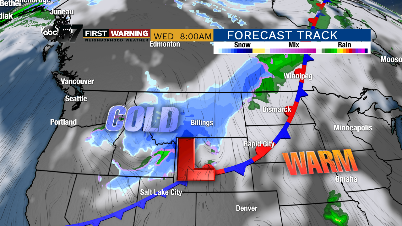 Strong fall system as of 8 a.m. Wednesday.
It hasn't developed quite yet as of Sunday evening, but it will quickly get its act together late in the day Tuesday in the northern Rockies.
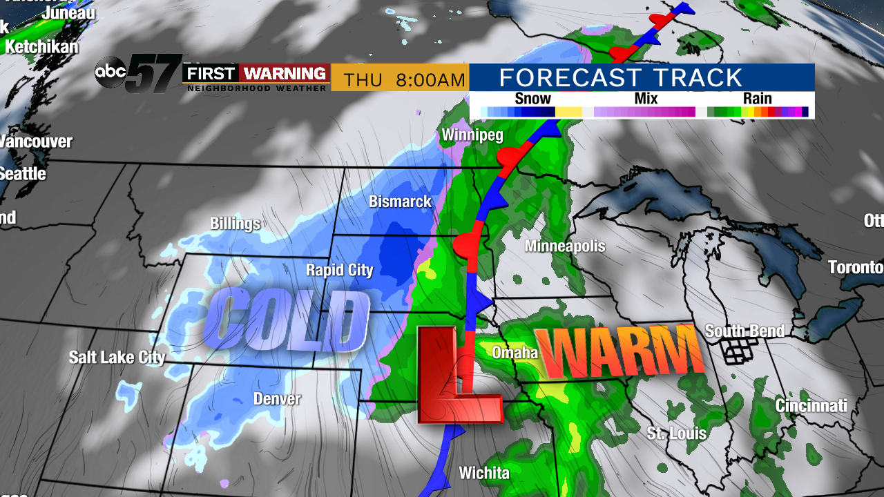 Strong storm system as of 8 a.m. Thursday.
Blizzard conditions will also be possible in these states as winds pick up.
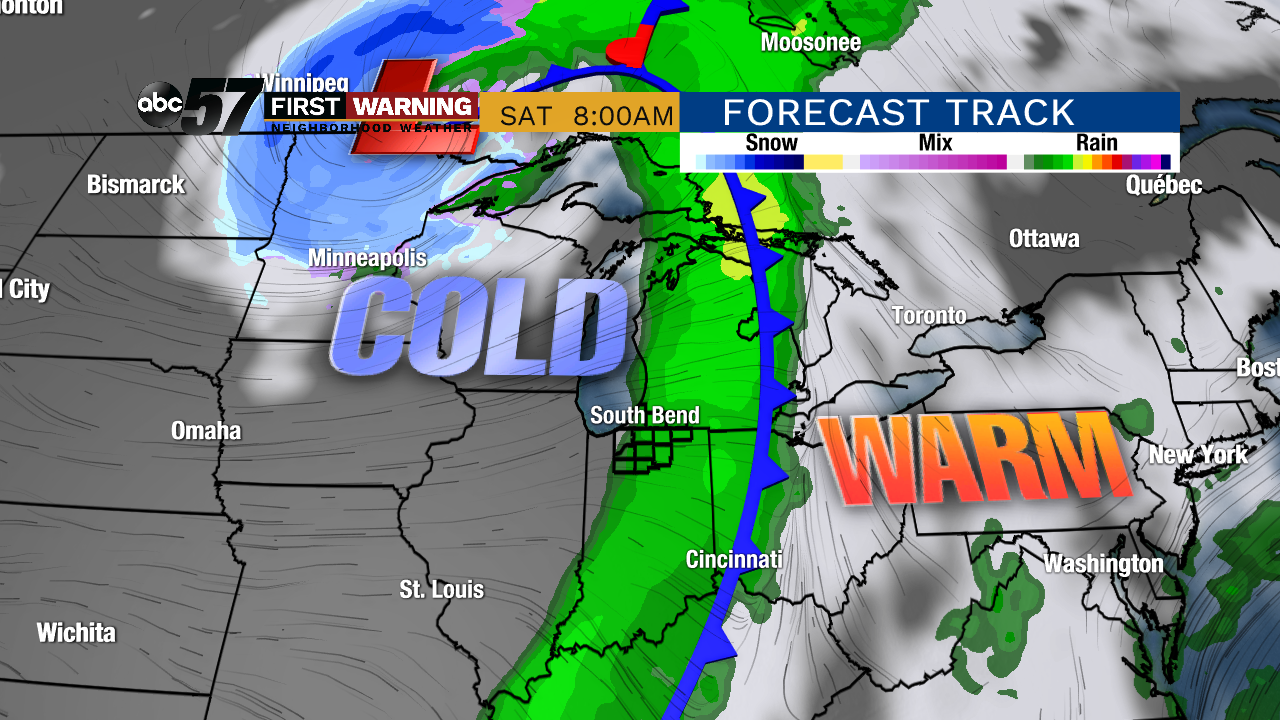 Strong system as of 8 a.m. Saturday.
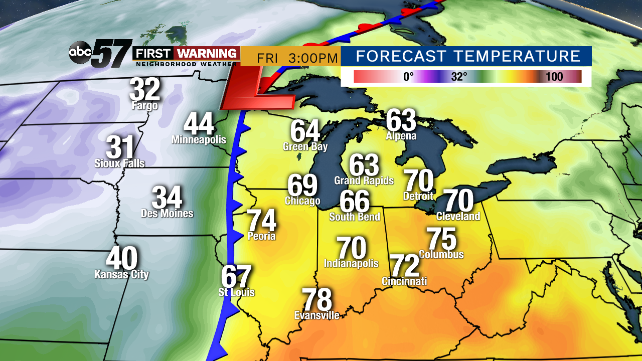 Potential temperatures at 3 p.m. Friday.
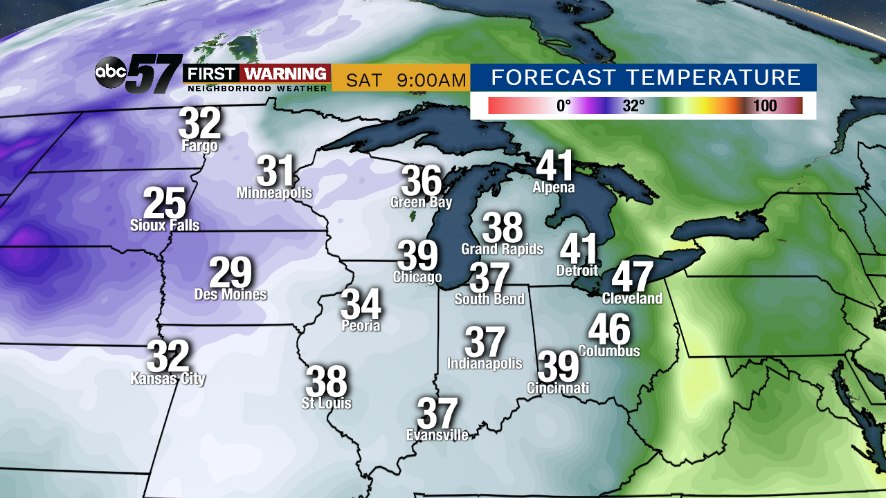 Potential temperatures at 9 a.m. Saturday.
We won't get to the freezing mark, but frosty temperatures are a possibility. Lows next weekend will likely dip into the upper 30s with middle 30s not impossible.
It's still too early to say whether or not frost will for sure happen, but it's a distinct threat.
 Potential snowfall thru Sunday.
It's looking increasingly likely that snow will accumulate -- perhaps quite heavily in some spots -- between Tuesday night and Saturday afternoon from Washington to Nebraska to Wisconsin.
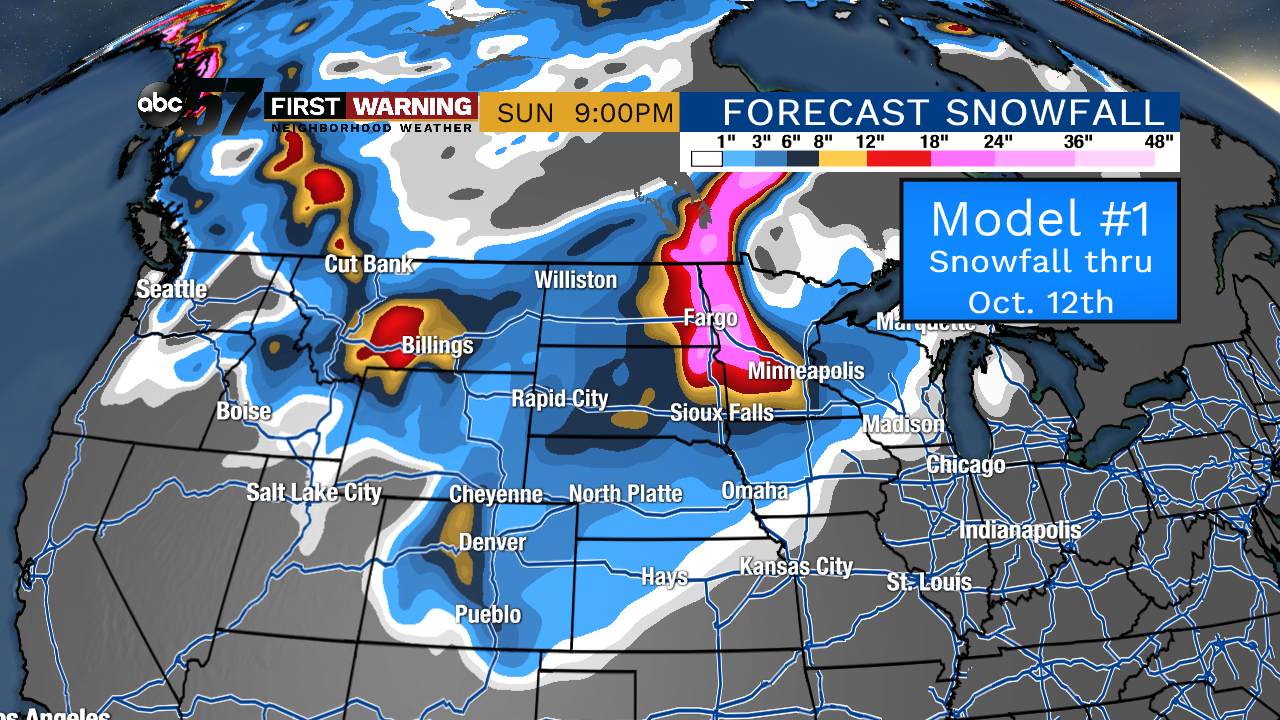
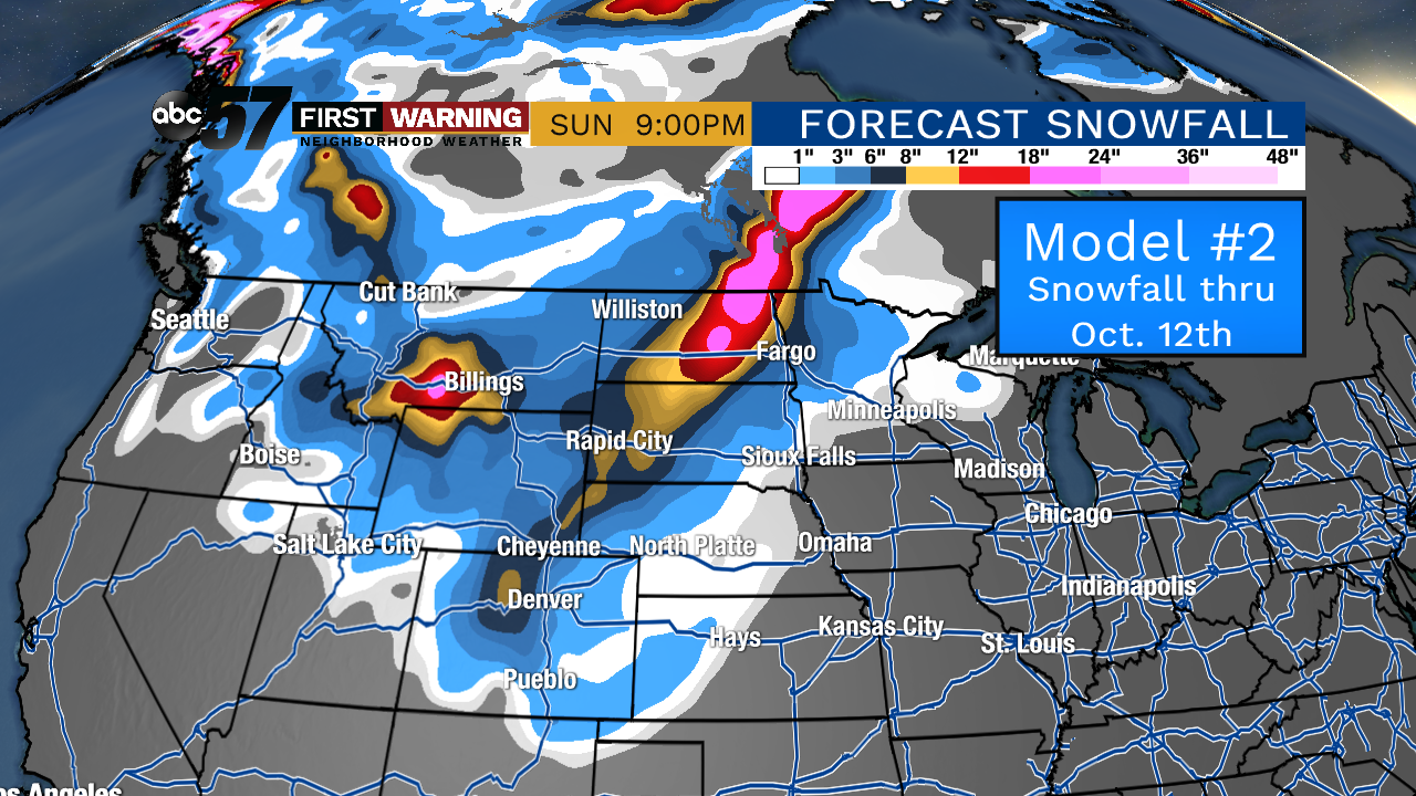 Potential snowfall by Saturday.
It's still not known where the exact location of the heaviest snowfall and blizzard-like conditions will be, but the potential exists for some areas to see a foot of snow or more.
