
-
1:49

Heavy rain, high winds, and hail are main severe concerns today
-
1:26

Amidst several rounds of storms, some could be severe today
-
0:34

South Bend Community Review Board hosts open discussion on youth...
-
2:19

INDOT walks through a proposed diverging diamond intersection...
-
1:08

Notre Dame’s Leonard Moore highlights student success and raises...
-
1:05

Mayflower Bridge set to close beginning April 6
-
0:21

Colfax Avenue eastbound lane closed for water and sewer work
-
0:46

Madison Street closed for lifestyle district project
-
4:11

Non-profit organization provides deep dive into Blackstone, a...
-
1:52

Storms possible overnight, strong storms by Tuesday evening
-
3:48

New partnership aims to help fight food insecurity across Elkhart...
-
2:00

A sunny Monday ahead, rainy almost every other day this week

They severe threat is lowering, but thunderstorms are still likely. There is limited energy for storms to ramp-up to severe, and clouds ahead of the storms will only continue to reduce that factor. Plan on a round of rain this evening with thunder and lightning. There still could be severe weather, straight line wind, even a tornado but that threat is likely isolated.
Temperatures start to cool this week, 70s through midweek and 60s by the weekend. The next fall front hits Thursday into Friday with rain likely. This weekend is fair and much cooler, highs in the 60s.
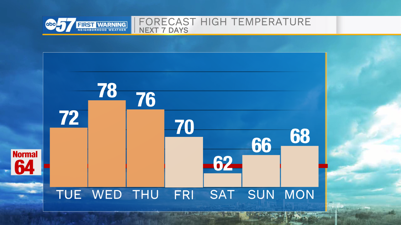
Tonight: Scattered thunderstorms. Low 60.
Tuesday: Mostly to partly cloudy. High 72.
Wednesday: Partly cloudy. High 78.
Thursday: Rain showers. High 76
Sign up for the ABC 57 Newsletter